Curated OER
A Question of Rivers
Interactive PowerPoints are terrific tools for self quizzing before an exam. This particular presentation is about the action and physical features of rivers. There are nine boxes to click on, each leading to a picture or map. When you...
Curated OER
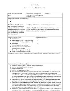
Let the River Run
Learners explore the environment by reading a story in class. In this water formation lesson, students define environmental terms such as rivers, streams, gulf, oceans and lakes. Learners read the story A River Ran Wild and discuss the...
Curated OER
Play Doh Map of Your State
Young scholars create a state map using Playdoh. In this hands-on state geography lesson, students work in groups to form a three-dimensional map of their state using Playdoh made at home following a (given) recipe. Young scholars...
Curated OER
Growth of a River
Students evaluate geography by drawing an image in class. In this river lesson, students identify a list of vocabulary terms associated with bodies of water. Students identify how a river is formed and draw a picture of one including the...
Curated OER
Responsible Stewardship: The Saving of the Great Lakes
Students devise a plan to protect the Great Lakes. In this environmental lesson, students conduct research to identify nonprofit groups that help protect the waterways. Students write letters to the Congressman or a nonprofit...
Curated OER
What is a River?
Pupils study the various types of bodies of water: rivers, oceans, lakes and ponds. They observe models of each and then use clues to discuss how they are alike and different. They imagine they have found a new planet and draw a map...
Curated OER
Can We Keep the Lake Clean?
Students are introduced to the water cycle. They help draw a picture of a lake ecosystem, adding human impacts that affect water quality. Students help fill in the components of a drawing of a water system. At the end of the lesson...
Curated OER
Be a Watershed - Create a Living River
Students investigate water ways by conducting an experiment with classmates. In this natural resources lesson, students define a watershed and identify where large ones are located within the United States. Students utilize...
Curated OER
Big Arky, A Real Arkansas Monster
Middle schoolers examine the world of the Arkansas alligator and topics that are related to wetland environments. They pay attention to the relationship between geography, climate, environment, and the animals who live there. A role-play...
Curated OER
Landforms of Illinois
Fifth and sixth graders are introduced to the primary landforms of Illinois and discover how they were created. Landform cards are made for each pupil. They use the twenty-questions format until they have identified each one. Then,...
Curated OER
Drought Threatens Huge Man-Made Lake
Students locate Lake Mead, then read a news article about Lake Mead drying up and how that would effect water and power supplies to the region. In this current events lesson, the teacher introduces the article with a map and vocabulary...
Curated OER
Rivers... for Kids
Pupils investigate U.S. geography by exploring it's bodies of water. For this river formation lesson, students identify the reasons rivers are needed in our country by reading assigned text. Pupils examine a diagram which explains how...
Curated OER
Geographic Landforms
Each slide is a simple notebook page with one landform in blue and its definition in red. There are 26 vocabulary terms in all, some you may want to use, and others easily hidden. It is recommended that you add photos or other graphic...
Curated OER
Science: Draining the Land - the Mississippi River
Students use topographic maps to identify parts of rivers. In addition, they discover gradient and predict changes in the channels caused by variations in water flow. Other activities include sketching a river model with a new channel...
Curated OER
Geography Action! Rivers 2001- Stream Table
Learners use a stream table to simulate river and watershed systems. The affect of gradient on stream flow as well as erosion and deposition are two items that students examine.
Curated OER
Geography Terms
Students identify different landforms and fill out a worksheet where they explain what each landform is. In this geography lesson plan, students fill in a landform map and then use landform words as they describe the landforms.
Curated OER
National Marine Sanctuaries Shipwrecks
Junior oceanographers access the Channel Islands National Marine Sanctuary Shipwreck Database and plot the locations of several shipwrecks. Shipwrecks are always an enthralling subject and this activity allows your learners to act as...
Curated OER
Marine Life, Oceans, Lakes and Rivers
Students examine the types of organisms found in oceans. In groups, they read articles about the research done at certain sites. They work together to research their own water ecosystems and report the findings to the class. To end...
Curated OER
Lake Billy Chinook
Students explore aerial photographs and maps of Round Butte Dam. They examine the land modifications necessary to create a dam. After reading a book about building a dam, students compare the environmental impact of Lake Billy Chinook to...
Curated OER
Michigan Food: From Farm to You
Students recognize Michigan on a map and understand how its climate is affected by the Great Lakes. In this Michigan food lesson, students play a trivia game to identify the produce of Michigan. Students relate the climate in each part...
Curated OER
Topographic Mapping Skills
In this geography worksheet, students read an excerpt about topographic maps and why they are useful for various jobs. They also respond to eleven questions that follow related to the excerpt and locating specific map points on the map...
Curated OER
Interpreting Aerial Photographs
Students interpret aerial photographs. They view aerial photographs or satellite-produced images to locate and identify physical and human features. They study satellite images and label their images for bodies of water, clouds,...
Curated OER
There's a Watershed in my Backyard!
Students explain what the term watershed is by creating a model. For this science, geography lesson, students demonstrate how the water moves in a watershed. Additionally, students learn about point source and nonpoint source pollution....
Curated OER
Sunken Millions
This PowerPoint provides a game show format with multiple choice questions about fresh and salt water. Topics include sources of water, water geography, uses of water, and the water cycle.

