Hi, what do you want to do?
Curated OER
Educational Technology Clearinghouse: Maps Etc: Latium and Neighbors, 750 Bc
A map of Latium and Neighbors around the earliest time of Rome. This map shows the territories of Caerites Latini, Sabini, Etruria, and others, as well as important cities of the time, major rivers and lakes, coastal features, and...
University of California
Ucmp: The World's Biomes
This is an introduction to the major biomes on Earth. This page groups biomes into five major types: aquatic, deserts, forests, grasslands, and tundra. Information on climate, animal/plant life, and much more is given for each of type...
US Geological Survey
U.s. Geological Survey: Groundwater Information by Topic
A massive amount of information about groundwater. Topics covered include groundwater basics, humans and groundwater, groundwater quality, and its place in the water cycle. Includes true-and-false quiz and a Q&A section, as well as a...
Other
Chebucto: Soil & Water Conservation Society of Halifax
This site provides statistical information about rivers all around the world. Stats include mean discharge, drainage area, and length.
Curated OER
Unesco: Kazakhstan: Saryarka Steppe and Lakes of Northern Kazakhstan
Saryarka - Steppe and Lakes of Northern Kazakhstan comprises two protected areas: Naurzum State Nature Reserve and Korgalzhyn State Nature Reserve totalling 450,344 ha. It features wetlands of outstanding importance for migratory water...
Travel Document Systems
Tds: Malawi: Geography
See how the Great Rift Valley and Lake Malawi dominate Malawi's geography. Read about the climate, terrain, and population density. Information is from the U.S. State Dept. Background Notes.
Other
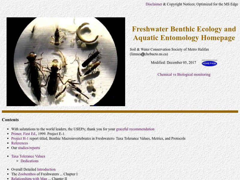
Freshwater Ecology
This is a comprehensive and detailed site providing information on aquatic macroinvertebrates. The emphasis is on biomonitoring of water quality through quantitative assessment of numbers and types of small aquatic organisms.
University of Utah
University of Utah: Genetic Science Learning Center: Meet the Microenvironments
Investigate the Great Salt Lake's islands, rivers, and man-made structures that define several diverse microenvironments.
Curated OER
University of Texas: Rwanda: Political Map
A small political map of Rwanda showing the major cities, rivers, and neighboring countries. Map is from the Perry Castaneda Collection.
CK-12 Foundation
Ck 12: Life Science: Aquatic Biomes
[Free Registration/Login may be required to access all resource tools.] Aquatic biomes can be generally classified based on the amount of salt in the water. Freshwater biomes have less than 1% salt and are typical of ponds and lakes,...
Walled Lake Consolidated Schools
Loon Lake Elementary School: Jacques Marquette
A biography of Jacques Marquette (1637-1675), a French explorer and Roman Catholic missionary who was one of the earliest European explorers in North America. He joined the French explorer Louis Jolliet on a trip down the Mississippi...
Walled Lake Consolidated Schools
Loon Lake Elementary School: Henry Hudson
A biography of Henry Hudson (1565-1611), an English explorer and sea captain. He made four voyages in an attempt to discover a northern route between Europe and Asia. Hudson never found such a passage, but he sailed farther north than...
Library of Congress
Loc: Earth as Art: A Landsat Perspective
A really cool site showing Satellite (Landsat 7) images of unique geographical and meteorological phenomena. Images show cloud formations to rainforest devastation.
Curated OER
Etc: Maps Etc: Berlin, Potsdam, and Vicinity, 1903
A map of Berlin, Spandau, Potsdam, and the vicinity in 1903, showing cities and towns, railroads, rivers, and lakes. The map is color-coded to show urban, rural, and forested areas.
Other
International Lake Environment Committee Foundation: Lake Biwa (Japan)
See a map of Lake Biwa, and a brief description of the biggest lake in Japan.
Other
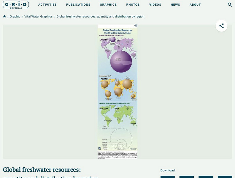
Grid Adrenal: Global Freshwater Resources: Quantity and Distribution by Region
Glaciers and icecaps contain approximately 70% of the world's freshwater, but groundwater is by far the most abundant and readily available source of freshwater. This graphic illustrates the quantity (in cubic kilometres) and...
Curated OER
Etc: Maps Etc: Lake District and Isle of Man, 1908
A detailed travel map of western England around the Lake District and the Isle of Man from 1908, showing portions Westmoreland and Lancashire counties. The map shows first class and secondary roads, railways, cities, towns, coastal and...
Curated OER
Etc: Niagara River During the War of 1812, 1812 1814
A map of the Niagara River between Lake Erie and Lake Ontario during the War of 1812 (1812-1815), showing the forts Erie, George, and Niagara, and the towns and battle sites of Lewiston, Queenstown, Lundy's Lane, Chippewa, and Buffalo.
Curated OER
Educational Technology Clearinghouse: Maps Etc: Great Lakes Region, 1906
A map from 1906 of the Great Lakes Region, showing major cities and ports, canals (including the Erie Canal), rivers, and steamship routes across the lakes, including routes of the St. Lawrence and Lake Champlain.
Curated OER
Educational Technology Clearinghouse: Maps Etc: Western Part of Lake Erie, 1812
A map of western Lake Erie and Lake St. Claire showing important sites during the War of 1812, including the battleground on the River Thames, Detroit, Brownstown, Fort Malden, Frenchtown, Fort Meigs, and Fort Lower Sandusky (Fort...
Curated OER
Educational Technology Clearinghouse: Maps Etc: The Lake of Mexico, 1722
A map from the book 'Voyages de Francois Coreal aux Indes Occidentales’ (Amsterdam, 1722) showing the environs of the Lake of Mexico (Lake Texcoco or Lago Texcoco, sometimes called Tezcuco), including islands and causeways, marshlands,...
Curated OER
Educational Technology Clearinghouse: Maps Etc: The Lake Victoria Region, 1920
A map of the region around Lake Victoria, or Victoria Nyanza, in 1920, showing the northern portion of German East Africa, the eastern portion of Belgian Congo, and all of British East Africa including the Uganda Protectorate. The map...
Curated OER
Educational Technology Clearinghouse: Maps Etc: Vicinity of Lake George, 1872
Fort Edward was on the site of the present village of Fort Edward, in Washington County, on the east side of Hudson River, and about forty-five miles north from Albany.
Curated OER
Etc: Maps Etc: Explorations of Hudson and Champlain, 1609
A map of the region explored by Samuel de Champlain and Henry Hudson south of the St. Lawrence River in 1609. The map shows the area from the St. Lawrence down the Richenlieu south to Lake Champlain to the southernmost point reached by...


