ISTE
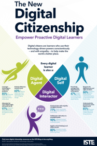
The New Digital Citizenship
Boost digital citizenship with an engaging infographic that promotes the importance of being a positive digital agent, self, and interactor.
Curated OER
Multicultural Awareness Respect Activity
A brief article suggesting a "getting to know you" activity. Discusses the different aspects of respect and learning from our differences.
Other
Western Oregon University: Earth System Science: Geologic Time [Pdf]
An 81-page slideshow that looks at the principles of geology with respect to relative dating, at different concepts describing geological processes, at absolute age and radiometric dating, at the eons and eras in the geologic time scale,...
Other
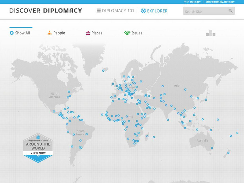
Discover Diplomacy: Around the World
The following map is a visual representation of the presence of the United States around the world. This interactive map shows our diplomats and their roles in their respective countries, places in the world where we practice diplomacy,...
TES Global
Tes: Othello: Patriarchal Domination Theme: Worksheets
[Free Registration/Login Required] These worksheets and charts focus on Desdemona and Emilia as they move respectively from resistance to domination to submission to domination in Othello by William Shakespeare.
Google Cultural Institute
Google Cultural Institute: Cold War
Learn about the Cold War, a period of geopolitical tension between the United States and the Soviet Union and their respective allies, the Western Bloc and the Eastern Bloc, which began following World War II.
Lawrence Hall of Science
The Math Page: Topics in Pre Calculus: Symmetry
Here is a site that clearly and thoroughly explains the symmetry of even and odd functions and how to test for these types of symmetry. There are example problems solved, problems for the student to attempt, and answers to the student...
Curated OER
[ Image: Nyerere Was Respected for His Idealism]
This BBC obituary of Julius Nyerere takes a look at his life and his political accomplishments.
Curated OER
Aircraft Engines
Discusses the various types of jet engines and explains how they produce their power. Describes the primary components of jet engines and their respective roles.
Curated OER
Warm Air: Electric Furnace
Site describes Electric furnaces. The major parts of electric furnaces and their respective roles are discussed, and maintenance and troubleshooting tips are provided.
Curated OER
Official Recognition of the Negro's Interest
This site comes from the third chapter of the E.J. Scott book, American Negro and the World War. This page discusses the official recognition of black people who helped fight in World War I, and the difficulties African Americans had...
Curated OER
Etc: Dev of Colonies and Early Western Explorations, 1700 1775
A map of eastern North America showing the early development of the European colonies and westward exploration to the Mississippi River. The map shows the routes of several early explorers with dates of exploration, including La Salle,...
Curated OER
Educational Technology Clearinghouse: Maps Etc: Presidential Election, 1912
A map of the United States showing the results of the 1912 presidential election. The map is keyed to show the states carried by the Democrats (Woodrow Wilson), the Progressive Party (Theodore Roosevelt), and Republicans (William Howard...
Curated OER
Educational Technology Clearinghouse: Maps Etc: Presidential Election, 1884
A map of the United States showing the results of the 1884 presidential election. The map is keyed to show the states carried by the Democrats (Grover Cleveland), Republicans (James Blaine), and the areas where minor parties garnered 5...
Curated OER
Educational Technology Clearinghouse: Maps Etc: Presidential Election, 1916
A map of the United States showing the results of the 1916 presidential election. The map is keyed to show the states carried by the Democrats (Woodrow Wilson), Republicans (Charles Evans Hughes), and shows the Socialist Party votes...
Curated OER
Educational Technology Clearinghouse: Maps Etc: Presidential Election, 1900
A map of the United States showing the results of the 1900 presidential election. The map is keyed to show the states carried by the Republicans (William McKinley), Democrats (William Jennings Bryan), and the areas where minor parties...
Curated OER
Educational Technology Clearinghouse: Maps Etc: Presidential Election, 1904
A map of the United States showing the results of the 1904 presidential election. The map is keyed to show the states carried by the Republicans (Theodore Roosevelt), Democrats (Alton B. Parker), and the areas where minor parties...
Curated OER
Educational Technology Clearinghouse: Maps Etc: Presidential Election, 1860
A map of the United States showing the results of the presidential election of 1860. The map is color-coded to show the states carried by Lincoln (Republican), Breckinridge (Southern Democrat), Bell (Constitutional Union), and Douglas...
Curated OER
Educational Technology Clearinghouse: Maps Etc: Presidential Election , 1860
A map of the United States showing the results of the presidential election of 1860. The map is color-coded to show the states carried by Lincoln (Republican), Breckinridge (Southern Democrat), Bell (Constitutional Union), and Douglas...
Curated OER
Educational Technology Clearinghouse: Maps Etc: Relief of North America, 1890
A relief map from 1890 of North America, Central America, Greenland, and the Caribbean to Puerto Rico showing the general mountain systems, highlands, and plains of the region. Major river systems are shown. "North America is the third...
Curated OER
Etc: Maps Etc: Climate and Watersheds of the United States, 1868
A map from 1868 of the United States showing physical features, mean annual temperatures, rainfall distribution, watersheds, and principal products in the area. The average annual temperatures are shown by isotherms, with temperatures...
Curated OER
Etc: United States Growth in Population by Decades, 1900 1910
A map of the United States showing the increase in population per state between the 1900 and 1910 census. The map is keyed to show State population increases ranging from under 2 per cent to 50 per cent and over. "This is a map...
Curated OER
Unesco: Ethiopia: Konso Cultural Landscape
Konso Cultural Landscape is a 55km2 arid property of stone walled terraces and fortified settlements in the Konso highlands of Ethiopia. It constitutes a spectacular example of a living cultural tradition stretching back 21 generations...
Curated OER
Unesco: Ecuador: Historic Centre of Santa Ana De Los Rios De Cuenca
Santa Ana de los Rios de Cuenca is set in a valley surrounded by the Andean mountains in the south of Ecuador. This inland colonial town (entroterra ), now the country's third city, was founded in 1557 on the rigorous planning guidelines...
Other popular searches
- Character Education Respect
- Bulletin Board Ideas Respect
- Respect Activities for Kids
- Guidance Lessons on Respect
- Respect Lesson Plans
- Teaching Respect
- Respect Activities
- Self Respect
- Respecting Authority
- Respect Personal Space
- Respect Authority
- Respect for Authority


