Curated OER
Latin American Relief Map
Students, in groups, research, design and construct a relief map of a section of Latin America using papier-mache. They show major landforms, elevations and notable bodies of water. They present their maps to the class.
Curated OER
A Child's Daily Life in South Africa
Students listen to the book, Not So Fast Songololo, and locate South Africa on a map. They identify similarities between the daily life of a child in South Africa and America, and write a letter and draw a picture to a child in South...
Curated OER
The North and South Magnetic Poles
In this north and south magnetic poles worksheet, students read about the presence of auroras over the earth's magnetic poles as opposed to the geographic poles. Students use 2 photographs taken by the IMAGE FUV and the Polar instruments...
Curated OER
Topographic Maps Worksheet
In this geography skills worksheet, students respond to 37 multi-part questions that require them to read and interpret topographic maps.
K12 Reader
Conflict Over North American Lands
Readers are introduced to some of the conflicts that arose over land and resources in the Americas in a two-part cross-curricular comprehension worksheet that asks kids to study the article and then to use information provided to...
Global Oneness Project
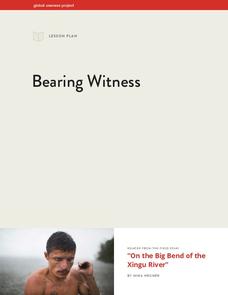
Bearing Witness
A controversial construction project in South America, the Belo Monte dam, is endangering local cultures, ecosystems, and communities. High schoolers create a concept map based on an online article they read before engaging in...
Curated OER
Cacao Tree Geography
Students use a map to learn about where chocolate comes from. In this lesson on the cacao tree, students locate various regions where the cacao tree grows. They will discuss why the cacao tree grows more favorably in particular climates...
Curated OER
Agriculture: It Doesn't Just Happen
After reading an informational text on the Agricultural Research Service, learners research the role of the ARS in Oklahoma. Using reputable online sources, they label a map of the state with relevant areas. Researchers focus on one of...
Curated OER
Why Do Geese Fly South For the Winter?
Fifth graders examine migration by tracing animal migration routes on a map. For this animal life lesson, 5th graders observe a map of North America and read about the migration patterns of geese. Students trace the path most...
Curated OER
Equator, North Pole, and South Pole
Students identify the Equator, North Pole, and South Pole on the globe. In this map skills lesson, students use a globe marker to locate specific locations on the globe. Students find where they live in relation to the Equator.
Curated OER
Places on the Planet: Latitude and Longitude
Middle schoolers locate different places on globes and maps by learning about latitude and longitude lines. In this latitude and longitude lesson plan, students identify specific locations based on the degrees of latitude and longitude.
Curated OER
Brazil and the Amazon
Sixth graders examine the features of the country of Brazil. In this Geography lesson plan, 6th graders complete a graphic organizer on the geography of Brazil.
Midwest Institute for Native American Studies
Introduction to Pre-Columbian Lessons
Native peoples established civilizations all over Central and North America. Introduce native civilizations with a unit that promotes discussion, reinforces map skills, enhances reading comprehension, and exposes young historians to...
Curated OER
Revolutionary Women of South Carolina
Students examine multiple primary sources. For this revolutionary war lesson, students read case studies regarding women from South Carolina. Students will compare the different roles women played during the Revolutionary War. Students...
Curated OER
Breaking News English: Map Shows the Chinese Discovered America
In this English instructional activity, students read "Map Shows the Chinese Discovered America," and then respond to 47 fill in the blank, 7 short answer, 20 matching, and 8 true or false questions about the selection.
Curated OER
Continents and Oceans
In this geography worksheet, students read a paragraph and learn about the seven continents and five oceans of the world. Students study a map of the world and answer 12 short answer questions. This is an online interactive worksheet.
Curated OER
Country Capitals
Students locate country capitals on a world map. For this map skills lesson, students review the definition of the word country and discuss what a capital is. Students locate and label capital cities on a world map using a map marker.
Curated OER
The Seven Continents Scavenger Hunt
Who doesn't enjoy an engaging scavenger hunt? Here, scholars listen to, and discuss, the informative text, Where is my Continent? by Robin Nelson. They then explore the seven continents and four major oceans using...
Curated OER
Traveling Through North America
Students identify places and landmarks in North America, specifically Canada and the United States, by using and constructing maps. Six lessons on one page; includes test.
Curated OER
Corn in Ancient America
Students explore the importance of corn to the survival of early civilizations of the Americas. Through research and discussion activities, they read and describe how corn was used as food and currency in early civilizations. They...
Curated OER
When a Map Isn't A Map...
In this maps activity, students read about the Earth, sky, rivers and lakes, and more, and then answer short answer questions about it. Students complete 3 questions.
Curated OER
We've got the whole world in our hands
Students explore spatial sense in regards to maps about the globe. In this maps lesson plan, students label oceans, locate the continents and poles, follow directions, and explain the symbols on a map.
Core Knowledge Foundation
Volume 1 - A History of the United States: Precolonial to the 1800s
Volume One of the 299-page Core Knowledge History of the United States covers events from the Precolonial Period to the 1800s.
Curated OER
Cultural America
Seventh graders investigate the cultural differences that can be found in America. They discuss what it means to be called an American. The patterns of migration to America are discussed with the use of maps and geographical terms....


