Curated OER
Route To School Mapping Assignment
Students create a map showing the route from home to school. Students include a legend, compass, label buildings, and color the map route on the map. They write out specific directions.
Curated OER
Mapping in Words
Students create maps to describe the Wabanaki's relationship with their environment. They discuss the names the Wabanaki people gave to areas of land and water. They review a map of their community to discuss the names of towns and their...
Cornell University
Constructing and Visualizing Topographic Profiles
Militaries throughout history have used topography information to plan strategies, yet many pupils today don't understand it. Scholars use Legos and a contour gauge to understand how to construct and visualize topographic profiles. This...
Curated OER
Survivor Stories
Trace a survivor's story using a timeline, map skills, poetry and/or prose and photography, and make a visual representation of a survivor's journey through his or her life as a culminating activity for the class and the survivor....
Curated OER
Goldilocks and the Three Bears
Students analyze classic children's stories by creating story maps. In this children's literature lesson, students read Goldilocks and the Three Bears, and practice retelling the story with picture cards that need to be put into...
Curated OER
Sea Ice: Unscrambling the Egg Code
Students determine sea ice thickness, concentration, and floe size by reading egg codes. In this sea ice conditions lesson, students color code a map based on prescribed criteria and use the maps to identify changes in sea ice...
Curated OER
Creating Station Models
Learners review weather conditions at various cities and create station models on a weather map.
Curated OER
Elements of Civilization
High schoolers create their own ancient civilizations based off of topographical maps of Egypt, Mesopotamia, the Indus Valley, and the Yellow River. In this social studies lesson, students are assigned one topographical map to use to...
Curated OER
Weather Versus Climate
Young scholars research on the internet to understand the difference between weather and climate. In this weather versus climate lesson plan, students research the internet, read a climate zone map, look into the climate zones, and...
Curated OER
Tracing the Route of Bracero
Students make a map showing the work of a Bracero Worker. In this Bracero lesson plan, students listen to a worker in an online oral history as he explains his work locations and crops. They use a map to plot the areas he worked and the...
Curated OER
FINDING A RESOLUTION
Students examine detailed Moon and Earth views provided by the NASA-sponsored "World Wind" computer program. They work in groups to create maps of different scales using landmarks of their choice, and challenge their classmates to...
Curated OER
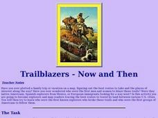
Trailblazers- Now and Then
Students examine and study the routes of trailblazers. In this American history lesson, students find a route on a map and compare that to the route of trailblazers. Students will then compare that map with a topographical map to...
Curated OER
Unraveling the Web
Students consider how a message might be traced along a complex network, then explore backbone maps as a basis for understanding the purpose and structure of the Internet.
Curated OER
Sahara Special
Third graders read the book Sahara Special and participate in comprehension activities. In this realistic fiction lesson, 3rd graders create a brochure for where they live. Students have personal bags, a brown paper bag, that they fill...
Curated OER
Delicious Dinners by Jr. Chefs
Students create a protein-rich dinner. In this nutrition lesson, students brainstorm foods that are rich in protein. Students make burritos and identify the color of meat when it is cooked thoroughly.
Curated OER
Gel Electrophoresis: Sort and See the DNA
Young scholars construct DNA fingerprints. In this genetics lesson, students watch an on-line gel electrophoresis animation, then they work in groups to use a restriction map to create a restriction enzyme and use that to arrange a DNA...
Curated OER
Making a Brand for Ourselves the "Cowboy" Way
Students define cowboys and learn about their roles on rangelands. In this rangeland lesson, students define cowboys and cowgirls and complete a KWL chart. Students read Cattle Kids and Til the Cows Come Home. Students visit the...
Curated OER
Mapping the Lewis and Clark Trail
Students explore how physical and human geography features effected Lewis and Clark's expedition by using the Lewis and Clark Digital Discovery Web site.
Curated OER
Map Lesson Plan
Fourth graders locate and label major sites related to the Revolutionary War in the Hudson River Valley. They examine topographical features of each site and list a few of these features and list two advantages of each military site.
Curated OER
People Who Make A Difference: American Heroes
Students think about the characteristics of a hero so they can later evaluate which historical figures on the heroes chart meet the criteria.
Center for History Education
Road to Revolution: How did Actions and Responses Lead to an Independent United States?
Using primary sources, maps, and an interactive M&M game, young historians examine the American revolution as if they were detectives trying to solve a crime. Resource includes graphic organizers and a final writing prompt to aid...
Curated OER
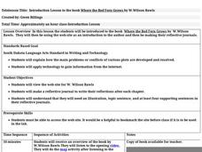
Introduction Lesson to the Book Where the Red Fern Grows
An excellent lesson plan on the classic book, Where the Red Fern Grows. Learners view the W. Wilson Rawls website and engage in a series of activities generated by the website. They write in their reflective journals, watch a video, and...
Curated OER
Recreate the Race
Young scholars research and find the route of the Alaskan dog sled race.In this Iditarod race lesson students find the checkpoints for the Iditarod on a map. Young scholars research information in pairs about each one of the checkpoints....
Curated OER
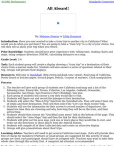
All Aboard!
Students, in groups, create a display showing a "train trip" to a destination of their choice from a teacher-made list. They also answer a series of questions related to their trip. Groups present their displays.


