Curated OER
Hurricanes As Heat Engines
Students examine sea surface temperatures to see how hurricanes get heat from the oceans surface. For this hurricanes lesson students use the Internet to find data and make line plots.
NOAA
Into the Deep
Take young scientists into the depths of the world's ocean with the second lesson of this three-part earth science series. After first drawing pictures representing how they imagine the bottom of the ocean to appear, students...
Seussville
Oh! the Places You'll Go!
Honor Dr. Seuss on his birthday with a read aloud of the story Oh! the Places You'll Go! and a variety of activities that inspire scholars to dream of their future endeavors. Readers take part in conversations, research the...
University of Southern California
What Is The Ocean?
Go on a tour of the ocean through the lens of a scientist. Learners read maps of the ocean floor, study tide behavior, examine wave motion, and analyze components of soil. Each lesson incorporates a hands-on component.
Stanford University
Ruby Bridges
A two-part lesson features Civil Rights hero, Ruby Bridges. Part one focuses on the heroic actions of Ruby Bridges then challenges scholars to complete a Venn diagram in order to compare themselves to her. Part two begins with a...
Curriculum Corner
Fairy Tale Unit of Study
What makes a fairy tale a fairy tale? Use a 27-page packet to supplement your next fairy tale unit. With sequencing activities, story map worksheets, character analyses and story elements graphic organizers, and fairy tale highlight...
Curated OER
Arc GIS Project: Visualizing the Holocaust
A cross-curricular lesson for middle schoolers that covers language arts, social studies, geography, and math, this is a great extension activity if your class is reading The Diary of Anne Frank or learning about the Holocaust....
Curated OER
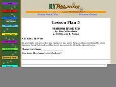
Sparrow Hawk Red - Attribute Web
A useful scaffold to help your class with character analysis and text interpretation. Questions about characters from Sparrow Hawk Red by Ben Mikaelsen guide your young readers to describe a character literally, along with interpreting...
Curated OER
MAPS AND TOPOGRAPHY
Students analyze the details of a topographic map and create one of their own by utilyzing a map of elevations.
Curated OER
Me on the Map Lesson 2
Students analyze and interpret maps, globes and geographic information systems to define and identify cities, counties, states, countries and continents to create a booklet called me on the map. They also determine and calculate the...
Curated OER
Mapping an Empire
How did the expansion of the Roman Empire during the first century contribute to its downfall? Using a map of the Roman Empire in 44 BC and one of the Roman Empire in 116 AD as references, class member use critical reading skills to...
Curated OER
How To Make an Apple Pie And See the World
Learners define and discuss global interdependence. They read How to Make an Apple Pie and See the World and keep a list of the countries visited during the story and identify all of the productive resources and natural resource...
Curated OER
Lesson 2: Mapping Our Home
Students recognize the importance of community participation in the census. In this U. S. Census lesson plan, students use map-reading skills to find answers and learn the difference between senators and members of Congress.
Curated OER
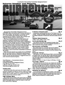
Extreme Weather and Mapping
In this environment worksheet, students read an article about extreme weather conditions and mapping it out. They respond to 10 multiple choice questions about what they read. Then, students explain how droughts can occur and the...
Curated OER
"Akira Takes a Test" Reading Comprehension-Short Stories
In this reading comprehension worksheet, students read a passage about a girl taking a geography test at school. Students then answer 10 multiple choice questions.
Curated OER
Map Coloring
In this math worksheet, students create a map using different colors. They use a specific pattern and can use only four colors. This worksheet is a proof of the making of a map using no more than 4 colors. There is an answer key.
Curated OER
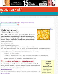
Make This Week's Lessons Pop(corn)!
Students create popcorn timelines, maps, and graphs; do popcorn science and math; explore popcorn history and nutrition; and munch leftover popcorn snacks too!,
Curated OER
Idea Mapping
Students generate, share and display ideas as a group. They break into small groups to work on hand-drawn maps made up of concentric circles. they come before the group and make a similar diagram by charting each other's characteristics.
Curated OER
Formulas Multiple Choice
In this formulas learning exercise, students determine the distance between two points. They read story problems, identify needed information, write equations and solve them. Students find the midpoint of a line. This...
Curated OER
Tropical Travel choices
Young scholars recognize the difference between needs and wants. For this tropical travel lesson, students observe a coin from the Northern Mariana Islands and plan a trip. Young scholars read text about the island and...
Curated OER
MAKE YOUR OWN BOOK OF THE DEAD
Young scholars study the Book of the Dead and its importance to Ancient Egyptian culture, identify with ancient Egyptians through reading about their culture and religion, and use scroll-shaped paper and colored pencils to create their...
Curated OER
Polar Adventure: Read All About It!
Students investigate reports of an adventure to the North Pole or the South Pole and then chronicle it by writing a newspaper article or making a timeline. The focus is placed on a recent or historic expedition to the region selected.
Curated OER
How Can We Make Businesses Safe And Effective?
Fourth graders complete several lessons in order to gain an overview of various facets of business. They read books about business, identify business careers that are of interest to them, write letters to local business leaders, listen...
Curated OER
American Indians, European Settlers, and Colonial Arkansas
Students identify the interdependence among various ethnic groups in early Arkansas history. They illustrate timelines and visit historic sites. They make maps of the site and give class presentations.


