Curated OER
Cardinal Directions
First graders study cardinal directions on maps. In this geography lesson, 1st graders determine and show where North, South, East, and West are on various maps.
Curated OER
Johnny Appleseed Walkabout
Second graders calculate mileage for a journey. In this place value and measurement lesson, 2nd graders read Johnny Appleseed, work in groups to locate his birthplace on a map, locate the other states he stopped in, and measure the...
Curated OER
Navigation
Students explain that globes are the best way to show positions of places, but flat maps are portable and can show great detail. They make a mercator projection of the route Lewis and Clark took on their journey.
Curated OER
Reshaping the Nation
High schoolers learn why the census makes a difference. In this U.S. Census lesson plan, students learn how to read and use a cartogram while they explore new ways to represent data.
Curated OER
Why We Count
Students visualize census data on a map and use a map key to read a population map. In this census lesson plan, students use a map of the Virgin Islands and corresponding worksheets to gain an understanding of population density.
Curated OER
Cacao Tree Geography
Students use a map to learn about where chocolate comes from. In this lesson on the cacao tree, students locate various regions where the cacao tree grows. They will discuss why the cacao tree grows more favorably in particular climates...
Curated OER
Wales: An Interdisciplinary Unit
Students practice basic map and geographic skills as they compare Oregon to Wales. Students color map of Wales and Oregon using color codes to distinguish between land, water, and bordering nations or states, listen to stories and...
Curated OER
A View from the Ground
Students look at a park from ground perspective. In this map skills lesson, students are introduced to a story about a girl at a park and make observations about the park based on a picture. This prepares students for the next lesson in...
Curated OER
Reading Satellite Images
Students analyze satellite images. In this astronomy lesson, students examine 3 satellite images in order to understand how satellite images are taken and what they can teach scientists.
Curated OER
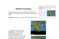
Weather Forecasting
Learners discover how to read a current weather map. In this weather forecasting lesson plan, students view weather maps from three consecutive days and observe how quickly weather moves and changes. Learners review key terms associated...
Curated OER
Choices and Commitments: The Soldiers at Gettysburg
Learners investigate the Gettysburg Campaign and the major actions for each day of the battle. They read primary source documents, write a diary entry, analyze the Gettysburg Address, and write a persuasive speech regarding an issue in...
Curated OER
Trouble With Trolls
Learners listen to The Trouble With Trolls and discuss fables. In this story elements lesson, students work on reading skills. Learners participate in different reading activities.
Curated OER
Red Gets Fed
Learners practice with the strategy that letters represent phonemes and spellings map out phonemes in spoken words. They work on the phoneme sounds of /a/ and e=/e/ in correspondences with reading. Each student also recites the tongue...
Curated OER
Right Place, Right Time
Fourth graders complete mathematical word problems. They study the relationships among distance, speed, and time; and measure travel distances. They measure distances using a piece of string and a ruler and practice converting several...
Curated OER
Choose a Path
In this addition worksheet, students utilize data from a map to answer 6 fill in the blank questions where they provide the missing addends to addition problems.
Curated OER
The Big Buck Adventure
Students practice making change, and adding and subtracting money. In this money lesson, students listen to a reading of The Big Buck Adventure by Shelley Gil. They access teacher assigned web sites to practice making change, adding...
Curated OER
History In Pictures
Sixth graders explore Lewis and Clark's expeditions. For this Lewis and Clark lesson, 6th graders view the routes they took and discuss how the territory has changed. Students make a timeline of their journey. Students research online...
Curated OER
The Impact of Disease on Our Lives
Students write a report about infectious diseases where they demonstrate their understanding of new terminology. In this writing lesson, students analyze the effect of disease in their lives and and make scientific inquiry about the...
Curated OER
Is the Hudson River Too Salty to Drink?
Students explore reasons for varied salinity in bodies of water. In this geographical inquiry lesson plan, students use a variety of visual and written information including maps, data tables, and graphs, to form a hypothesis as to why...
Curated OER
Reading Comprehension/history: George Washington
In this George Washington activity worksheet, students read a one page information sheet about George Washington. Students put 10 events from his life in correct order. Then students answer 4 critical thinking questions.
Curated OER
Learning a New Environment
Students review a school map with color-coded markers and use it to locate classrooms, bathrooms, library, principal's office, etc. They color a school map, cut it into puzzle pieces and then reassemble the pieces.
Curated OER
Common Themes
Tenth graders test usefulness of a model Earth by comparing its predictions to observations in the real world. In this landforms lesson students construct an island from a contour map using model clay then analyze the landscape...
Curated OER
Star Maps and iPads: Explore The World Above
Use these helpful stargazing tips and tools to enjoy the night sky this summer.
Concord Consortium
The Six Faces of Amzora
Here's a task that is out of this world! Given a description of a fictional cube-shaped planet, scholars answer a set of questions about the planet. They create a two-dimensional map and consider the distances between locations on the map.


