Curated OER
Map Creation
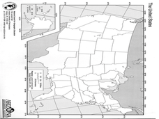
Second graders identify a map, symbol, key, and compass rose. Students create and print a map for teacher evaluation using the computer. Students identify the symbols on their map and orally present them to the class.
Curated OER
Landscape Diversity in the Yukon Territory
Students review and analyze a satellite image of the Yukon territory.
Alabama Learning Exchange
The Very Hungry Class
Students listen to a read aloud of Eric Carle's, The Very Hungry Caterpillar, as an introduction to their study of the metamorphosis of a butterfly. They participate in a number of cross-curricular activities in this unit of lessons.
Curated OER
What is Climate?
Students explore the differences between climate and weather. In this introductory lesson plan of a climate unit, students discuss the vocabulary and concepts associated with weather and climate. They build their information base for...
Curated OER
Enriching Students' Understanding of Criminal and Tort Law Using Technology
Students define criminal and tort law and explain how they are different.
Curated OER
Executive Departments PowerPoint Presentations
Ninth graders research the fifteen Executive Departments. They explore and explain the structure of the federal bureaucracy. Students organize their information about the Executive Departments in a PowerPoint presentation.
Curated OER
Different Perspectives of Oregon's Forest Economic Geography
Students map data on employment in wood products manufacturing in Oregon counties. In this Oregon forest lesson, students discover the percentage of people employed in the forest manufacturing industry. Students create a box and whisker...
Curated OER
Magnetism and the Magnetic Force
Fourth graders investigate magnetism and the magnetic force.
Curated OER
The Nutrients Public Transportation System
Students investigate the human circulatory system by experimenting with hoses. In this human body lesson, students create a system of hoses simulating the circulatory system which they utilize to pass objects through....
Curated OER
More Jelly Bean Math
Students use their color categorized jelly beans to find the range, mean, median and mode. They use their recorded data documenting how many jelly beans there are for each color in order to calculate the range, mean, median and mode of...
Curated OER
Route 66 And Population Patterns
Learners investigate the geography located along Route 66. They research how the population patterns change in certain areas along the highway. Students use the information in order to form hypotheses about how and why the population...
Curated OER
Flips, Turns, and Slides: Adventures with Transformations
Students explore transformations. In this math lesson, students plot points on a coordinate grid and construct shapes. Students discuss movements on the grid as flips, turns and slides.
Curated OER
Animal Research Project
Third graders prepare an oral report using Appleworks to present information on their animal. They write a short narrative comparing and contrasting their animal to another students and, after watching other presentations, discuss what...
Curated OER
Canada
Fourth graders sample the rich diversity of Canada's people and cultures, glimpse the vastness of Canada's lands and waters, and get an idea of the wealth and variety of its resources, wildlife, and history.
Curated OER
The Geographic Doctor Seuss
Learners define the term region using semantic mapping, listen to the Dr. Seuss story Yertle the Turtle, and discuss the conflict over borders in the story. They draw a map divided into regions.
Curated OER
Second Graders Create Their Own Social Studies Book (Part I, The 5Ws of the Constitution)
Students develop their own social studies textbook using a blank theme book as they complete activities and learning experiences throughout the year. The activities are in art, music, simulations, read alouds, shared writing and a class...
Curated OER
Welcome to New York State
Students choose one region of New York state, and create a travel brochure that includes information such as geographical features, tourist attractions, accesibility, economic features, and historical events that occured in that region.
Curated OER
I am, and this is what makes me special
Students design a PowerPoint presentation using six slides that include a title, a picture and five positive attributes about the student. They include the specified pictures and describe how they relate to themselves.
Curated OER
Urban Planning: Plan a City
Students analyze the concept of urbanization by planning the placement of some of the major urban/suburban features that make up most cities. They arrange the cultural features to benefit the people who live there, and maintain respect...
Curated OER
Louisiana Purchase
Learners use maps to locate and describe the area purchased by the Louisiana Purchase. In groups, they write a letter to Thomas Jefferson in which they evaluate the topography, climate and geography of the land. They determine the land's...
Curated OER
Backseat Travelers
Fourth graders investigate the geography of the Southeast regions of the United States. They conduct Internet research, listen to the book "No Star Nights," and plan and write a trip through this regions.
Curated OER
Wsshington Monuments Projects
Eighth graders choose a landmark or monument to investigate (individually or with a partner). After agreeing on items to study they research the landmark/monument and prepare a presentation.
Curated OER
"Real Life" Budgeting Project
Students experience what it is like to be a responsible citizen through a monthly budget through using a variety of research skills.
They apply collected data in a decision making exercise and
present the final product in a clear and...
Curated OER
WWII Website
Tenth graders research a topic related to World War II. They explore the causes and legacy of WWII, the European Theater of Operations, the Pacific Theater of Operations, Diversity in WWII, Women in WWII, and the Homefront. Students...


