Harvard University
Harvard University: Center for Geographic Analysis: Africa Map
Multi-layered interactive map of Africa featuring spatial data for researchers to explore. Contents covers historic maps, period maps, political and population maps, economic maps, environmental maps, and much more. You can also search...
University of Texas at Austin
University of Texas Libraries: Russia and the Former Soviet Republics Maps
Collection of maps (political, geographic, thematic, topographic, etc.) related to Russia and the former Soviet Union.
University of Texas at Austin
University of Texas: Perry Castaneda Library: Brazil Maps
Presents a great collection of maps all having to do with Brazil. There are country maps, city maps, and thematic maps that cover topics such as politics, geography, economy, land use, population, climate, and more.
Curated OER
Ecuador map.jpg (42166 Bytes)
Comprehensive reference tool with an abundance of country specific information about the South American country of Ecuador. Content covered includes photos, symbols, provinces, history, economy, geography, climate, population, culture,...
Curated OER
Ecuador Map .Gif (35419 Bytes)
Comprehensive reference tool with an abundance of country specific information about the South American country of Ecuador. Content covered includes photos, symbols, provinces, history, economy, geography, climate, population, culture,...
Curated OER
Map of Puerto Rico
Detailed information from Infoplease.com on Puerto Rico, including data on its size, location, population, and economics.
Curated OER
Map of Guyana
A country profile of Guyana featuring quick facts and information about culture, geography, climate, history, population, and travel advisories. Includes a map and image of the flag.
Curated OER
Map of Bolivia
Provides quick facts and information on geography, history, government, culture, population, religion, and travel advisories for the country of Bolivia. Includes a map and image of the flag.
Curated OER
Map of Brazil
Useful tool for finding quick facts and information on Brazil's culture, geography, religion, population, and travel advisories. Includes a map and image of the flag.
Curated OER
Map of Paraguay
A country profile of Paraguay featuring quick facts and information and statistics on culture, population, language, geography, history, religion, and travel advisories. Includes a map and image of the flag.
Houghton Mifflin Harcourt
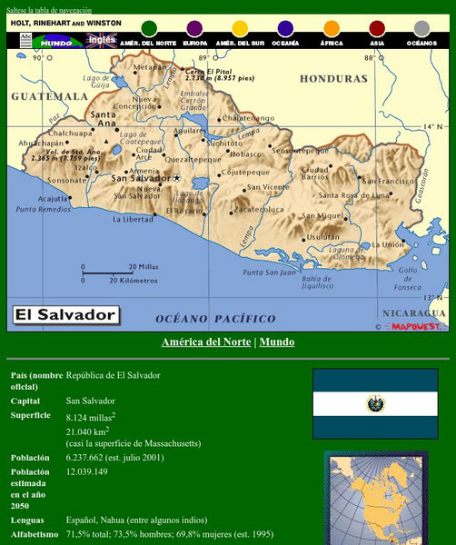
Holt, Rinehart and Winston: America Del Norte: El Salvador
This site has a map of El Salvador in Spanish, with informational data also presented in Spanish about the country. Land mass, population, life expectancy, literacy, industry, agriculture, minerals and resources are among the topics...
Houghton Mifflin Harcourt
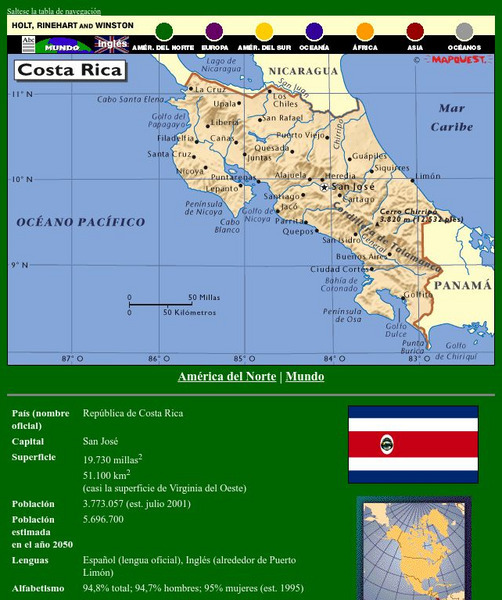
Holt, Rinehart and Winston: America Del Norte: Costa Rica
This site has a map of Costa Rica in Spanish, with informational data also presented in Spanish about the country. Land mass, population, life expectancy, literacy, industry, agriculture, minerals, and resources are among the topics...
Houghton Mifflin Harcourt
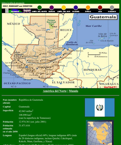
Holt, Rinehart and Winston: America Del Norte: Guatemala
This site has a map of Guatemala in Spanish, with informational data also presented in Spanish about the country. Land mass, population, life expectancy, literacy, industry, agriculture, minerals, and resources are among the topics...
Houghton Mifflin Harcourt
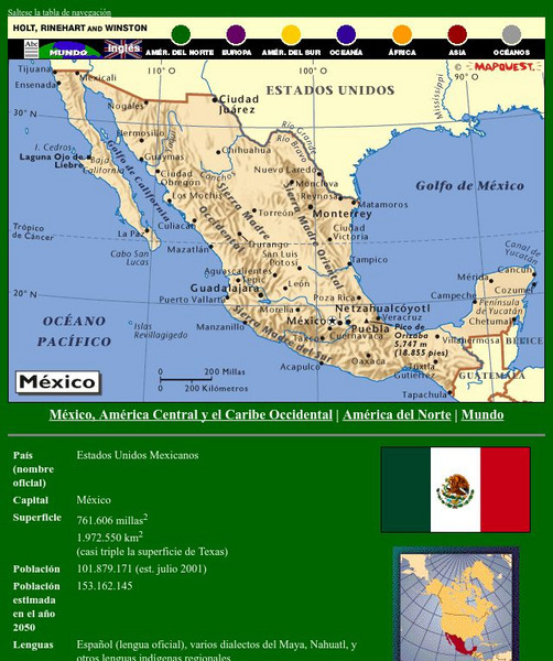
Holt, Rinehart and Winston: America Del Norte: Mexico
This site has a map of Mexico in Spanish, with informational data also presented in Spanish about the country. Land mass, population, life expectancy, literacy, industry, agriculture, minerals and resources are among the topics...
Houghton Mifflin Harcourt
Holt, Rinehart and Winston: America Del Norte: Honduras
This site has a map of Honduras in Spanish, with informational data also presented in Spanish about the country. Land mass, population, life expectancy, literacy, industry, agriculture, minerals and resources are among the topics...
Houghton Mifflin Harcourt
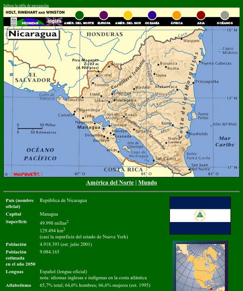
Holt, Rinehart and Winston: America Del Norte: Nicaragua
This site has a map of Nicaragua in Spanish, with informational data also presented in Spanish about the country. Land mass, population, life expectancy, literacy, industry, agriculture, minerals, and resources are among the topics...
Houghton Mifflin Harcourt
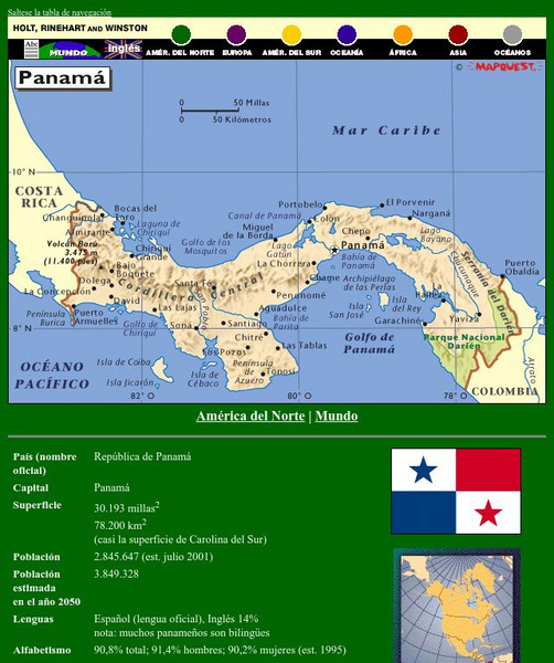
Holt, Rinehart and Winston: America Del Norte: Panama
This site has a map of Panama in Spanish, with informational data also presented in Spanish about the country. Land mass, population, life expectancy, literacy, industry, agriculture, minerals and resources are among the topics...
Houghton Mifflin Harcourt
Holt, Rinehart and Winston: America Del Sur: Argentina
This site has a map of Argentina in Spanish, with informational data also presented in Spanish about the country. Land mass, population, life expectancy, literacy, industry, agriculture, minerals, and resources are among the topics...
Houghton Mifflin Harcourt
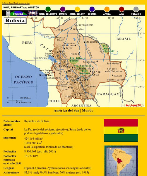
Holt, Rinehart and Winston: America Del Sur: Bolivia
This site has a map of Bolivia in Spanish, with informational data also presented in Spanish about the country. Land mass, population, life expectancy, literacy, industry, agriculture, minerals, and resources are among the topics...
Houghton Mifflin Harcourt
Holt, Rinehart and Winston: America Del Sur: Chile
This site has a map of Chile in Spanish, with informational data also presented in Spanish about the country. Land mass, population, life expectancy, literacy, industry, agriculture, minerals and resources are among the topics addressed....
Houghton Mifflin Harcourt
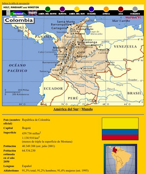
Holt, Rinehart and Winston: America Del Sur: Colombia
This site has a map of Colombia in Spanish, with informational data also presented in Spanish about the country. Land mass, population, life expectancy, literacy, industry, agriculture, minerals and resources are among the topics...
Houghton Mifflin Harcourt
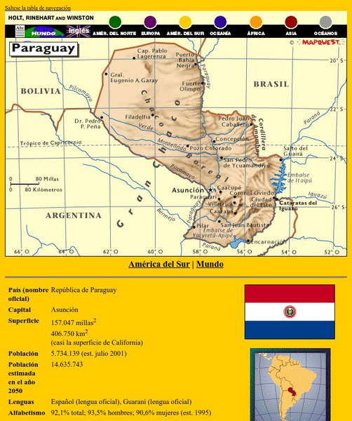
Holt, Rinehart and Winston: America Del Sur: Paraguay
This site has a map of Paraguay in Spanish, with informational data also presented in Spanish about the country. Land mass, population, life expectancy, literacy, industry, agriculture, minerals and resources are among the topics...
Houghton Mifflin Harcourt
Holt, Rinehart and Winston: America Del Sur: Peru
This site has a map of Peru in Spanish, with informational data also presented in Spanish about the country. Land mass, population, life expectancy, literacy, industry, agriculture, minerals and resources are among the topics addressed....


