Curated OER
Cities as Transportation Centers
Middle schoolers work in small groups to identify some of the major transportation centers, recommending two as possible sites for a national political convention, based on population density and the travel networks available in 1835.
Curated OER
The Early History of Haiti
Seventh graders make list of places Columbus explored on his first journey to Americas, locate island of Hispaniola on map, examine groups of people who have inhabited island, complete blank map and key of Hispaniola, and research early...
Curated OER
Hurricanes and Climate
Students investigate maps and data to learn about the connections between hurricanes and climate. In this exploratory lesson plan students describe and graph the 6 regions where hurricanes happen and discuss how hurricanes have changed...
Curated OER
And the Rains Came Down: A South American Rainforest
Students examine the characteristics of a South American tropical rainforest. They analyze maps, develop graphs, listen to the book, The Great Kapok Tree, and create a rainforest mural.
Curated OER
Country: United Kingdom
Young scholars use the Internet to examine the food, sports and history of England, Scotland, Wales and Northern Ireland. They view photographs and maps.
Curated OER
China's Ethnic Minorities
Third graders are introduced to various Chinese ethnic groups. They consider how geography affects ethnic groups and examine artifacts produced by Chinese peoples. They prepare a presentation of their research and artifact interpretation.
Curated OER
The Commonwealth - Members and Structure
Students research the member countries that make up the Commonwealth. They develop research skills using atlases. They define the word community. They complete an online geography quiz.
Curated OER
Strengthening Democracy in Latin America
Sixth graders examine the many challenges facing the nations of Latin America today. In this World Geography instructional activity, 6th graders analyze various documents that will help strengthen democracy. Students create a...
Curated OER
Urban and Rural Communities
Students discuss similarities and differences of urban and rural communities. In this urban and rural communities lesson, students compare urban and rural communities using a Venn Diagram. Students examine maps of each type...
Curated OER
Site vs. Situation: Location! Location! Location!
Students examine places with a similar latitude to Alabama, and discuss the importance of a location's site versus its situation. They analyze maps, create a chart, and write a paragraph on the difference between site and situation.
Curated OER
Where Is Hoku?
Students are introduced to map making and reading. Using maps, they identify the cardinal directions and discuss the importance of a legend. They analyze the human characteristics of the classroom and create overhead view maps of the...
Curated OER
Places and Production
Students investigate the economy and the market value of goods. In this algebra instructional activity, students differentiate between domestic goods value and international good value. The define and identify the importance of GDP or...
Curated OER
Biggest Metro Areas in the USA
In this online interactive geography quiz worksheet, students respond to 100 identification questions about metropolitan areas in the United States. Students have 10 minutes to complete the quiz.
Curated OER
Biggest Muslim Cities Quiz
In this online interactive geography quiz worksheet, students respond to 34 identification questions about the largest Muslim cities. Students have 5 minutes to complete the quiz.
Curated OER
Biggest US City by Letter Quiz
In this online interactive geography quiz worksheet, students respond to 26 identification questions about U.S. cities. Students have 5 minutes to complete the quiz.
Curated OER
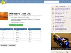
Hottest US Cities Quiz
In this online interactive geography quiz learning exercise, students respond to 20 identification questions about the hottest cities in the United States. Students have 4 minutes to finish the timed quiz.
Curated OER
Lowest Fertility Countries Quiz
In this online interactive geography quiz worksheet, students respond to 20 identification questions about countries with the lowest fertility rates. Students have 3 minutes to complete the quiz.
Curated OER
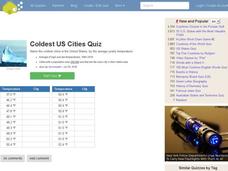
Coldest US Cities Quiz
In this online interactive geography quiz worksheet, students respond to 20 identification questions about the coldest cities in the United States. Students have 4 minutes to complete the quiz.
Curated OER
Mayan History
Students examine Mayan contributions to the world. In this Mesoamerican culture lesson, students view a slideshow about the Maya and then peruse books about the accomplishments of the culture. Students create...
Curated OER
European Capitals Quiz
In this online interactive geography quiz worksheet, students respond to 45 identification questions about the capitals cities of European countries. Students have 5 minutes to complete the quiz.
Curated OER
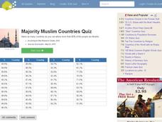
Majority Muslim Countries Quiz
In this online interactive geography quiz worksheet, students respond to 47 identification questions about Muslim cities. Students have 4 minutes to complete the quiz.
Curated OER
World Capitals Quiz
In this online interactive geography quiz worksheet, students respond to 195 identification questions about the capital cities of countries in the world. Students have 12 minutes to complete the quiz.
Curated OER
Top World Languages Quiz
In this online interactive geography quiz worksheet, students respond to 50 identification questions about world languages. Students have 5 minutes to complete the quiz.
Curated OER
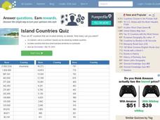
Island Countries Quiz
In this online interactive geography quiz worksheet, students respond to 48 identification questions about island nations in the world. Students have 5 minutes to complete the quiz.


