Curated OER
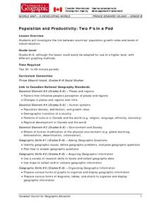
Population and Productivity: Two P's in a Pod
Students investigate the link between countries' population growth rates and levels of industrialization. They observe that, over time, as a country becomes more industrialized, its population growth rate decreases.
Curated OER
Population Pyramid
Students learn about demographic population pyramids. They then design and fictitious nation and draw its population pyramid.
Curated OER
Meeting the Needs of an Aging Population
Learners examine population trends and predict how the age of the majority of Canadians will change 15 years from now in various geographic areas. They will gather statistical evidence that supports their projection. Learners will then...
Curated OER
Fascinating Geography Facts
In this geography worksheet, students will read 4 interesting United States geography facts and 19 fascinating world geography facts.
Curated OER
What is the Population Distribution of Cartoon Characters Living On the Pages of Your Newspaper?
Students read various cartoons in their local newspaper and calculate the population demographics, spatial distribution and grouping of the characters. Using this information, they create a population distribution map and share them with...
Curated OER
A Look at the Population Density of the United States
Students acquire census information and create maps of the population density of the United States on different scales. They role play the roles of workers of a retail company and they use the population data to market to their customers.
K20 LEARN
If Our Classroom Were The World: Proportions And Percents
It's a small world after all. Classmates consider world population, languages, and religions in a cross-curricular lesson. Applying percentages and proportions, they determine what the class make-up would be if the class represented the...
Global Oneness Project
Citizen Photojournalism
Matt Black's photo essay, "The Geography of Poverty" provides a shocking reminder of the poverty that exists in the United States. The resource not only focuses attention on poverty but also conditions that have given rise to situation...
Curated OER
Population and Population Density
Students read and interpret graphs. For this population lesson, students explore population and population density as they read several data graphs and respond to questions.
Curated OER
Populations in the Path of Natural Hazards
Students read "Geographical Mobility: 1995-2000." They examine the maps in the handouts and compare them with maps from an atlas. In the second part of this lesson, students read "In Harm's Way." They receive three more handouts, one a...
Curated OER
Census Data and New Hampshire History
Pupils graph the population growth of New Hampshire using historical census data.
Curated OER
In the Wake of Columbus
Students explore how the population decreased in native cultures.
Curated OER
European Elevation Sort
Given a prepared database of European countries, sixth graders sort the countries in ascending order by elevation and identify the five countries with the highest elevations. This cross-curricular lesson combines elements of computer...
Curated OER
Population-Building a Foundation
Students research to find information about populations and complete world maps by labeling the current population, and determining the 10 countries with the largest population. They search the "World Population Data Sheet." On the third...
Curated OER
The Motivation for Movement
Students explore the geographic theme of movement. In this migration lesson plan, students discuss push-pull factors that motivate immigrants and interpret illegal immigration data. Students also discuss the difficulties that illegals face.
Curated OER
Successful Resource-based Learning Strategies for the Geography of Canada Course
Students conduct a statistical research project on population changes. They evaluate demographic issues, such as the size and location of native people. immigrant groups, and the age and gender of the population.
Curated OER
The Coyote Population: Kansas Prairies
Students discover animal lifestyles by researching their ecosystem. In this animal statistics lesson, students research the geography of Kansas and discuss the reasons why wild animals survive in the open Kansas fields. Students complete...
Population Connection
The Peopling of Our Planet
How many people live on the planet, anyway? The first resource in a six-part series covers the topic of the world population. Scholars work in groups to conduct research and make population posters after learning about the global...
Space Awareness
How To Travel On Earth Without Getting Lost
Have you ever wanted to travel the world? Take a virtual trip with a geography lesson that uses longitude and latitude, the position of the sun, an astronomy app, and a classroom globe.
Curated OER
Where Do I Live?
Students gain a better understanding of the population of the region they live in by comparing U.S. census data on the internet.
Curated OER
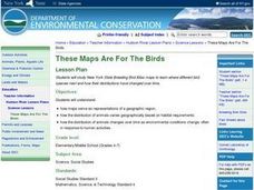
These Maps are for the Birds
Students identify and study New York State Breeding Bird Atlas maps to learn where different bird species nest and how their distributions have changed over time. They also identify how maps serve as representations of a geographic...
Curated OER
Comparing Countries
Students compare facts about different countries. In this comparing lesson, students collect information about the US and another country and compare them. Students locate countries on the map and make a hypothesis about the lives of...
Curated OER
Route 66 And Population Patterns
Students investigate the geography located along Route 66. They research how the population patterns change in certain areas along the highway. Students use the information in order to form hypotheses about how and why the population...
Curated OER
Mapping Population Changes In The United States
Students create a choropleth map to illustrate the population growth rate of the United States. They explore how to construct a choropleth map, and discuss the impact of population changes for the future.
