Curated OER
Exploring Nations
Students, in groups, research countries in East and Southeast Asia. The group designs an oral presentation and PowerPoint slideshow to showcase research on landforms, political and economic issues, global interaction and special-purpose...
Curated OER
Kansas vs the U.S.
Students demonstrate an understanding of the physical and political geography of Kansas. They view maps and films to gain knowledge of Kansas. They calculate the percentage Kansas harvests for each crop out of the national total.
Curated OER
Geography
Learners work together in groups to research the cultural groups of West Africa, Sudan and the Guinea Coast. They compare and contrast each culture and locate the political and cultural boundaries on a map.
Curated OER
No magic borders
Middle schoolers discuss what they have heard about pollution. They explore the purposes and limitations of political boundaries and borders and identify some of the causes and effects of pollution.
Curated OER
Immigrants East and West
Students investigate the personal, political and economic events that drove people to leave their home countries. They research Chinese migrations in the 1800s and the English migrations in the 1600s. They create an identity based on...
Curated OER
Blowing in the Wind
Students identify and interpret maps, graphs, charts, tables and political cartoons. Students identify what a compass rose is and review its meaning in relation to standard directions. Students design their own weathervanes. Students...
Curated OER
Boundaries
Students are introduced to the term of mental mapping. Individually, they develop their own mental map of Washington state and discuss as a class what makes a boundary. They draw their mental map on paper and compare it with their...
Curated OER
A Nation in (Some) Context
Eleventh graders view selected websites to gain information about Puerto Rico and think about its relevance to Rafael Ferrer's "12 Variations on An 18th-century Map of Puerto Rico".
Curated OER
Waterworks In Braintree
Students examine how water affects the community of Braintree. Using a map, they locate main resevoirs and rivers in the area and research the history of one of the resevoirs. They use charts and graphs to show how land use has changed...
Curated OER
Our Way of Life
Learners interview Native American Elders about animal migration, traditional food gathering, and subsistence. They research endangered animals, draw a game cycle, and create maps of local migration of animals.
Curated OER
Our Earth: Storehouse of Natural Resources
Students listen to an explanation of the science of the mining industry and create a geological map of Africa. They discuss the uses of minerals and resources and research a natural mineral resource in their part of the world.
Curated OER
Why Here? Why Not There?
Students analyze a map and graph information on eleven countries. Using the characteristics of the countries, they determine if they should host the summer or winter Olympic games. After viewing a video, they locate the latitudes of...
Curated OER
From Riches to Rice
Tenth graders identify and locate Africa, the United States, the Original 13 colonies, and the region of West Africa on a map. They list examples of culture and African American culture. Students link the culture of West Africa with the...
Curated OER
Exploring Climate Change with GIS
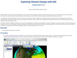
Students investigate climatological changes that are occurring to the Earth. In this climate change lesson, students access an assigned web site to view maps and lessons that show how climate change makes a difference to life on Earth.
Curated OER
Studying the Caribbean Immigration
High schoolers use the site maps and other resources to research one of the influential Caribbean immigrants or descendents of immigrants mentioned in a narrative they have read. They write an essay about an influential immigrant.
Curated OER
Geography and AIDS
Students use Internet research to complete and compare maps and view a video to explore the AIDS/HIV crisis in parts of Africa. They discuss their findings.
Curated OER
In The Shadow of Angkor
Students are introduced to basic historic and geographic facts about Cambodia. They understand the spiritual component of Cambodia's art. They identify Cambodia on a map of the world. They construct a graphic representation of a film...
Curated OER
Negro Leagues Scrapbook
Students compile a scrapbook of photographs, quotations and notes, representing the perspective of a Negro Leagues baseball player. The scrapbook should include photographs with captions, letters, news headlines, and any other materials...
Curated OER
World Geography: Who am I?
Students are able to provide a basic description of one country that has arsenic in its water supply. They are able to locate these countries on a map. Students explore the majors countries that have been affected by arsenic...
Curated OER
Census Statistics
Twelfth graders become familiar with the geography of Ireland. They explore the processes involved in data collection. Students examine and discuss Census Statistics and read and interpret maps/graphs. They decide how the census data can...
Curated OER
Western Hemisphere
Fourth graders use a database to compare countries in the western hemisphere. They describe a variety of regions in Texas and the Western Hemisphere such as political, population, and economic regions that result from patterns of human...
Curated OER
Food in History
Students research, predict and offer solutions regarding factors that affect current or future food crops could result in economic, political or social changes.
Curated OER
Indigenous People
Students examine what foods are indigenous to America and how Western European expansion impacted indigenous communities. They identify indigenous foods that they themselves eat, and label maps and identify ethnic groups in the Americas.
Curated OER
Bosnia, Serbia
Students read and discuss an article about the geographical and political history of Bosnia. They examine recent conflicts, discuss tension between various ethnic and religious groups and review timelines and maps.
Other popular searches
- Wwi Political Map
- Maps of Europe Political
- Physical and Political Maps
- Canada Political Map
- Americas Political Map
- Blank Political Maps
- Political Map of Africa
- United Kingdom Political Map
- Europe Political Map
- Physical & Political Maps
- Mexico Political Map
- State Political Maps


