Angel Island Immigration Station Foundation
How Do Pictures Tell the Story of Angel Island?
Young historians learn more about the history of Angel Island Immigration Station through their analysis of primary source images. Guided by a list of inferential questions, scholars learn how to make and record observations on a...
Curated OER
Topo Map Mania!
Students read and use topographical maps. They also use a compass to find bearing to an object on a map and in the classroom. Ask your students how they might travel to somewhere they have never been to befo
Curated OER
Classifying Matter: A Concept Map
In this classifying matter worksheet, students create a concept map to show the relationships between given terms such as elements, matter, substances and solutions.
Curated OER
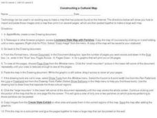
Constructing a Cultural Map
In this constructing a cultural map worksheet, students use cut and paste technology to make a map of Louisiana that has pictures from the Internet.
Curated OER
Landscape Picture Map: Making a Map Grid
Learners create a map grid system. In this map instructional activity, students discuss how mapmakers use a grid system to make giving directions easier. Learners learn how the grid system works and create a grid system on their...
Curated OER
Semantic Mapping In Biochemistry
Students create a semantic map utilizing material learned in previous biochemistry lessons. Their maps will include material on the four types of organic compunds previously explored in class.
Curated OER
Relative Location
First graders use landmarks to describe relative locations of a place. In this geography and mapping lesson plan, 1st graders draw picture maps of their bedrooms to show an object's location in relation to other objects. As an...
Curated OER
Concise Directions: Pictures in School
Students practice giving directions. In this descriptive writing lesson, students create maps and other visual aids that provide sets of directions for students to get from one location of their school building to another.
Mary Pope Osborne, Classroom Adventures Program
The Backpack Travel Journals
Strap on those backpacks, it's time to travel through history with this literature unit based on the first four books of The Magic Tree House series. While reading through these fun stories, children create story maps, record interesting...
Curated OER
Listening Comprehension: Retell Main Events of a Story
Story retell is a very important skill. Little learners use a story map and a previously heard story to walk through the retell and story sequencing process. They complete this activity as a whole class and then on their own.
Curated OER
Finding Your Way Around the World
Students plan a trip around the world and create a PowerPoint presentation of the journey. In this map, atlas, and technology instructional activity, students plan a trip around the world in which they avoid using an airplane. Students...
Curated OER
Comprehension: Identify Story Grammar
This fully scripted lesson could be a big help for someone new to teaching Kindergarten. It outlines what you should do and say as you teach grammar and literary elements such as, main character, setting, and events through reading. The...
Curated OER
Gopher It! Exploring German Cyberspace
Students are introduced to the Gopher research tools. In groups, they compare and contrast English and German services on the gopher servers. They create their own dictionary of computer related terms and spend time downloading picture...
Curated OER
Denali Park Topographic Maps
Middle schoolers construct a topographic map of the Denali National Park. They identify different elevations and record historic landmarks in student science journals.
Curated OER
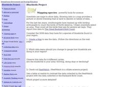
Bluebirds Project: Mapping Species
In this bluebirds project: mapping species worksheet, learners create a map based on data for bluebirds in their area, then answer 5 questions about the mapping of the species. This page has numerous links to helpful web resources.
Curated OER
Map It Out
Explore how illustrations add to a story. Young learners will look at picture books to see how the pictures tell the story. They create illustrations to go with a chosen story, and then flip the activity so they have to write a story to...
American Immigration Law Foundation
No Pretty Pictures
Here is a nice set of activities and discussion questions to accompany your class reading of No Pretty Pictures, a memoir of a young girl's experiences and struggle for survival during the Holocaust.
Space Awareness
Valleys Deep and Mountains High
Sometimes the best view is from the farthest distance. Satellite imaging makes it possible to create altitude maps from far above the earth. A three-part activity has your young scientists play the role of the satellite and then use...
Concord Consortium
The Six Faces of Amzora
Here's a task that is out of this world! Given a description of a fictional cube-shaped planet, scholars answer a set of questions about the planet. They create a two-dimensional map and consider the distances between locations on the map.
Annenberg Foundation
Mapping Initial Encounters
Picture someone's excitement of seeing a horse for the first time. How about a cow? The Columbian Exchange changed life for not only Native Americans, but also for Europeans and the entire world. The second lesson of a 22-part series...
Howard Hughes Medical Institute
Lesson 6: Biomes and Landscapes
Aside from the amazing animals in Gorongosa National Park, what else is there to discover? The sixth installment in an eight-part themed series contains an interactive map where scholars can learn more about the geographic features of...
Curated OER
Weather
Here is a comprehensive and colorful collection of slides to introduce 4th - 8th graders to all things weather-related. The factors that contribute to weather are defined, types of clouds and the related conditions are explained, air...
Curated OER
Types of Transportation
Students identify and describe various modes of transportation. In this transportation lesson, students discuss the types of transportation shown in the Landscape Picture and discuss the purpose of that vehicle. Students locate examples...
Curated OER
Natural Features
Students identify natural features on a map. In this geography lesson, students identify six physical features and create pictorial definitions for each term. The terms which are listed in this lesson are mountain, hill, island, river,...


