Curated OER
About the U.S.A.
Students research the United States and discover its different climate zones, geographical features, animal life, and various cultures. Students complete a research chart using books, encyclopedias and the internet and present their...
Curated OER
Native American Indians
Fourth graders identify Native-American groups in Texas before European exploration and describe the regions in which they lived. They list Native American Indian tribes from Texas, describe them, and evaluate how the environment...
Curated OER
The Geographic Doctor Seuss
Students define the term region using semantic mapping, listen to the Dr. Seuss story Yertle the Turtle, and discuss the conflict over borders in the story. They draw a map divided into regions.
Curated OER
Comparative Geography II
Students engage in a research question of finding the effect of population density upon the use of land in a physical area. They also find the effect of how this can effect the lifestyles of the people who live there.
Curated OER
Canada...A Visual Journey
Students work together to analyze the six natural regions of Canada. Using this information, they create a visual representation of each region on a large wall map and present it to the class. They must identify five key points of each...
Curated OER
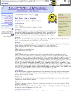
Salt Relief Map of Virginia
Fourth graders create a salt relief map of the four regions of Virginia. They indentify land forms and bodies of water, and summarize how they made their project.
Curated OER
New Hampshire and the Five Themes of Geography
Students explore the location, place, human-environmental interactions, movement, and regions of the New Hampshire landscape through the use of visual representations.
Curated OER
The Sands of Arabia
Sixth graders apply geographic information to the study of World History. For this Geography lesson, 6th graders create a political/physical map of the Middle East, develop questions and answers about the culture of the Middle East, and...
Curated OER
Outlandish Landforms
Seventh graders examine landforms. In this world Geography lesson, 7th graders research and create a physical model of a chosen landform. They then draw a 2-d paper map of that model.
Curated OER
Historical and Physical Georgia: Change
Students explore the geographical features of Georgia. In this geology lesson, students explore the physical regions of Georgia and make observations regarding their changes through the years.
Curated OER
What in Our World Affects the Way People Live
Sixth graders study various maps that show geographical features and population. They compare the maps and make inferences about how various geographical features influence the population and human activities of an area.
Curated OER
Travelogs
Pupils make travelog journals to send to acquaintances in other states in order to receive mail in return. They make scrapbooks with the return mail they receive.
Curated OER
Discovering Places & Regions
Fifth graders research physical and cultural features of a place. They practice skills in gathering information from various sources, using tools such as graphic organizers, word processing, multimedia, and use of the Internet.
Curated OER
Canada's Landform Regions
Students identify and describe the processes that created the landform regions in Canada. They map the regions and research one region to discover more about it. They present their findings to the class.
Curated OER
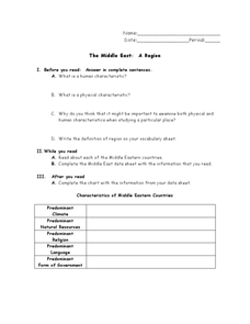
The Middle East: A Region
In this Middle East worksheet, learners respond to 4 short answer questions about the region and its characteristics after they read assigned textbook pages. Students also complete a graphic organizer.
Curated OER
Africa's Climatic Regions
Students are introduced to the different climates and vegetation of Africa, and compare them to similar climatic regions found in the United States.
Curated OER
Regions of the United States
Young scholars explore the regions of the United States. In this geography lesson, students read the text When I Was Young in the Mountains and compare the setting of the story with their geographical setting. Young scholars use a...
Curated OER
Australia Outline Map
In this Australia and Oceania outline map activity, students make note of the major landforms and bodies of water located within this region.
Curated OER
Canada's Natural Regions and Their Varied Characteristics
Students study Canada's six natural regions, including both the human and economic activities of each. In groups, they create a display representing one of the six regions.
Curated OER
Canada's Arctic Barometer
Students research arctic climates. In this Web-quest investigation, students will identify Arctic climate changes, explain the effects of these changes, relate the changes to other regions, and write their findings in a letter format.
Curated OER
Desertification
Students investigate the process of desertification in the Sahel region of Africa. They discuss photos from a National Geographic magazine, analyze the physical/political map of the Sahara, identify the causes and effects of...
Curated OER
Aboriginal Peoples And The Universals of Culture
Sixth graders research specific features of a province or territory of Canada. In this Canadian history lesson, 6th graders identify aboriginal culture areas on a map, identify cultural features represented in their region, and create...
Curated OER
Building an Empire Mapping China
Students create travel brochures of China's nine regions and make a bulletin board display with them.
Curated OER
What a Relief Map
Students create a map using cookie dough. In this geography lesson plan, students research the physical features of a country, draw a diagram and design and create a map out of cookie dough.
Other popular searches
- Physical Regions of Canada
- Physical Regions of Ontario
- Canada Physical Regions
- Tennessee Physical Regions
- Europe Physical Regions
- Maps Canada Physical Regions
- Us Physical Regions
- World Physical Regions
- U.s. Physical Regions
- Physical Regions of the World


