Hi, what do you want to do?
Curated OER
Natural Hazards Research Paper and Oral Presenation
High schoolers use the internet and look at a list of the world's countries and the natural hazards that impact them. They comprehend that it is sometimes called "Nature's Fury," each natural hazard has a heartbeat, a locational pattern,...
Curated OER
Gila Monsters Meet You at the Airport
Second graders listen to "Gila Monsters Meet You At the Airport" and complete venn diagrams of geographical areas.
Curated OER
Vanishing Rainforests: How can We Save Them?
Students focus in on the Amazon Rain forest. They research about various plants and animals that exist in our rain forests. Students develop knowledge of resources that come from our rain forests. They analyze the cause/effect of rain...
Curated OER
Where In the World Are We?
Fifth graders read postcards and find their locations on maps. They use the pictures and text on the postcards to write about imaginary vacations. They compute the mileage and compare it to TripMaker data.
Curated OER
Exploration Watershed
Students discuss what a watershed is, and locate watersheds on a map. In this watershed lesson, students use the information they have been introduced to and create a color coded watershed map of their own.
Curated OER
Moving With Your Roots
Students dissect common words to study the origins of those words. In this language arts lesson, students study the Greek and Latin roots found in many words within English language. Students use dictionaries to fill out worksheets...
Curated OER
Egyptian Weather Lesson
Learners chart temperatures in Egypt on spreadsheet to determine how weather conditions affect lifestyles.
Curated OER
I Heard the Owl Call My Name
Tenth graders read I Heard the Owl Call My Name by Margaret Craven. They share interpretations and conclusions in either oral or written form. They deliver a speech that conveys information using clear and concise language.
Curated OER
Does Conflict Shape Nations? The Middle East
Students locate settlements and observe patterns in the size and distribution of cities using maps, graphics, and other information. They explain the processes that have caused cities to grow.
Curated OER
Studies of the Eastern Worlds: Japan
Seventh graders, in their study of Japan, examine and discuss the effect the atomic bomb had on Japan. They watch videos and then read the story of Sadako and her magic cranes. They make their own origami cranes and write a paragraph on...
Curated OER
Clean Kansas Water
Students gain an understanding of ways we can be responsible custodians of our water supply. Students explore the governor's clean water initiative involving the Lower Kansas/Republican river basin and the pollutants present there.
Curated OER
Landform Bingo
Students review landform terms and review fact and opinion. They make fact and opinion statements and play landform BINGO.
Curated OER
Studies of the Eastern Worlds: Cultural Maps
Seventh graders look for similarities and differences in the culture of Eastern World countries by looking at the art from each country. They test their hypothesis and assumptions through further research in the media center. Finally...
Other
Topo Zone: Free Usgs Topo Maps for the Entire United States
A huge collection of topographic maps for each of the US states. Scroll down to see a map of the United States and click on the state you are interested in. From there, you can search for a particular location, choose a featured map, or...
HotChalk
Hot Chalk: Lesson Plans Page: Edible Geography
Lesson that helps students understand geography of states by creating an edible map of the state, using real food to indicate parts of the state.
Houghton Mifflin Harcourt
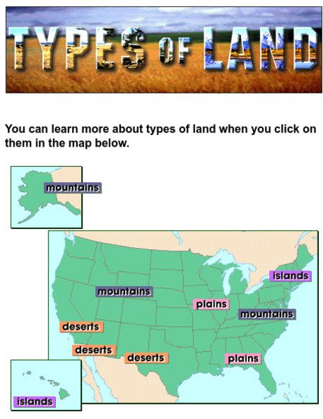
Harcourt: School Publishers: Types of Land
This clickable map of the United States defines different geographic features such as mountains, plains, islands, and deserts.
Johns Hopkins University
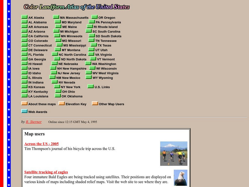
John Hopkins University: Color Landform Atlas of the u.s.
This site from John Hopkins University provides detailed maps of and physical information on each of the 50 states. Maps range from relief maps to satellite images, to historical maps.
Library of Congress
Loc: America the Beautiful
A resource page of online map resources, lesson plans, students activities and the transcript of a live chat on the geography of the United States.
Discovery Education
Discovery Education: Around the World
This resource will compare different regions of the world by climate, geography, animal life, and culture. The site focuses on the differences within the United States regions.
Encyclopedia Britannica
Encyclopedia Britannica: The Rio Grande
This entry provides a description of the physical features, the economy surrounding and the study and exploration of the Rio Grande river.
Mocomi & Anibrain Digital Technologies
Mocomi: What Is a Region?
Learn about regions, the different types, how the United States is divided, and other interesting facts.
ClassFlow
Class Flow: Tornados in the Us
[Free Registration/Login Required] Overview: In this lesson, students will learn the basics about how tornadoes are formed, and when and where they are most likely to occur. They will learn that the United States is the country most...


