Curated OER
Pennsylvania State Map
In this geography of Pennsylvania worksheet, learners color and label a map of the state. Students also study the location of Pennsylvania on a grey background map of the entire 50 states.
Curated OER
Pennsylvania Outline Map
In this Pennsylvania outline map worksheet, students examine political boundaries of the state and the placement its capital city as well as its major cities. This map is not labeled.
Curated OER
State to State Scavenger Hunt
In this states worksheet, students utilize the Internet to access one specific website to locate the answers to five fill in the blank statements about the states found on a United States map.
Curated OER
Do You Know Your 50 States?
Learners use the names and abbreviations of the 50 states to label a blank map of the United States.
Curated OER
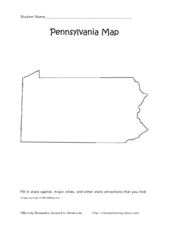
Pennsylvania Map
In this state maps activity, students identify the map of Pennsylvania. Students fill in the state capital, the major cities, and other state attractions.
Curated OER
Map of Pennsylvania's Waters
In this labeling bodies of water in Pennsylvania worksheet, students observe a map outline of the state with water sources and use the word bank of names of creeks, lakes, reservoirs, and rivers to identify them. Students label 21 bodies...
Curated OER
The United States in 1790
In this geography skills worksheet, students study the provided map of the United States in 1790 and then complete the provided quiz over the 17 states and territories.
Curated OER
Mystery State #4
In this mystery state learning exercise, students answer five clues to identify the state in question. They then locate that state on a map.
Curated OER
Geography and Topography, History and Architecture
In this social studies lesson plan, students answer short answer questions about the geography, topography, history, and architecture of the east part of the United States. Students complete 24 questions.
Curated OER
Freeform Pennsylvania Map
In this Pennsylvania map worksheet, students research, study and label twenty important cities, physical attributes and the neighbors that surround Pennsylvania on a Pennsylvania map.
Curated OER
Globe Skills Lesson 5
In this map skills activity, students read a text selection about locations during the American Revolution and then respond to 8 fill in the blank questions.
Curated OER
Project Map: Latitude And Longitude Worksheet
In this latitude and longitude worksheet, students find the coordinates of 14 cities around the world and use this information to complete 14 short answer questions. This worksheet includes online atlas web links.
Curated OER
Old Stone House Lesson Plan
From stagecoach to railroad tracks, your class will discover how advancements in travel in the United States during the nineteenth century played an integral role in the industrialization and development of American society. The main...
Curated OER
Rivers Run Through It
In this mapping practice worksheet, 5th graders read an informational paragraph and answer 7 questions about the parts of a map along with places shown on a given map.
Curated OER
Birds on Wade Islands
In this birds on Wade Islands worksheet, students read a 1 page passage about the state of the birds on Wade Islands and answer 1 short answer questions about it. Students answer "What actions should the wildlife agencies take?"
Curated OER
Sheets Island Archipelago
In this Sheets Island worksheet, students read about the controlling of the Sheets Island, look at a map of it, and answer short answer questions. Students answer 4 questions.
Curated OER
Social Studies Quiz B-Grade 4
In this grade 4 social studies quiz worksheet, 4th graders complete a 15 question multiple choice quiz covering a variety of grade 4 concepts.


