Curated OER
Mapping Perceptions of China
Students discuss what types of things are included on a map. They compare and contrast maps of China with a map they create and practice using different types of maps. They write analysis of their classmates maps.
Rainforest Alliance
Knowing the Essential Elements of a Habitat
To gain insight into the many different types of habitats, individuals must first get to know their own. Here, scholars explore their school environment, draw a map, compare and contrast their surroundings to larger ones. They then...
Curated OER
Compass Rose Directions
Second graders use cardinal and intermediate directions to locate places on maps and places in the classroom, school, and community. They draw a setting map of "Little Red Riding Hood." Students give five steps of cardinal or...
Curated OER
Capitals, Oceans, And Border States
Students investigate geography by completing games with classmates. For this United States of America lesson, students examine a map of North America and identify the borders of Mexico and Canada as well as the Pacific and Atlantic....
Curated OER
James and the Giant Peach Plot Analysis
It's all about the plot, main events, and story mapping with this lesson. As the class reads the novel James and the Giant Peach, they create an excitement graph that actually charts key events and moments of excitement. After...
Channel Islands Film
Island Rotation: Lesson Plan 1
How do scientists provide evidence to support the theories they put forth? What clues do they put together to create these theories? After watching West of the West's documentary Island Rotation class members engage in a series of...
Curated OER
Literature Study Guide: To Kill a Mockingbird
Teaching tools designed to support student-centered literature study. Geared toward homeschoolers reading Harper Lee's book To Kill a Mockingbird, I would use these in my classroom. The materials are applicable to any text: graphic...
Curated OER
Community Map of The Giver
Middle schoolers read "The Giver" after finishing the unit on inventions and inventors. Using the information in the novel, they develop a geographic map illustrating the community in the story. They identify human and physical features...
Curated OER
Essential Elements of Habitat
First graders compare their local area with the Belize landscape. They construct maps of the school area, adding descriptive information. They write haiku poems about their favorite outside places.
Curated OER
Town Mouse/ Country Mouse
Students recognize the difference between the city and the country. In this City Mouse, Country Mouse lesson, students listen to a story and describe and map differences between the city and the country. Students understand that people...
Curated OER
How Worldly Are You?
Sixth graders locate and map six components to have a working knowledge of maps. In this map skills lesson, 6th graders define the six map components and work in groups to draw a map using the components. Students read a related...
Curated OER
Family Life Among the Ashanti of West Africa
Students examine the way of life of the Ashanti who live in West Africa. After locating the countries on a map, they are shown slides of artifacts to determine their uses. In groups, they compare and contrast the Ashanti's view of...
Curated OER
Where Is Hoku?
Students are introduced to map making and reading. Using maps, they identify the cardinal directions and discuss the importance of a legend. They analyze the human characteristics of the classroom and create overhead view maps of the...
Curated OER
Steamers Lesson 1: Routes
Students are introduced to the useage of steamboats in North Carolina. In groups, they research the routes of steamers and discover how they were used. They draw an illustrated map and a timeline of the routes. As a class, they...
Curated OER
Steamers Lesson 1: Background Information
Students discover the use of steamboats in North Carolina. After reading background information, they take notes on their reading and participate in a class discussion. They complete a KWL chart and share what they have gathered in small...
Museum of Disability
Taking Visual Impairment to School
What is the world like when you can't see, or when your vision is impaired? Learn about how Lisa communicates with the world around her with Taking Visual Impairment to School by Rita Whitman Steingold. Learners answer...
Curated OER
Reading Assessment/ Test Preparation
In this reading test preparation worksheet, students read the stories and answer 36 multiple choice questions about them. This is an on-line interactive reading comprehension test.
Curated OER
Postcards from Somewhere
Young scholars correspond with e-pals about their community. In this cross curriculum geography, technology, and literacy lesson, students complete a postcard webquest about their home location including local photographs. Young scholars...
Curated OER
Volcanoes
Second graders review the characteristics and aspects of volcanoes. Using this information, they write a creative story and draw illustrations to accompany the words. They use geographical terms to describe a location and the physical...
Curated OER
Tables, Charts and Graphs
Students examine a science journal to develop an understanding of graphs in science. In this data analysis lesson plan, students read an article from the Natural Inquirer and discuss the meaning of the included graph....
Curated OER
Folktales around the World (Middle, Reading/Writing)
Students analyze, synthesize, and use the elements of various US cultural folk tales to describe the elements of fiction in general and in folk tales specifically.
Other
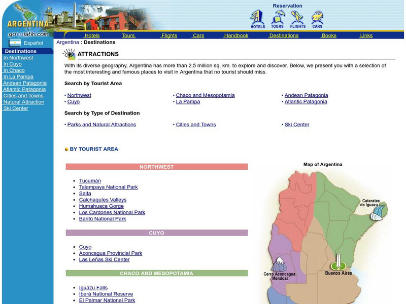
Go to Latin: Argentina Destinations
With its diverse geography, Argentina has more than 2.5 million sq. km. to explore and discover. Here is a selection of the most interesting and famous places in Argentina a tourist cannot miss. You can search for a destination by...


