Curated OER
Orienteering: Welcome to the Jungle
Students work together in groups to complete a treasure hunt. Using the school grounds, they search for pictures and stuffed animals of different species. They use a GPS to locate them and record which habitat they live. They calculate...
Curated OER
Waldseemuller's Map: World 1507
Students investigate the 1507 word map. In this world geography lesson, students examine the details of each section of the map and then draw conclusions about how the people of 1507 understood the world. Students are evalated on...
Curated OER
Assessing and Making Maps
Students evaluate maps using the TODALSIGs basic map analysis system, explained on the worksheet. They create a map of Alaska using TODALSIGs. Students brainstorm the elements of maps.
Curated OER
SpellO': An Orienteering Lesson
Students participate in hands-on activities to practice orienting maps. Given activity cards, students accurately read maps and locate specific stations. Students collect information from the maps to spell a message when the activity...
Curated OER
Map Making/Floor Plans/Map Reading
Students apply their knowledge of scale when mapping the classroom. They determine the use of a map legend and orient a map using a compass. They create the classroom maps using transfer graph paper.
Curated OER
Mapping Puerto Rico
Students use maps to discover where Puerto Rico is located. In groups, they use the internet to research the vegetation. They also compare and contrast the relationship between the United States and Puerto Rico's government.
Curated OER
Combining Map and Compass
Students practice using the map and compass to find a location. In this geography lesson series, students identify basic requirements needed when traveling in the wilderness. They plan a healthy menu for a backpacking trip.
Rainforest Alliance
Knowing the Essential Elements of a Habitat
To gain insight into the many different types of habitats, individuals must first get to know their own. Here, scholars explore their school environment, draw a map, compare and contrast their surroundings to larger ones. They then...
Curated OER
Silk Roads Big Map
Students create an oversized map from Europe to East Asia. They include information such as Silk Roads, geographical features, major cities and cultural information on their map.
Curated OER
Orienteering - The Fundamentals
Students investigate the concept of a compass and it has been used in the past and in modern times. They practice using it in the wilderness in order to test its importance in various exploring activities. Each activity is accompanied by...
National Wildlife Federation
Where In the World Is the Arctic?
Exactly how far away is the Arctic? Learners use maps to orient themselves to their locations on the globe. They then make calculations to describe how their location relates to the location of the Arctic regions.
Curated OER
Things That Stick Out Or: How To Find Your Way Around on a Map
Students explain the meaning of and recognize the map outlines of a peninsula, an isthmus, and a cape.
Curated OER
Maps in Kindergarten: Rosie’s Walk
Students are read, Rosie's Walk by Pat Hutchins. In this sequencing lesson, students discover the importance of knowing how to create a map and read it. They listen to the story and complete various map making activities.
Curated OER
Orienteering Your School
Students use a compass to move from one point to another point. The procedure can be a valuable tool to help students become more observant of their surroundings.
Curated OER
Orienteering 2
Students are shown the basics of map and compass work. They name the parts of a compass and comprehend the function of each part. Students define paces and tallies and use them in a real world situation. They use a map and compass to...
Curated OER
Learning Directions on a Map
Students use north, south, east, and west to identify relative locations and provide directions.
Curated OER
CLASSROOM MAPS
Students do a blind tour of their school by responding to verbal commands. They look and discuss various maps in the classroom. They locate the direction of the sunrise and discuss the compass directions of North, South, East, and West.
Curated OER
Following a Bearing
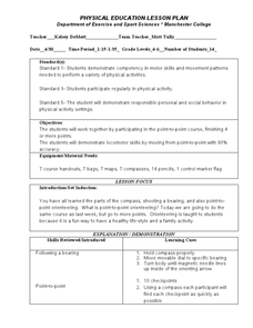
Students practice finding a bearing. In this orienteering lesson, students review how to use a compass and set a bearing. Students complete a worksheet where they practice finding a bearing and complete a group activity to...
Curated OER
The Amazing Race
Students improve their directional awareness by locating sites and symbols on a map. They increase their heart rates while traveling to each site and performing the specified task/exercise at each site.
Curated OER
Learning a New Environment
Students review a school map with color-coded markers and use it to locate classrooms, bathrooms, library, principal's office, etc. They color a school map, cut it into puzzle pieces and then reassemble the pieces.
Curated OER
What do Maps Show?
Eighth graders practice the skill of reading maps. In this geography instructional activity, 8th graders participate in a classroom lecture on how to read a map.
Curated OER
MAPS AND TOPOGRAPHY
Students analyze the details of a topographic map and create one of their own by utilyzing a map of elevations.
Curated OER
Cookie Mapping
Students study the components of a bedrock geology map through a hands-on activity involving a cookie and graph paper.
Curated OER
Orienteering
Students proceed through a simple course following a map but not using a compass. They must find 18 controls working in pairs that leave at 2 minute intervals. Students must record letter and after finding all 18 controls they will...


