Curated OER
Discovering Dinosaurs: Planning your Summer Vacation
Learners utilize the features of the Atlas of Canada website to plan an imaginary vacation from Victoria, British Columbia to Drumheller, Alberta.
Curated OER
Historical Research on Explorers of Canada
Eighth graders study an online atlas of Canada to research an early explorer.
Curated OER
Tracing the Route of Bracero
Learners make a map showing the work of a Bracero Worker. In this Bracero lesson, students listen to a worker in an online oral history as he explains his work locations and crops. They use a map to plot the areas he worked and the crops...
Curated OER
Project Map: Latitude And Longitude Worksheet
In this latitude and longitude learning exercise, students find the coordinates of 14 cities around the world and use this information to complete 14 short answer questions. This learning exercise includes online atlas web links.
Curated OER
Rising Sea Levels: UK and Bangladesh
Learners explore the possible effects of global warming. In this geography/global warming lesson, students identify regions using an atlas and complete a global warming worksheet. Learners perform an experiment in which they simulate...
Curated OER
Let the Good Times Roll
Young scholars read an online New York Times article and investigate the Mardi Gras celebration in New Orleans. They examine how Hurricane Katrina affected the celebration. They design a float that represents the Mardi Gras celebration.
Curated OER
Re: Forest Station
Students read an online article to explore rainforests of the world starting with the Barro Colorado reserve in the Panama Canal. They participate in a mock international summit about rainforest conservation issues.
Curated OER
Social Studies: Where I Come From
Students research the countries of their origins and examine life there today. They write family travel logs by interviewing family members about their heritages, and they visit the Xpeditions Website for online resources about their...
Curated OER
Royal Treatment
Students analyze the Nepalese King's response to pro-democracy demonstrations, and examine existing monarchies around the world. They conduct research, read an article, and present information on various modern-day monarchies.
Curated OER
Tour du Jour?
Students read an article about tourism in Hokkaido, Japan and address the impact of global warming on world wide tourist destinations. They make posters predicting the impact of warmer temperatures on various tourist attractions
Curated OER
Canada's Landform Regions
Students use a atlas to identify and describe Canada's Landform region. Using the information they collect, they create a thematic map of the region and describe all of the physiographic regions and the processes that formed them. They...
Curated OER
Organization of a Territory, Map Elements
Third graders compare printed and online maps and use proper geographic terminology to answer questions.
Geography 360°
Introducing Europe
Provide your learners with a comprehensive introduction to Europe with this great set of worksheets. Map activities include matching European countries to their capitals and places on a political map, as well as exploring different...
Curated OER
The Commonwealth - Members and Structure
Students research the member countries that make up the Commonwealth. They develop research skills using atlases. They define the word community. They complete an online geography quiz.
Curated OER
Comparing Distances
Students practice estimating distances by analyzing a map. In this length measurement instructional activity, students view a map with a distance key and use their measurement skills to estimate the distance between two cities. Students...
Curated OER
It's Your Move
Students study about the creation of a German village in South Korea for returning emigrants. They examine other cases of migration and relocation from modern world history.
Curated OER
Terrestrial Ecozones, Population Density and Species at Risk
Tenth graders navigate and use the online Atlas of Canada. They explain the cause and effect relationship between human settlement and the natural environment and wildlife species. They utilize a worksheet imbedded in this plan.
Curated OER
Nunavut, Our Communities
Young scholars research the Online Atlas of Canada to locate the communities of Nunavut. Students examine the geographic area and characteristics of the communities.
Curated OER
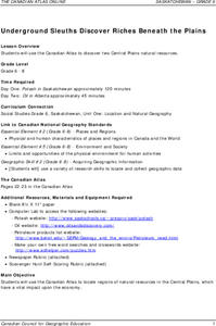
Underground Sleuths Discover Riches Beneath the Plains
Students identify Alberta, Saskatchewan, and Manitoba on map, and use Canadian Atlas to locate regions of natural resources in Central Plains, which have vital impact upon the economy. Students then complete scavenger hunt worksheet.
Curated OER
Geography: Intro to Canada
Students investigate the geography of Canada by analyzing a map of the country. In this North American geography lesson, students identify the 13 provinces of Canada and their locations by examining a Canadian map. Students may use...
Curated OER
The Underground Railroad
Students discuss how slaves fought against their situation and how did they escape. They discover what the Underground Railroad was and how it slaves used it to reach freedom. They then play a game focusing on the Underground Railroad in...
Curated OER
India And Pakistan At 60
High schoolers engage in a lesson that is concerned with the comparison of India and Pakistan. They construct a venn diagram comparing the two while conducting research. There are several extension activities that include a timeline,...
Curated OER
Canada's Landform Regions
High schoolers identify and describe the processes that created the landform regions in Canada. They map the regions and research one region to discover more about it. They present their findings to the class.
Curated OER
Canada...A Visual Journey
Young scholars work together to analyze the six natural regions of Canada. Using this information, they create a visual representation of each region on a large wall map and present it to the class. They must identify five key points...


