Curated OER
Etc: Maps Etc: Mexico, Central America and the West Indies, 1852
A map from 1852 of Mexico, Central America, and the West Indies. The map shows territorial boundaries at the time, including the Mexican States, capitals and major cities and ports, railroads, rivers, lakes, mountain systems, and terrain...
Curated OER
Educational Technology Clearinghouse: Maps Etc: Mexico and West Indies, 1855
A map of Mexico, Central America, and the West Indies showing the foreign territorial possessions and independent countries in the region in 1855. The map is color-coded to show the territorial and island possessions at the time of Spain...
Curated OER
Educational Technology Clearinghouse: Maps Etc: Mexico, 1920
A map from 1920 of Mexico showing major cities and ports, railroads with connections to the railroad network in the United States, shipping routes from New Orleans and San Francisco with distances given in nautical miles, rivers with...
Curated OER
Etc: Maps Etc: From New Orleans to the Gulf, 1862
A map of the Mississippi River from New Orleans and Lake Pontchartrain to the mouth on the Gulf of Mexico. The map shows the location of Forts Jackson and St. Philip, two Confederate forts essential to the protection of New Orleans,...
Curated OER
Educational Technology Clearinghouse: Maps Etc: Vicinity of New Orleans, 1916
A map from 1916 of the Mississippi River Delta from New Orleans and Lake Pontchartrain to the mouth of the river on the Gulf of Mexico. The map shows railroads, swamp lands, navigation lights, and water depths in fathoms. The 3, 10, 20,...
Curated OER
Educational Technology Clearinghouse: Maps Etc: Environs of New Orleans, 1903
A map from 1903 of the Mississippi Delta region showing the site of New Orleans, Lake Pontchartrain, Lake Borgne, and the course of the Mississippi River through the bird's-foot delta to the Gulf of Mexico.
Curated OER
Educational Technology Clearinghouse: Maps Etc: North America, 1800
A map of North America and Central America showing territorial claims and possessions in 1800. The map is color-coded to show the territories of the United States, British, Spanish, French, and Russians, and indicates areas of disputed...
Curated OER
Educational Technology Clearinghouse: Maps Etc: North America, 1783
A map of North America, Central America, and northern South America at the end of the American Revolutionary War (1783). The map is color-coded to show the territory of the United States at the time, British possessions in Canada,...
Curated OER
Educational Technology Clearinghouse: Maps Etc: North America, 1858
A map from 1858 of North America showing the boundaries at the time for Russian America (Alaska), Greenland, British America or New Britain, Canada East and Canada West, the United States, Mexico, Central America, and the West Indies...
Curated OER
Etc: Maps Etc: The Mississippi River Route of Hennepin, 1697
A facsimile of a portion of the map created in 1697 describing the exploration and discoveries of Father Louis Hennepin in New France and Along the Mississippi. The map shows the region from the Great Lakes to the Gulf of Mexico along...
Curated OER
Educational Technology Clearinghouse: Maps Etc: South America, 1921
A map from 1921 of South America showing the political boundaries of the time, major cities, railroads, terrain, rivers, and coastal features, and includes an insert map of the Galapagos Islands. " South America, the fourth largest grand...
Curated OER
Educational Technology Clearinghouse: Maps Etc: United States, 1845
A map of the United States in 1845 after the Louisiana Purchase, the Lewis and Clark Expedition, and the annexation of Texas. The map is color-coded to show the States and territory of the United States west to the Pacific with the dates...
Cayuse Canyon
The Us50
This clickable map of the United States gives students access to research information from history and tourism to attractions and famous historic figures.
Curated OER
Etc: The Territory of the United States, 1845 1886
A map from 1886 of the United States showing the territories ceded by Mexico and the acquisition of Alaska. The map is color-coded to show the possessions of the United States, Great Britain, and Mexico at the time, and the Mexican...
Curated OER
Etc: Texas Controversy and Territorial Adjustment, 1836 1850
A map of the western United States between 1836 and 1850 showing the Texas controversy and territorial adjustments at the time. The map is color-coded to show the unorganized territory of the Louisiana Purchase and the boundary line with...
Curated OER
Etc: Territorial Development of the United States, 1783 1889
A map from 1889 of North America showing the expansion in the region of the United States from the original Thirteen Colonies at the end of the Revolutionary War in 1783 to the time the map was made, around 1889, before the territories...
Curated OER
Etc: The Us at the Outbreak of the Civil War, 1860 1861
A map of the United States at the outbreak of the Civil War (1860-1861) showing the States that seceded to form the Confederate States of America. The map also shows the territorial boundaries of the Washington Territory, Dakota...
Smithsonian Institution
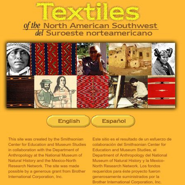
Smithsonian: Textiles of the North American Southwest
This site explores the weaving traditions of the Native American and Hispanic peoples of northern Mexico and the southwestern United States. A gallery of artifacts, timeline, map glossary, and textual descriptions are included. This is a...
Curated OER
Map of New Mexico
Use this site to learn the history of the controversial creation of the atomic bomb in the United States. Sound clips from National Public Radio and a photo gallery help to give you a first hand experience of the making of the atomic bomb.
Wikimedia
Wikipedia: Pacific Ring of Fire
Wikipedia offers information on the location of the Pacific Ring of Fire, an area of frequent earthquakes and volcanic eruptions. Map included.


