Curated OER
Nutrients In Chesapeake Bay
Students perform pH and turbidity test to determine water quality. In this environmental science instructional activity, students analyze NASA database on chlorophyll-a in the bay. They explain how a small river area affects Chesapeake Bay.
Curated OER
Volcanoes and Urban Planning
Students analyze satellite image data of Volcan Villarica. In this earth science lesson, students identify dangerous areas surrounding the volcano. They propose a new safe location for the town.
Curated OER
NASA Search
In this space worksheet, students identify and locate vocabulary terms related to NASA and space. There are 31 words located in the puzzle.
Curated OER
Keep Your Eye on the Sky
Young scholars examine the different types of satellites, cloud formations and weather patterns. In this weather lesson plan students use the Internet to research weather satellites, then write an article and create graphs.
Curated OER
Sea Surface Temperature Trends of the Gulf Stream
Learners explore the importance of the Gulf Stream. Using a NASA satellite images, they examine the sea surface temperature. Students collect the temperature at various locations and times. Using spreadsheet technology, they graph the...
Curated OER
Systems of Equations in Space Science
In this system of equations worksheet, students solve 2 problems by creating a system of equations for each problem in order to determine the average intensity of flares from the sun and the average power from a satellite transponder.
Curated OER
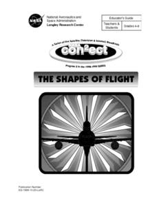
The Shapes of Flight
Young scholars explore interaction between mathematics, science, and technology as they look at process of researching, developing, testing, and evaluating airplane design. They calculate glide ratio for model paper airplane by using...
Curated OER
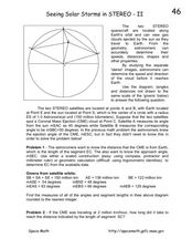
Seeing Solar Storms in STEREO-II
In this solar storms learning exercise, students use a diagram given the location of two STEREO spacecraft satellites, a coronal mass ejection, the sun and the Earth to solve 2 problems about the coronal mass ejection. Students use...
Curated OER
Strange New Planet
Fourth graders gather data and simulate a Mars spacecraft mission using multi-sensory observations.
Curated OER
Graphing With RXTE
High schoolers use data from the Rossi X-ray Tiiming Explorer (RXTE) satellite to analyze and graph.
Curated OER
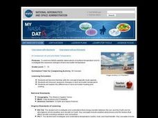
A Comparison of Land and Water Temperature
Students use the NASA website's Live Access Server to create a graph of surface temperature at two locations on earth. They analyze the data and then answer specific questions provided in this lesson. They also examine and compare the...
Curated OER
How Can a Spacecraft Always Face the Sun?
Young scholars determine the correct orbital path for a satellite that collects data about the sun so that its view of the sun never be obstructed by the Earth.
Curated OER
Plane Weather
Students examine the important issue of plane safety. In groups, they are introduced to how NASA determines if it is safe to fly on a particular day given certain conditions. They use the internet to research the types of tools and...
Curated OER
Stars and Slopes
Students use the slopes of various curves plotted on log-log graph paper to classify stellar objects as binary stars, supernovae, or active galaxies.The data used in this lesson were obtained from X-ray astronomy satellites.
Curated OER
Coral Bleaching in the Caribbean
Students practice analyzing images, maps and graphs from Internet-based educational resources. They explore the correlation between sea surface temperature and coral bleaching. Students comprehend that coral reefs are collections of tiny...
Curated OER
Ozone Layer
Seventh graders develop an understanding of the ozone layer, it's affect on Earth, and the effect of human activity on the ozone layer. They then interpret data from satellite pictures and develop an understanding of longitude/latitude...
Alabama Learning Exchange (ALEX)
Lost in Space - A Solar System Study
Fourth graders study the planets of our Solar System collecting data on a worksheet. They use online tools to create a puzzle or other digital product using the information from their research.
Curated OER
Solar System Planet Research
In this space science instructional activity, students collect data that includes information in a chart or graph to display in a group. They identify and describe various planet features of a specific planet of choice. Students write...
Curated OER
STEREO Watches the Sun Kick up a Storm!
For this solar storm worksheet, students use images of a solar tsunami to determine the size and speed of the wave. This worksheet has 5 problems to solve.
Curated OER
The Pressure of a Solar Storm
In this solar storm worksheet, students are given three equations and they calculate the magnetic pressure and the particle pressure of a solar storm. They also determine the distance to the magnetopause of the solar storm and determine...
Curated OER
Snow Cover by Latitude
Students create graphs showing the amount of snow coverage at various points of latitude and compare graphs.
Curated OER
The Measurement of All Things: Atmospheric Detectives
Students identify the characteristics of aerosols. Using remote sensing, they participate in an experiment in which they determine how the sun's radiation and elements in the atmosphere interact with one another. They also research the...
Curated OER
A Journey of Discovery with RXTE
Students complete different missions to examine the topic of x-ray sources. They use satellite images and websites to gather the information they need to complete the lesson. They complete a worksheet to end the lesson.
Curated OER
How Far Away is SOHO?
High schoolers create a scale model of the Earth and the sun that demonstrates where the SOHO satellite is in relation to the Earth.


