Curated OER
Real World Investigation- Math and Geography- Elevation Changes
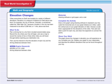
For this math and geography real world investigation, 6th graders plan a driving trip to a city that is located several states away from their home while recording the elevations of three cities that are included in the trip. They use...
Edgate
Great Grids
Learners use grid boxes as a measurement tool and discover how grids are used for mapmaking and scaling down an area. They begin by attempting to draw a model shape drawn by the teacher by using the gridding process. At the conclusion of...
Curated OER
Traveling aroud Our Town
Learners are asked to describe to a partner how he or she walks to school or the bus stop. They are shown on the overhead an one-inch grid paper, and at the intersection of two lines on the grid paper, students are shown a house and...
Benjamin Franklin Tercentenary
From Ben’s Pen to Our Lives
What would Ben do? Jumping off from the pseudonymous letters Ben Franklin fooled his older brother into publishing when he was still a teenager, young literary lovers dive into acting, writing, and addressing a local issue with wit and...
Curated OER
The Mathematician And The Archaeologist
Students decorate clay pots and destroy them in order to learn the techniques of modern-day archaeologists and practice mathematical measurements. This is an exciting lesson suitable for Social Studies, Math, Science, or Art classroom.
Curated OER
Mapping and Excavating a Jello Mold
Fifth graders, in groups, map the three layers of different colored jello layers in molds and note the placement of fruit in them. On the grid paper they draw each grape, raisin, or other object and carefully remove each layer. After...
Curated OER
Let's Go Golfing
High schoolers bring their visions for golf courses to life. In this scale model lesson plan, students research golf courses online, plan golf courses on grid paper, and then create scale models of the courses they planned.
Curated OER
Compass Directions
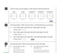
In this compass activity, students solve 10 problems pertaining to compass directions. Students draw arrows on compasses according to the directions. Students also plot paths on grid paper, following directions given. This page is...
Curated OER
Mapping with a Compass: A Simulated Survey
Students use compasses and grids to map the locations of artifacts found in a simulated dig site. In groups, they role-play as future archeologists excavating a school site. Groups begin at their assigned datum and site the artifacts...
Curated OER
Map Your School
Learners participate in a project to map their school. They measure and graph various areas around the school. Young scholars find the longitude and latitude of the school and research the school's history, and highlight special...
Curated OER
Coordinate Grid: Mapping Archeological Sites
Fourth graders discover how to apply the Cartesian coordinate system by figuring out the length and width of their school playground. They determine that pacing is an important tool for the initial mapping of a site. Students conduct a...
Curated OER
Snowboarding! Join the U.S. Team: Olympics, Math, Weather
Students make weather predictions and observations, research the cost of snowboarding equipment, and use their math skills to plot the course of a Giant Slalom Snowboarding event.
Curated OER
Cartography Project
A lesson involving mapping, the use of a compass, writing and following directions, and exploring the first two themes of geography is here for you. Learners create original maps that show the routes they take through their own...
Curated OER
Mapping a Site Using a Coordinate Plane
Learners map their playground as if it were an archeological site. They locate objects on the playground and determine their location using coordinate points. A related lesson is Coordinate Grid: Mapping an Archeological Site.
Curated OER
Lagoon Lake
Students develop skill in using co-ordinates. Up to eight cardinal points of the compass are used making this a useful activity in simple map and grid work. They utilize educational software to gain practice.
Curated OER
Water and Land 207
Students examine maps of different projections, mathematically calculate distortions, and note the advantages and disadvantages of each map. They study the different maps and transfer the map to graph paper.
Curated OER
Marketing Occupations
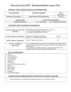
Young scholars identify and explain the variables effecting supply and demand in the marketing industry. Then they define the terms supply and demand and graph supply and demand curves on a standard grid. Students also formulate what...
Curated OER
A Recipe for Reading: Asian Style Rice and Eggs
Learners read, write about, and cook with rice in this home economics lesson. They reflect on the experience eating rice at home or in other ethnic foods.
Curated OER
Fractions of Active Volcanoes
In this fractions worksheet, students draw the fraction of active volcanoes in the different areas of the world. Students color 4 different areas to represent the fraction of the world with active volcanoes.
Curated OER
My Favorite Holiday
Students create a My Favorite Holiday Calendar Page. They recall the months of the year and identify the various components of a calendar. Students also apply their learning about holiday customs to consider their own favorite holiday...
Curated OER
Investigating Latitude and Longitude
Students examine the lines of latitude and longitude on a map, and explain why these lines might be useful. In this lesson students also explore websites that provide information to improve their understanding of how and why latitude and...
Curated OER
"Geometry With Quilts"
Fifth graders examine the geometry of quilts. They discuss the history of quilting, design two nine-patch squares, exchange one design on an Internet bulletin board, and construct a hot pad that is quilted.
Curated OER
Atlas Scavenger Hunt
Learners discover what type of information in an atlas by participating in a scavenger hunt. With a partner, they try to find the answers to many questions as possible. They exchange their papers with another partner group and check...
Curated OER
Introduction to Archaeology
Students view a PowerPoint presentation called, Archaeological Terms then discuss the job of an archaeologist and new vocabulary. They view the teacher made "artifact grid" and photograph the grid from different angles. They work in...


