Hi, what do you want to do?
Ducksters
Ducksters: Geography for Kids: European Countries
Learn about Europe and the countries of Europe. Facts such as geography, flags, maps, exports, natural resources, and languages are on this website.
Curated OER
Educational Technology Clearinghouse: Maps Etc: Central and Western Europe, 1920
Map of Central and Western Europe after the Treaty of Versailles at the end of WWI. The map includes railroads, canals, major cities and capitals, and the country boundaries established by the Treaties of Versailles, proposed boundaries...
Curated OER
Etc: Maps Etc: Political Boundaries in Europe, 1920
Map of Central and Western Europe after the Treaty of Versailles at the end of WWI. The map includes railroads, canals, shipping routes, major cities and capitals, and the country boundaries established by the Treaties of Versailles,...
Curated OER
Etc: Maps Etc: Western Europe During the Third Inter Glacial Stage, 25,000 Bce
Map of Western Europe, at a time when sea levels were much lower and the British Isles were connected with the mainland. Major river routes are shown extending to the theoretical coastline of the period. According to the authors in 1916,...
Curated OER
Educational Technology Clearinghouse: Maps Etc: Barred and Safety Zones, 1917
A map of the "barred zones" and "safety lanes" outlined in Germany's 1917 note to the United States regarding neutral shipping to and from Europe.
Curated OER
Educational Technology Clearinghouse: Maps Etc: Grape and Wine Production, 1916
A 1916 map of grape and wine production in Europe.
Curated OER
Educational Technology Clearinghouse: Maps Etc: Distribution of Languages, 1916
A map of the distribution of Indo-European languages in Europe, including Celtic, Germanic, Latin, Slavic, Greek, and Albanian languages. Areas where language families other than Indo-European are also shown, including Lapp, Finnish,...
Antonio Salinas and Maria Jesus Egea
Vedoque: Geografia De Europa
This game is about the various countries of Europe. It has a set of questions about their locations on the map, their capitals and their flags.
Library of Congress
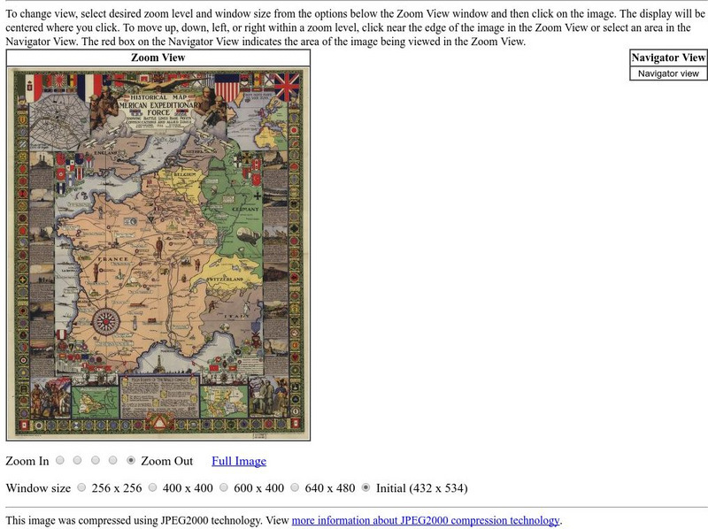
Loc: American Memory: Historical Map American Expeditionary Force
Explore this interesting historical map drawn by Ezra C. Stiles that showed the American Expeditionary Force in Europe during World War I.
University of Oregon
Mapping History: Late Aegean Bronze Age
A key makes this map useful for locating cities and palaces of the Late Aegean Bronze Age (1250-1000 BC) and for understanding the extent of Mycenaean culture.
US Holocaust Memorial Museum
U.s. Holocaust Memorial Museum: Map: European Rail System, 1939
Map showing the network of railroads in Europe that facilitated the transport of Jews to extermination camps in German-occupied Poland.
Other
Islam Project: Maps
A series of historical and near-present-day maps that span Islamic history. Starting with A.D. 750, the maps illustrate both the spread of Islam (from Medina outward to Africa, the Middle East, Europe, and other parts of the world) and...
PBS
Pbs|cet: The Story of the Jews With Simon Schama
Simon Schama travels through three thousand years of Jewish history across Europe, the Middle East, Northern Africa, Bermuda, and into the United States. Notable historical data and images are presented through an interactive map.
Curated OER
Etc: Maps Etc: Commercial Map of the United States, 1872
A commercial map from 1872 of the United States showing the principal railroad and steamship routes in the region at the time. The map shows state boundaries and capitals, major cities and ports, submarine telegraph cables to Europe,...
Nations Online Project
Nations Online: Romania
A great country profile that takes you on a virtual trip to Romania in Eastern Europe. An overview is given on its art, culture, people, environment, geography, history, economy, and government. There are numerous links available that...
Nations Online Project
Nations Online: Switzerland
Offers a virtual destination guide and profile of the alpine nation of Switzerland, background overview, and numerous links to comprehensive information on the country's culture, history, geography, economy, environment, population,...
Nations Online Project
Nations Online: Belgium
Features a country profile of the European nation of Belgium, background overview, and numerous links to extensive information on the nation's culture, history, geography, economy, environment, population, news, tourism, government, and...
Nations Online Project
Nations Online: Lithuania
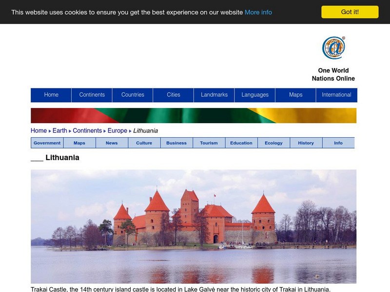
Great destination guide and country profile of Lithuania featuring a background overview, and numerous links to comprehensive information on the country's culture, history, geography, economy, environment, population, news, tourism,...
Nations Online Project
Nations Online: Macedonia
Excellent online resource that provides a country profile of the Balkan nation of Macedonia, background details, and numerous links to in-depth information on the nation's culture, history, geography, economy, environment, population,...
Nations Online Project
Nations Online: Czech Republic
Here you can find a country profile and travel guide to the European country of the Czech Republic, background overview, and numerous links to extensive information on the country's culture, history, geography, economy, environment,...
Nations Online Project
Nations Online: Luxembourg
A great reference source for getting a country profile of the little European nation of Luxembourg. Offers background details, and numerous links to key information on the nation's culture, history, geography, economy, environment,...
Nations Online Project
Nations Online: Spain
Presents a virtual destination guide and profile of the European country of Spain, background overview, and numerous links to comprehensive information on the country's culture, history, geography, economy, environment, population, news,...
Nations Online Project
Nations Online: Croatia
Features a virtual destination guide and country profile of the European nation of Croatia, background details, and numerous links to in-depth information on the nation's culture, history, geography, economy, tourism, environment,...
Philadelphia Museum of Art
Philadelphia Museum of Art: How Big Is Africa? [Pdf]
Comparative map of Africa that demonstrates the size of its landmass in relation to that of Europe, the United States, and China.
Other popular searches
- Blank Maps of Europe
- Outline Maps of Europe
- Geography Maps of Europe
- Maps of Europe 1914
- Maps of Europe Political
- Maps of Europe Ppt
- Maps of Europe Pot
- Maps of Europe 1919
- Topography Maps of Europe
- Blank Maps of Europerating=3
- Maps of European Renaissance
- Blank Maps of Europe Cold War






![Philadelphia Museum of Art: How Big Is Africa? [Pdf] Graphic Philadelphia Museum of Art: How Big Is Africa? [Pdf] Graphic](https://content.lessonplanet.com/knovation/original/471327-0528f8d8c2b18263f3dbb4bc84c9399d.jpg?1661492057)