Curated OER
Where in the Latitude Are You? A Longitude Here.
Students distinguish between latitude and longitude on the map. In this mapping lesson, students participate in mapping skills to recognize spatial relationships, and where to find natural resources on the map. Students create...
Teach Engineering
Incoming Asteroid! What's the Problem?
Oh, no! An asteroid is on a collision course with Earth!. Class members must rise to the challenge of designing a shelter that will protect people from the impact and permit them to live in this shelter for one year. In this first lesson...
Curated OER
MAP MAGNETIC FIELD OF A ROOM
High schoolers map the magnetic field of a room (classroom or room at home -- recommend kitchen) at two or more heights. They create a coordinate grid within the room and make a relatively accurate map of the room to super impose the...
Teach Engineering
The Great Pacific Garbage Patch
The Great Pacific Garbage Patch is one of several garbage patches around the world where garbage accumulates naturally. As part of a GIS unit that combines oceanography, environmental science, and life science, class members investigate...
Curated OER
Weather Reporting
Young scholars locate a weather map on the internet and explain or predict the weather for the following day. Students interpret the information on the weather map and pick the correct clothing to wear for that day. Young scholars chart...
Curated OER
Plotting A Hurricane Using latitude and Longitude
Students explore map and plotting skills by tracing the movement s of hurricanes through the Earth's systems. a hurricane map is developed from daily media reports.
NOAA
Plate Tectonics I
Young geologists get a glimpse beneath the earth's surface in this plate tectonics investigation. After first learning about the different layers of the earth and the constant movement of its plates, young...
Curated OER
Map Field of Current
Learners determine that moving charges create a magnetic field. They discover that the speed and direction of motion, the amount of charge, and the deflection angle observed are closely linked. A voltmeter, pendulum, and a constructed...
Curated OER
Skeletal, Skin, and Muscular Systems
Eighth graders explain the functions of various body systems. Using a concept map, 8th graders identify and explain the fuctions of the skeletal, skin, and muscular systems of the body. After completing their concept map, students...
Curated OER
Race and Genetics: An Integrated Approach
Students analyze racial issues related to the Human Genome Project. They participate in a mock symposium and write a reflection/position paper based on specific ethical principals.
Curated OER
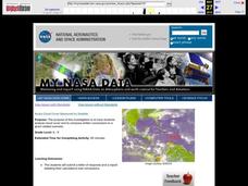
Aruba Cloud Cover Measured by Satellite
Students analyze cloud cover and to compose written conclusions to a given related scenario. They submit a letter of response and a report detailing their calculations and conclusions.
Curated OER
Volcanoes:How Safe Are They?
Young scholars explore volcanoes, locate them on maps, record general information about volcanoes, and organize information on a fact sheet.
Curated OER
Communications: To the Rescue!
Students role-play as soldiers rescuing lost mountain climbers. Working in teams, they interpret maps to locate the climbers and use flashlights to send and receive coded messages about the rescue. Their goal is to complete the task in...
Curated OER
Geology Word List
In this science worksheet, students review the vocabulary words for the separate categories related to the concept of geology.
Curated OER
Drifting Continents
In this plate tectonics worksheet, learners study the continents map and complete 8 short answer questions related to them. They predict what the Earth will look like millions from now.
Curated OER
Lesson Plan of a Thematic Project - Water
Sixth graders investigate the properties of water. In this life science lesson, 6th graders create a concept map of water. They share their work with the class.
Curated OER
Current Interactions
High schoolers design an experiment to see how wind, temperature, and salinity work together to influence ocean currents and present it in a report format. They explain to their classmates how experiment findings relate to ocean currents.
Curated OER
A Brand New Day
Students locate Maine on a classroom map and discuss if Maine is where the nation's first light is found, where would the nation's last light be seen. They explore the idea of the sun rising in the east and setting in the west.
Curated OER
Watershed Investigations
Young scholars find maps of the region to show rock formations and soil types and use GIS to compare radon levels. They describe three types of radioactive decay, interpret graphs, and follow steps to develop a nuclear bomb or energy.
Curated OER
Blowing in the Wind
Students identify and interpret maps, graphs, charts, tables and political cartoons. Students identify what a compass rose is and review its meaning in relation to standard directions. Students design their own weathervanes. Students...
Curated OER
Patterns of Heredity
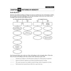
In this heredity worksheet, students will complete a graphic organizer with information relating to heredity, incomplete dominance, selective breeding, and hybrids.
Curated OER
Weather Wise
Students investigate weather and how to forecast it. They discuss the three types of clouds and the kind of weather they bring. After setting up a database, they reearch weather-related websites to check cloud conditions and weather...
Disney
Where Do Brown Bears Live?
What do brown bears in Alaska's Katmai National Park need to survive? Pupils explore the unique habitats, diet, and survival needs of this animal. They predict the consequences of removing any integral part of the bear's survival,...
Curated OER
Levers and Pulleys
Seventeen pages of material leave you well-prepared to carry out this lesson on levers and pulleys. Photos and diagrams make the instructions clear; resource links provide additional information. The missing aspects of this teacher's...


