Curated OER
Donde en el mundo estas?
Learners give & follow directions given in Spanish, using oral, written and graphics. They use maps, globes, atlases, and remote sensing, GIS, and GPS to acquire and process information about places.
Curated OER
Seeing the Seafloor Using Sound - Multibeam Sidescan Sonar
Students are told that sound is not just stuff that our ears hear. They are explained that it is a tool for measuring and looking at objects in a new way. Students are introduced to sound waves and sonar imaging. They are explained...
Curated OER
Mountains "Fold, Fault, Erupt, and Erode"
Fifth graders conduct an experiment to demonstrate the folding and rippling of rock to form a mountain. They identify mountain chains on a map, participate in the demonstrations, and define folding fault block, igneous eruptions, igneous...
Curated OER
Aquifer Model
Learners, after researching and brainstorming about aquifers and locating aquifer maps of Texas, participate in the building of a model of an aquifer complete with a pumping station. They also answer a variety of questions at the...
Curated OER
Exploring the World's Geography
Students discuss the seven continents of Earth and the diverse geography. After discussion, they create their own paper-mache globes which properly display all seven continents, the equator, and the prime meridian. They conduct research...
Curated OER
Intermediate Guided Reading Lesson Plan
Third graders read Children of the Earth and Sky: Five Stories about Native American Children by Stephen Krensky. In this guided reading instructional activity, 3rd graders gain knowledge about various Native American tribes. Using a...
Curated OER
The Whiningdingdilly
Students read the book The Whiningdingdilly and complete a Venn Diagram, write a friendly letter, find misplaced animals, and morph animals and humans. In this The Whiningdingdilly lesson plan, students practice reading, writing, map...
Curated OER
The Coldest Place at the Bottom of the World
Students research and trace Shackleton's actual and intended route on an area map. They analyze the altitude changes involved in a trek across Antarctica and complete a worksheet comparing Antarctica to their own state.
Curated OER
Quad Squad
Students pretend they have visited a forest research station on an overnight field trip. They study forest fires, use compass directions, read maps, interpret imagery, and think about the impact of fire on ecosystems.
Curated OER
Meet Meteorology
Students explore meteorology, discuss Earth's atmosphere, create drawings of the water cycle, create meteorology journals, and role play forecasters. Nine lessons on one page; includes unit test.
Curated OER
What Do We Learn From the Repartiation of Alaska Native Artifacts?
Students observe and evaluate evidence of Alaska Native cultural symbols and artifacts. They research historical data from a variety of primary resources, including the Harriman expedition journals, related web sites, oral accounts,...
Curated OER
Football a Big Success in Small Alaska City
Students read about the creation of a football program at a small-town school in Alaska. In this current events instructional activity, the teacher introduces the article with a map and vocabulary activity, then students read the news...
Curated OER
Is Your Spot Hot?
Eighth graders explore global warming. In this Earth Science lesson plan, 8th graders will look for Harbingers and fingerprints for different areas. The students will identify an area at risk and they will then create a...
Curated OER
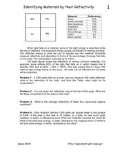
Identifying Materials by their Reflectivity
In this reflectivity worksheet, students read about the absorption and reflectivity of light by different materials. Students solve 4 problems and determine the composition of given materials based on the amount of light reflected. They...
Curated OER
The Adventures of the Alamo
Fifth graders demonstrate their ability to locate San Antonio on a Texas map, use the Internet to conduct research on the War of the Alamo, and simulate the past during dress-up day and Pinata Day.
Curated OER
Geography: examining the Glacial Features of Cape Cod
Students examine satellite images of the glacial features of Cape Cod. They analyze where human activity is located in terms of those features. Students make models of the features, including kettle holes. They also use contour maps...
Curated OER
Mapwork: A Place In the News
Students determine how to find geographic information about places they read about in the news. In this geography lesson, students look at political and physical maps to determine the difference. They access maps online to find the...
Curated OER
Off to the Future
Students read a handout and predict the position of the San Andreas Fault far in the future. In this future world instructional activity, students use a map worksheet to demonstrate the path of the Pacific Plate millions of years from now.
Curated OER
Discovering Fossils
Students dig for and discover fossils in a classroom setting. They dig on a tarp to find, map, assemble, and photograph their discoveries.
Curated OER
Carbon Monoxide and Population Density
Tenth graders investigate the carbon monoxide level at a fixed latitude to determine if there is a relationship to population density. They download data sets and generate a graph, and find locations using the Earth's coordinate system....
Curated OER
Rock Cycle Review
In this rock cycle worksheet, learners review major concepts related to rock formation by answering 15 multiple choice questions and matching 15 terms to their definitions. Students identify 7 rocks as metamorphic, sedimentary, or...
Curated OER
Multinational Corporation Relocation
Students examine and analyze the concept of why multinational corporations relocate production facilities from developed nations to less developed nations. They explore the patterns and networks of economic interdependence incorporating...
Curated OER
Star Quest
Learners review the concepts of the branch of science known as astronomy. They discuss stars and constellations and then view the night sky using a portable digital planetarium projector. They identify a variety of constellations using a...
Curated OER
Ocean Observations
Students examine a coastal ocean. In this physical science/earth science activity, students generate a list of questions about how researchers study the ocean. In addition, students investigate, through research on the computer, to...
Other popular searches
- Earth Scene Concept Maps
- Earth Scone Concept Maps
- Earth Science Mapping
- Earth Sciecne Concept Maps
- Mapping Earths Surface
- Mapping Earthquakes


