PBS
Pbs Learning Media: North American Rivers and Their Widths
Rivers are essential to any society. They provide fresh water, recreation, and transportation. Students will analyze the distribution and relationship among North American rivers using this map from NASA. Background information and...
National Geographic
National Geographic: Mapping u.s. Watersheds
Students will identify and explore major rivers and watersheds in the United States.
National Geographic
National Geographic: Mapping the World's Watersheds
In this lesson, students use a world map to locate and label major rivers and their watersheds. They then compare watershed shapes and look at typographical features that determine their shapes. A vocabulary list with definitions is...
PBS
Empire of the Bay: Site of the Red River Rebellion
Learn about the site of the Red River Rebellion through this video by PBS.
State Library of North Carolina
N Cpedia: Catawba River
Catawba River rises in the Blue Ridge Mountains of McDowell County, approximately 20 miles east of Asheville, flowing east-northeast above Hickory until turning southward into the massive Lake Norman Reservoir. It then continues south,...
University of Arizona
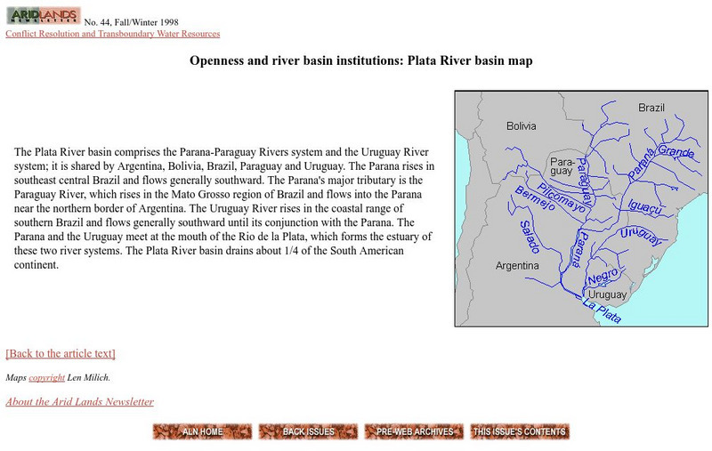
Plata River Basin Map
View a map of the Plata River basin, which is made up of the Parana-Paraguay and Uruguay River systems. Includes a short description of the region.
War Times Journal
War Times Journal: Ia Drang River Valley Battle Maps
Three animated battle maps on the famous three-day battle fought between the US Army and the North Vietnamese Army in November 1965. This battle represented the first major encounter between the two combatants.
PBS
Pbs Teachers: Water Use: Tragedy in the Owens River Valley
Map the geographical area of a watershed, evaluate watershed use and describe land use practices of the people within one. Investigate the events surrounding the war over the Owens River in California at the turn of the 20th century.
NASA
Nasa: World Map Puzzle
This site from the National Aeornautics and Space Administration provides an interesting activity with a relief map and its correlation with space. "Wouldn't it be fun to make your own miniature world, complete with mountains, valleys,...
PBS
Pbs Learning Media: Taming the Mississippi
At 2,300 miles long, the Mississippi River is the second longest river in North America. People have tried to control the flow of the river to prevent floods and keep it flowing towards port cities. This can lead to loss of land in the...
Greek Gods
Greek Gods: Ancient Greece: Styx
This site provides information about the Ancient Greek River Styx, the Gate of the Underworld, including where it was located, its purposes, a map, and a picture.
Geographypods
Geographypods: Theme 2: Natural Environments
A rich collection of highly engaging learning modules on topics related to the natural environment. Covers four main areas - plate tectonics, forms and processes, weather and climate, and rainforest and desert. Within each of these,...
Other
New Netherland Institute: Virtual Tour of New Netherland
A comprehensive site on the colonization of New Netherland by the Dutch. Find maps, pictures, and artifacts on this interesting tour.
PBS
Pbs Learning Media: Atchafalaya Bay Deltas
The Mississippi Delta is disappearing because of rising sea levels and the construction of levees, yet the deltas in the Atchafalaya Bay are growing. View this video from NASA showing images collected over 31 years showing the growth of...
Other
Combined Arms Research Library: Atlas of the Sioux Wars:
An in-depth look at the Sioux Wars from 1862-1877. Included are maps for many topics discussed.
Other
North Georgia History: Chickamauga: River of Blood
A very vivid review of the Battle from North Georgia.com. Images and links to maps are also provided.
Ohio History Central
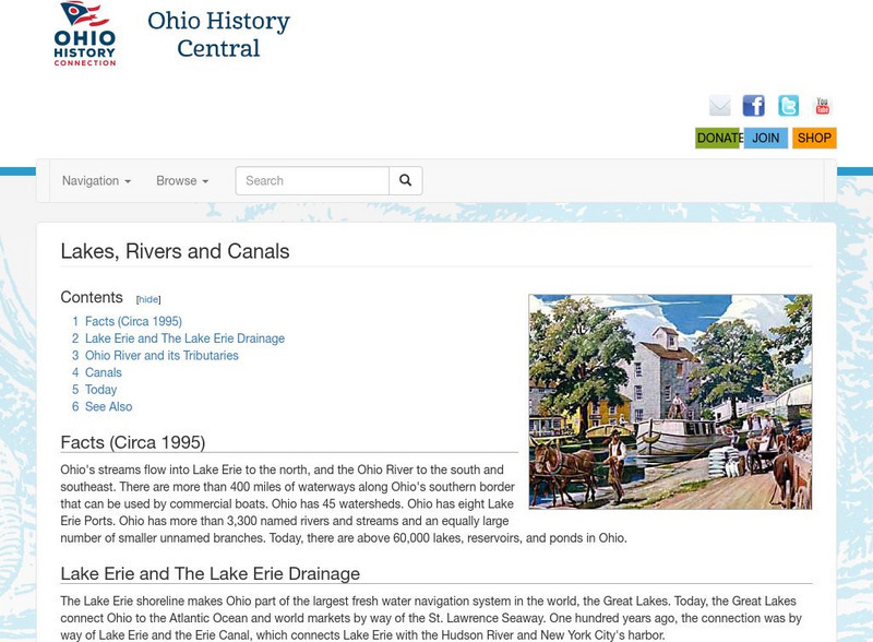
Ohio History Central: Lakes, Rives, & Canals
This site provides a brief introduction to the river system and canals of Ohio. Includes a history of the canal system, details and maps of the drainage throughout the state, and how the river systems are used today.
Enchanted Learning
Enchanted Learning: All About China
At this site from Enchanted Learning, you can learn all about China, view a map, and try some of the activities provided. Activities include printing out China's map and coloring it and learning Chinese numbers from 1 to 10.
Other
Manitoba Life and Times: Birth of Manitoba
Follow the events leading to the formation of Manitoba as a province. The early years at Red River, the Resistance, the Manitoba Act, amnesty, the metis, and the huge land grant are each addressed at length.
Other
Gateway New Orleans: Louisiana Purchase
Read a description of the terms of the Louisiana Purchase. There is a map to show the land that was included in this deal.
Other
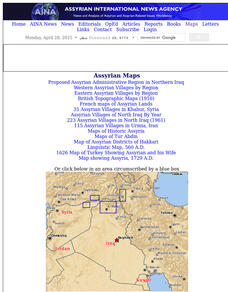
Aina: A Brief History of Assyrians: Geography
This is a brief article describing the geography of Assyria and its extent across the Middle East. Click on the word Assyria to take you to a map the region.
Other
Aina: A Brief History of Assyrians
Shows the extent of the Assyrian Empires from 1800 BC to 627 BC. Includes maps.
State Library of North Carolina
N Cpedia: Fontana Dam
Fontana Dam, the largest dam of the Tennessee Valley Authority (TVA) system, is located on the Little Tennessee River in Graham County. Completed in 1945, it is a gravity-type concrete structure 480 feet high, 2,365 feet long, and 376...


