Curated OER
Landscape Picture Map: Making a Map Grid
Students create a map grid system. In this map lesson, students discuss how mapmakers use a grid system to make giving directions easier. Students learn how the grid system works and create a grid system on their landscape pictures.
Curated OER
The Global Grid System-World Map Activity
Young scholars demonstrate how to use the global grid system. In this map skills instructional activity, students use a world map to locate various locations. Young scholars identify locations based on the global grid system. Students...
Curated OER
Where is ? ? ? ?
Students explain and explain the concept of a grid system. They define absolute and relative location and develop an imaginary city on graph paper using a grid system.
Curated OER
Introducing Maps Through Dance
Students are introduced to the key concepts of maps; direction, pathway/line, shape and symbol. They create the pathways and shapes they have "mapped" out on paper on the floor. They dance along the paths.
Curated OER
Playground Mapping
Students convert their physical models of a playground from a previous lesson into a map of the playground that includes a scale and key. They examine and discuss examples of maps, view an image to map photo essay, and create a map using...
Curated OER
Assessing and Making Maps
Students evaluate maps using the TODALSIGs basic map analysis system, explained on the worksheet. They create a map of Alaska using TODALSIGs. Students brainstorm the elements of maps.
Curated OER
Locating Places
Learners demonstrate how to use the map grid system. In this map skills lesson, students are given coordinates to locate several locations on a world map. Learners use the map grid system to identify these locations.
Curated OER
Where in the World
Students explore the global grid system. In this globe lesson, students identify latitude and longitude lines and how these can tell the coordinates of any place. They use the Internet to find the exact coordinates for their town.
Curated OER
MAP GRIDS, CLIMATES AND HEMISPHERES
Students compare/contrast the grid and latitude/longitude system used on a globe. They describe the areas which are considered to be a tropical, temperate, and polar, based on knowledge of climates.
Curated OER
Locating Places - Making a Map Grid
Students learn how to use a letter and number map grid. In this map grid lesson, students look at a landscape map and describe how to locate the airport. They compare the descriptions of different students to determine how they are the...
Curated OER
Electronic Mapping
Young scholars identify countries, oceans, and capitals by building an electronic map.
Curated OER
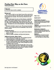
Finding Your Way on the Farm
Third graders make a grid map. In this directionality lesson, 3rd graders review how to use a grid to locate objects or places on a map. Students draw a grid map of the classroom and locate seating assignments. Students create a grid of...
Curated OER
Put Me in My Place: Using Alphanumeric Grids to Locate Places
Learners practice locating points on a large wall grid and create and label a neighborhood map. For this geography lesson, students spell and discuss places as the teacher places them on the map. They discuss the concept of an...
Curated OER
Geography and Culture of China
Take out a map, a paper, a ruler, and those coveted colored pencils for a lesson on Chinese culture and geography. This is a multifaceted approach to basic geography skills that incorporate story telling, class discussion, primary source...
Curated OER
Some Things You Need to Know to Read a Map
Students study things the you need to know to read a map and explain location.
Curated OER
Location, Location, Location: Using a Grid to Determine Context
Seventh graders are introduced to making inferences about artifacts. Using a grid system, they locate the artifacts and determine where they originated from. They use this information to make conclusions about the way people lived...
Curated OER
But Where Is It On This Modern Map? A problem-solving, mind-boggling experience!
Trace Columbus' voyages by locating them on 21st Century maps. Using a navigators lesson, 4th graders will examine the Age of Exploration and trace Columbus's routes accurately on laminated world maps using different maps. Note:...
Curated OER
School Sleuths Treasure Map
Students are explained how a grid and compass work. They are also explained that archaeologists use grids as a record of the exact location of artifacts. Students define the term datum as a point of reference on grids from which all...
Curated OER
Labeling a Map of Australia
Third graders label a map of Australia. Using the internet, they research the history and maps of the continent and print a blank map. They review on how to use a compass rose and legend. In groups, they create a brochure to share...
Curated OER
Plotting a Hurricane Using Latitude and Longitude
Learners define and use "absolute location," latitude, and longitude. They locate on a map or globe the Earth's poles, circles, tropics, and beginning points of measurements for latitude and longitude.
Curated OER
Me on the Map Lesson 1
Students use maps, globes, geographic information systems and other
sources of information to analyze the nature of places at a variety of scales. They identify on a map and determine the population
of the city, county, state, country...
Curated OER
Latitude on World Maps - World Map Activity 2
Learners explore the concept of latitude. In this geography activity, students discover the global grid system and complete a map activity which require them to record the latitude of various cities in the world.
Curated OER
"Yarning" About Latitude and Longitude
Learners identify various locations using latitude and longitude. In this map skills lesson, students use yarn and labels to create a "human globe." Learners identify the Prime Meridian, the Equator, and Northern and Southern Hemisphere.
Curated OER
Metrics And Measurements
Students engage in a study of measuring distances between geographical locations on a map. They are able to define and use the map scale in conjunction with the metric system. For this lesson they make their own maps and measure the...


