Curated OER
Identifying Pennsylvania Watersheds
Ninth graders study and identify the six major drainage systems in Pennsylvania. In this watershed lesson students read an article, complete an activity and take a quiz on what they learned.
Curated OER
NIH Image Fault Investigation
Students use the image processing software, NIH Imageto view images of Earth taken from the space shuttle. They use NIH Image to determine the length of the visible portion of the fault, where it has ruptured the Earth's surface.
Curated OER
A Moving Experience
Learners visit Time Machine's San Francisco Earthquake Era. They understand how the Earth's layers interact to cause changes in the Earth's surface. They review information about earthquakes and Earth's layers.
Curated OER
World Geography: Global Interdependence
Students are able to discuss the theory of climate change. They identify examples of how climate change impacts the earth's geo-spheres. Students are able to use the example of climate change to describe the interdependence of the...
Curated OER
Mountains "Fold, Fault, Erupt, and Erode"
Fifth graders conduct an experiment to demonstrate the folding and rippling of rock to form a mountain. They identify mountain chains on a map, participate in the demonstrations, and define folding fault block, igneous eruptions, igneous...
Curated OER
Flight Paths of Orbiting Satellites
Students examine the path a satellite follows as it orbits the earth. For this space science lesson, students use a globe as they illustrate a satellite in its orbital plane, then plot points on the satellite's path on the globe to see...
Curated OER
Early Explorers
Fifth graders study early explorers. In this World history lesson, 5th graders draw an outline of a map labeling each part, build geographical features out of dough, and paint each of the land and water features.
Curated OER
Seeing the Seafloor Using Sound - Multibeam Sidescan Sonar
Students are told that sound is not just stuff that our ears hear. They are explained that it is a tool for measuring and looking at objects in a new way. Students are introduced to sound waves and sonar imaging. They are explained...
Curated OER
Building a Topographic Model
Students explore Mount Shasta and various locations on Mars to examine ways geographical data can be represented. They study topographic maps and translating data from 2-Dimensions to 3-Dimensions.
Curated OER
Volcanoes: Mount Vesuvius
Students explain how volcanoes form. In this earth science lesson, students identify the different types of volcanoes. They create brochures about Mt. Vesuvius before and after the eruption.
Curated OER
Did You Feel That? Earthquake Data Chart
Students plot earthquakes on the world map using coordinates of longitude and latitude. They designate the earthquakes magnitude with a symbol which they include in the map key.
Curated OER
Geography, Map Skills & the Internet:
Learners research various websites focusing on Italy while enhancing student utilization of computer, keyboards and the Internet. They discuss their findings on the geography, history, topography, and culture.
Curated OER
Measuring the Earth
Students identify types of arcs and angles in a circle, find the measure of arcs and angles, and solve real world problems involving lengths of segments in circles, lengths, and areas.
Curated OER
Structure of the Earth
Sixth graders investigate earthquakes and volcanoes. They demonstrate fault lines with a folded piece of paper, conduct an erosion experiment, and construct a volcano using clay, baking soda and vinegar.
Curated OER
Linkages Between Surface Temperature And Tropospheric Ozone
Students collect and interpret data to make predictions about the levels of ozone in the atmosphere. Using the internet to collect data students use their collected data to create a line graph for analysis. Students make mathematical...
Channel Islands Film
Arlington Springs Man: Lesson Plan 2
West of the West's documentary Arlington Springs Man and a two-page scientific article about the same topic provide the text for a reading comprehension exercise that asks individuals to craft a one page summary of information gathered...
Curated OER
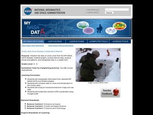
Great Lakes Snow Analysis Collaborative Network
Students interpret data on snow cover and analyze trend patterns. In this snow lesson students compare data and locate their school's GPS coordinates.
National Wildlife Federation
Quantifying Land Changes Over Time Using Landsat
"Humans have become a geologic agent comparable to erosion and [volcanic] eruptions ..." Paul J. Crutzen, a Nobel Prize-winning atmospheric chemist. Using Landsat imagery, scholars create a grid showing land use type, such as urban,...
Science 4 Inquiry
An Investigative Look at Florida's Sinkholes
In May of 1981, the Winter Park Sinkhole in Florida first appeared and is now referred to as Lake Rose. Scholars learn about the causes of sinkholes through an inquiry project. Then, they analyze recent data and draw conclusions to...
It's About Time
Renewable Energy Sources - Solar and Wind
There has been a huge solar energy spill! Let's go outside to play in it. This lesson includes multiple experiments showcasing solar and wind energies. Scholars build a solar heater and an anemometer before testing the results. The...
Curated OER
Probes, Exploration & Application
Students explore how a surface can be described without seeing it.
Curated OER
Latitude on World Maps
Sixth graders examine the purposes of maps. In this Geography lesson, 6th graders practice using latitude and longitude on a map.
Curated OER
Lesson: Journey of a Tree
Third graders explore the operation of a Christmas farm and how trees are shipped. After taking a tour of a Christmas tree farm and researching transportation, location and cost issues, 3rd graders create a map to show the distribution...
Curated OER
A Model of Three Faults
Learners investigate faults. For this science lesson, students explore the many stresses and strains in the earth's layers and research the types of faults in their state.


