Curated OER
My Science Box: Seafloor Spreading
Students examine the movement of plate tectonics. In this lesson on the spreading of the seafloor, students use maps and models to observe how the sea floor spreads.
Curated OER
Geological Forces and Topography
Students discuss and research the Earth's geological processes. For this geology lesson, students study maps of Utah and the United States to learn about geological features. Students then complete the research cards for each area of...
Curated OER
Dead Sea Investigation: Middle East and African Connections
Young scholars demonstrate comprehension of the physical characteristics of the Dead Sea region and its connection to the Red Sea and the African Great Rift Valley. They are given students the opportunity to understand the role of plate...
Curated OER
Under The Sea
Second graders study how a tsunami is formed by underwater events such as earthquakes, volcanoes or landslides. They discuss what they knew about living and non-living things in the ocean.
Curated OER
Down on the Ocean Floor
Students build a map of the Atlantic Ocean floor and mark the different depths. In this ocean floor lesson students identify parts of the ocean floor that they created and discuss patterns that they see.
Curated OER
Plate Tectonics
Students examine plate tectonics and landforms. In this plate tectonics lesson students complete an activity. Students practice drawing maps that show different fault lines and the land formations that were caused.
Curated OER
A Model of Earth's Tectonic Plates
High schoolers build a model of the Earth showing tectonic plate boundaries. The pattern for the model is provided in the instructional activity. This is a very useful hands-on component for a instructional activity about geology or...
Curated OER
Zoo Welcomes Baby Animals
Students engage in activities to gain a better understanding of endangered animals. In these animal lessons, students use vocabulary and comprehension skills to gain a better understanding of endangered animals. They also watch video...
Curated OER
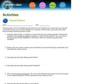
Tsunami Waves
In this tsunami waves worksheet, students explore data from the Indonesian tsunami of 2004 and answer ten questions about the data. They draw conclusions about the devastation and destruction based on the amplitude and speed of the tsunami.
Curated OER
What in the World?
Eighth graders plot points of longitude and latitude on a world map. In groups, they create a model of the earth's interior and label the parts,
Curated OER
The Physical Geography of Australia, Oceania, and Antarctica
Students access information from the United States Geological Survey's Web site This Dynamic Earth to research the Ring of Fire. They answer four questions and then apply what they have learned to create a bulletin board display.
Curated OER
Volcanoes In Japan
Sixth graders study the characteristics of volcanoes in this unit. They apply the research to the study of three volcanoes in Japan. They complete mapwork, identify indicators of impending volcanic activity, and describe the dangers...
Curated OER
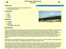
Plate Tectonic - Volcanoes Post Lab
Second graders discover volcanoes that occur around the world. They identifying volcano parts.
Curated OER
Plotting Plates
Learners investigate plate tectonics and their correlation with natural phenomena like earthquakes and volcanoes. They use the internet to see real-time data about earthquakes and volcanoes. Students plot latitude and longitude points on...
Curated OER
Geological Development of Indiana and the Movement of Peoples Across the State
Fourth graders examine the geological development of the state of Indiana. Using the internet, they interact with the United States Geological Survey. They identify earthquake zones and energy resources in the state. They work...
Curated OER
Geological Development of Indiana and the Movement of Peoples Across the State
Students are introduced to the geological development of the state of Indiana. Using the internet, they visit the U.S. Geological Survey and locate the earthquake zones in the state. In groups, they locate and identify the energy...
Curated OER
Lost Roman Treasure
Students simulate what it would be like to be archeologists. They evaluate a quadrant area of a lost Roman treasure map. They generate their findings on the map into specific categorizes.
Curated OER
Hazard Alert
Students examine data regarding the occurrence of natural hazards as they occur in the United States. They record data on a classroom chart, map the areas affected by the hazards, and analyze and discuss conclusions drawn from the...
Curated OER
Arsenic Globally
Students, using directed questions, identify five internet resources. They use these resources to identify relevant information by highlighting those sections that address the provided questions. Students present the answers to these...
Curated OER
NIH Image Fault Investigation
Students use the image processing software, NIH Imageto view images of Earth taken from the space shuttle. They use NIH Image to determine the length of the visible portion of the fault, where it has ruptured the Earth's surface.
Curated OER
Marine Animals: Stranded on the Coast
Young scholars identify marine animals that could become stranded due to coastal features and currents. They plot data on worksheets for locations of sea turtles actually beached or stranded. After plotting their points, they hypothesize...
NASA
Erosion and Landslides
A professional-quality PowerPoint, which includes links to footage of actual landslides in action, opens this moving lesson. Viewers learn what conditions lead to erosion and land giving way. They simulate landslides with a variety of...
NASA
Hurricanes and Hot Towers with TRMM
Take cover because a wild presentation on hurricanes is about to make landfall in your classroom! An outstanding PowerPoint presentation is the centerpiece of this lesson. Not only does it provide information and photographs, but several...
Channel Islands Film
Island Rotation: Lesson Plan 1
How do scientists provide evidence to support the theories they put forth? What clues do they put together to create these theories? After watching West of the West's documentary Island Rotation class members engage in a series of...


