Curated OER
Making Maps
For this map making worksheet, students learn about the science of making maps, which is cartography. They then answer the 11 questions on the worksheet. The answers are on the last page.
Curated OER
Map Making
Learners draw continents and oceans on a handmade globe and transfer their globe onto a flat map. In this maps lesson plan, students use paper and a tennis ball to make their globes.
Curated OER
Topographic Maps
Your choice of hands-on topographic mapping tasks is provided in this resource. From actual map-making to viewing and interpreting stereographic photos, the activities are sure to succeed. To make the most of this lesson plan, you will...
Curated OER
The Case of the "Lost Gorge:
Middle schoolers examine the case of a map making expedition. In groups, they read a case study on "The Lost Gorge" in the Finger Lakes region of New York state. They examine maps and determine where the error in the map-making occured...
Curated OER
Create a Community Tree Tour
Students study tree identification. In this tree identification lesson, students design and assemble a tree tour booklet describing 5 trees found in their community. The booklet should feature common and Latin names of the species, a...
Curated OER
Yo Ho, Yo Ho, A Pirate's Map for Me: An Original Story
Pupils read Blackbeard and brainstorm their knowledge of maps. In this language arts and geography lesson, students use landmarks on their playground to review north, south, east and west and discuss the compass rose. Pupils read This is...
Curated OER
Mapping Roxaboxen
Fourth graders read Roxaboxen and draw a map of the Roxaboxen community. In this language arts and geography lesson plan, 4th graders use specifications given, adding features to the map as described in the book and creating a legend.
Curated OER
Map Making with Lewis and Clark
Students develop maps based on a virtual internet expedition of The Louisiana Purchase land area. They create the maps based on an actual outdoor expedition of their communities. Student create two maps, one based on the Louisiana...
Curated OER
Follow the Yellow Brick Road
Young scholars watch a portion of "The Wizard of Oz" and discuss how a map could be useful to Dorothy. They identify key components of maps and design a map of their classroom, including a key.
Curated OER
Silk Roads Big Map
Students create an oversized map from Europe to East Asia. They include information such as Silk Roads, geographical features, major cities and cultural information on their map.
Curated OER
Kid Maps: Reading and Creating Maps with Human Characteristics
Young scholars look at maps. In this map lesson, students listen to the book My Map Book by Sara Fanelli and they see the difference between human characteristics (buildings, etc.) and natural characteristics (rivers, etc.). They create...
Curated OER
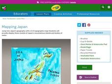
Mapping Japan
Students research the islands of Japan to investigate their location in the world and the islands' characteristics. They comprehend map making and topography. Studnets construct a scale-model map of the Japanese islands and surrounding...
DiscoverE
LIDAR: Mapping with Lasers
We would be lost without maps! How are they made? Introduce junior topographers to LIDAR technology with a fascinating activity. Set up a mock city, then have learners operate a laser measure to determine the shape of the landscape using...
Curated OER
Map It!
Fourth graders demonstrate map making skills by using the computer to create maps of the geographic features, regions, and economy for their state.
Curated OER
Map Making
Students examine a variety of strategies to identify the structure of a story. They listen to the book Where the Wild Things Are and, as a class, complete a story element chart. Students independently read a passage from Charlotte's...
Curated OER
Map Making
First graders explore maps to realize the concept that maps are simply small representations of a much bigger picture. They discuss the importance of maps in everyday life, examine a map of the school, and then make a map of their...
Curated OER
Map Making Project
Students identify and draw parallel, intersecting, and perpendicular lines and line segments. In this lines lesson plan, students draw a map with avenues and streets by drawing these lines.
Curated OER
Map-Making Basics
Students study maps. In this geography and art lesson, students create their own map of the classroom.
Curated OER
Life in Old Babylonia: The Importance of Trade
Students read maps and artifacts for information indicating the existence of a trade network in Old Babylonia and beyond. They list goods imported to and exported from Babylonia. They indicate trading centers on a map of ancient...
Curated OER
On the Road with Marco Polo: Marco Polo in China
Students investigate who the Mongols were and where their empire was located. They research Kublai Khan and the region he ruled. They study the major products of 13th Century China.
Curated OER
Those Who Have Come Before Me
Class members are transformed into explorers as they work in groups to locate hidden items and map their journey along the way. They then leave clues for other groups of students to follow, and ultimately discover how past explorations...
Curated OER
Designing a Hiking Trail
Put your students' map skills to the test with this engaging cross-curricular project. Given the task of developing new hiking trails for their local community, young cartographers must map out beginner and intermediate paths that meet a...
Rainforest Alliance
Knowing the Essential Elements of a Habitat
To gain insight into the many different types of habitats, individuals must first get to know their own. Here, scholars explore their school environment, draw a map, compare and contrast their surroundings to larger ones. They then write...
Teach Engineering
Who Can Make the Best Coordinate System?
Working with a map that does not have a coordinate system on it, small, collaborative teams must come up with a coordinate system for their map. Groups then explain their coordinate structure to the class.
Other popular searches
- Creative Project Map Making
- Map Making Floor Plans
- Thirteen Colonies Map Making
- Map Making 2nd Grade
- Map Making Classroom
- Map Making Activities
- Map Making and Elevation
- Map Making Geography
- Map Making Process
- Mapmaking Directions
- Map Making Lessons
- Mapmaking Instructions


