Polar Trec
Playground Profiling—Topographic Profile Mapping
The Kuril islands stretch from Japan to Russia, and the ongoing dispute about their jurisdiction prevents many scientific research studies. Scholars learn to create a topographic profile of a specific area around their schools. Then they...
Curated OER
The Personal Concept Map
There are lots of details that make you who you are! Illustrate what those details are with a personal concept map project. After learners view a step-by-step presentation, the follow a rubric to complete a concept map about themselves.
Curated OER
Map Your School
Learners participate in a project to map their school. They measure and graph various areas around the school. Students find the longitude and latitude of the school and research the school's history, and highlight special important areas.
Curated OER
What do Maps Show: How to Read a Topographic Map
Middle schoolers identify the characteristics of topographical maps. Using examples, they practice reading them and describing the information they gather from them. They also discover how to use the website from the U.S. Geological Survey.
Curated OER
Creating a Thematic Map
Students create and analyze a weather-related data table and a thematic map based upon information provided.
Curated OER
Weather Maps and Prediction
Young meteorologists read basic weather maps by learning about the symbols that are associated with them. This two-day instructional activity has some excellent demonstrations and activities to get youngsters thinking about the weather...
Owl Teacher
Imaginary Nation: Constructing a Map
Your young geographers will combine what they have learned about the five themes of geography and their inner creativity to design a physical map for an imaginary nation.
Education.com
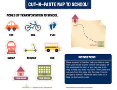
Cut-N-Paste Map to School
How do you get to school? Using the second page of the worksheet, you can draw a map of your route to school and paste on images of a scooter, bus, car, or feet.
Curated OER
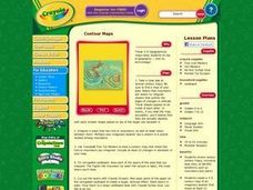
Contour Maps
Students review various contour maps, including local ones, to identify landforms such as mountains and plains. They create a 3-D contour map of an imaginary location that shows at least 10 changes in elevation. Afterward, they write a...
Luminations Media Group
Geography: Map Reading Basic Skills
Enhance scholars' map skills using this learning exercise displaying the land of Kahitsa’an from the series, The Realm, by K.L. Glanville. The activity helps readers visualize the make believe-land, examine its attributes, and answer 10...
Curated OER
Mapping Your Identity: A Back-To-School Ice Breaker
Identify the unique personal attributes of your class members. Begin by viewing the Visual Thesaurus and discussing displayed attributes associated with famous American leaders. Using these identity maps as models, pupils generate nouns...
Curated OER
Creating a Life Map
Students create their own life map in which they introduce themselves to each other by sharing what they are most proud of. They use a life map to expressive themselves creatively.
Curated OER
Mapping a Garden
Students study the components of a map, particularly the legend, the key, the symbols and the area. They develop their own map of a garden that they can plant in a future science lesson.
Curated OER
Map Coordinates: Monkey Map
Here's an engaging, meaningful, and clever activity on map skills for elementary schoolers. Pupils combine story writing with mapping skills to create an original piece of work. They utilize a worksheet embedded in the plan to guide them...
Curated OER
Map Skills
Thirds graders reinforce that a map is a drawing that shows what a place looks like from above. They use a map key and symbols to create a map of the school and its neighborhood.
Curated OER
What Can a Map Tell You?
Students investigate how maps can provide useful information about health issues. They study a map to draw conclusions about cholera death in London.
Education World
Edible Resource Maps!
Young scholars discuss resource maps and examine examples from library resources. Working in groups, they create edible resource maps by drawing examples, such as popcorn on the border of Iowa and Nebraska. Then they use cookies in the...
EngageNY
Reading Maps: Locating the Countries We Have Been Reading About
Show your class how to read a map and decipher all of the markings and features. Start out by connecting maps to their homework from the night before and their current reading, in this case That Book Woman, and a related informational...
Curated OER
Use Google Maps to Teach Math
Capture the engagement of young mathematicians with this upper-elementary math lesson on measuring time and distance. Using Google Maps, students first measure and compare the distance and time it takes to travel between different...
Curated OER
Introducing Maps Through Dance
Students are introduced to the key concepts of maps; direction, pathway/line, shape and symbol. They create the pathways and shapes they have "mapped" out on paper on the floor. They dance along the paths.
Curated OER
Story Mapping
Fill-out a story map to help your scholars with pre-writing. They will use a story map template to pre-write. They also organize their ideas into steps which become the foundation for their first draft. Concrete objects are brought in to...
Curated OER
Exploring Biomes Lesson 1: Mapping Biomes
Environmental science learners examine satellite imagery of temperature, vegetation, precipitation, and productivity. They use these maps to understand how scientists divide the planet into major biomes. As part of a larger unit on...
National Geographic
Mapping the Americas
Celebrate the geography of the Americas and develop map skills through a series of activities focused on the Western Hemisphere. Learners study everything from earthquakes and volcanoes of the Americas and the relationship between...
Curated OER
Lesson 2 Activity 2: Mapping Mount St. Helens
Students use topographic map skills to interpret impact of the May 18, 1980 eruption of Mount St. Helens on the volcano's topography, and draw profile views of Mount St. Helens before and after the May 18, 1980, eruption.


