Curated OER
What Is A Map?
Students become familiar with a map and what it is used for and become familiar with school and home surroundings. With the familiarity of their surroundings they discover that maps can be created to help them with directions and how to...
Curated OER
Map Projections: The Grapefruit Activity
Students partcipate in activities in which they examine different map projections. They discover the positives and negatives of each type. They use grapefruits to help them with the different types of map projections.
Curated OER
Story Map Situations
Third graders explore a variety of ways to represent text. They represent text in story maps while on the playground. Students depict the elements of a story on a story map. They create a poster for character, setting, problem, and the...
Curated OER
Reading a Local and National Weather Map
Students examine weather maps. They examine icons and map symbols. Students explore vocabulary words related to weather. Students analyze and evaluate information provided on the weather map.
Curated OER
Using Maps in the LCTL Classroom
Students review terms and prepositions of location and view a map to illustrate the meanings of the prepositions students are unfamiliar with. They play "Where am I?" game utilizing correct prepositions then they work with a partner to...
Curated OER
Map Grids
Students study map grids and explore how they can be used to locate positions of objects or features on a map. They read a story and then participate in a grid activity using a large map of the setting of the story.
Curated OER
Map Your House
Students are introduced to the concepts of maps as scale models of the whole. After a brief lecture on creating and using an accurate scale when drawing and reading a map. They create a scale drawing of the floorplan of their homes.
Curated OER
Our Land Lesson 2: Song Mapping
Students study the meaning of philanthropy as giving of time. talent, and treasures. They sing This Land Is Your Land while locating five of the places on a map of the United States showing that relief office are everywhere. They decide...
Curated OER
A Map Mystery
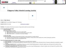
First graders solve a mystery by following map clues. In this map clues lesson plan, 1st graders follow a computer program called Neighborhood Map Machine. In this program, it gives students directional and spatial clues in order to...
Curated OER
Paint My Counties: Map Coloring the Counties of Arizona
Fourth graders identify the counties of Arizona. In this social studies lesson, 4th graders color a county map of Arizona using the fewest number of colors possible. Students write a persuasive paragraph.
Curated OER
Mapping Personal Narratives
Second graders write a personal narrative using webs they created and a story map worksheet. In this personal narrative lesson plan, 2nd graders make lists of ideas to write about and pick one to focus on.
Curated OER
Reading Weather Maps
Fourth graders the symbols that are used on weather maps. They develop five day forecasts based on information they gather from weather maps in the newspaper and on the Internet.
Curated OER
Me on the Map Lesson 1
Students use maps, globes, geographic information systems and other
sources of information to analyze the nature of places at a variety of scales. They identify on a map and determine the population
of the city, county, state, country...
Curated OER
Map the Mystery!
Seventh graders read the novel, "The House of Dies Drear", and create a story map to analyze the plot and recall events.
Curated OER
Map Out the Important Stuff!
Students practice summarization by creating a story map. Students listen to a read aloud by the teacher, after which the class creates a storymap of the major events in the story. They read a passage from the Indian in the Cupboard...
Curated OER
Semantic Mapping
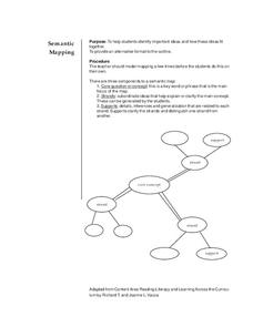
Pupils explore semantic mapping. Through teacher modeling and independent practice they complete a variety of semantic (concept) maps to coincide with specific areas of subject matter. They identify the core concept and include...
Curated OER
Exploring an Atlas
Students explore global geography by participating in an atlas activity. For this countries of the world lesson, students collaborate in small groups and analyze an atlas while researching continents, countries and demographics. Students...
Curated OER
Lesson 1: Map Data and the Census
Students learn about the history of the census. In this U. S. Census lesson plan, students develop an understanding about how the United States Constitution grants and distributes power and discover how the spatial organization of...
Curated OER
NATO Geography & Language
The class receives background information on NATO, an atlas, and a blank world map. They color the original 1949 countries in red, the 1952 additions in green, and the 1990 additions in blue. This exercise would be a good starting point...
Curated OER
Fun With Pacific Northwest Cities and Towns
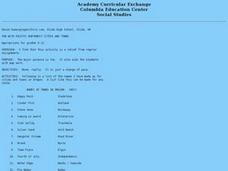
Intended for fun only, learners play with the names of cities common to their region or state. This lesson includes a list of cities in Oregon and not much else. What you and your class choose to do with your list of cities is up to you.
Curated OER
Tools of the Trade: The Use of Geographic Tools
Learners examine the tools of demographic analysis and apply them to real-world situations. They analyze maps, define terminology, and write an information paper for the appropriate government agency to recommend an action or policy change.
Curated OER
Orienteering - Lesson 4 - Distance and Height
Pretend that you've been dropped onto a mountain, in the middle of nowhere, and all you have to find your way is a topographical map and a compass. Could you find your way to the nearest town? Orienteering teaches the skills of map...
Curated OER
What in Our World Affects the Way People Live
Sixth graders study various maps that show geographical features and population. They compare the maps and make inferences about how various geographical features influence the population and human activities of an area.
Curated OER
Compass Rose for the New Millennium
Sixth graders are introduced to the concepts of a compass rose and how it used in relationship to reading maps in geography. The lesson is meant to build upon prior knowledge and skills.
Other popular searches
- Map Skills Lesson Plans
- Map Skills Worksheets
- Elementary Map Skills
- Geography Map Skills
- Basic Map Skills
- Social Studies Map Skills
- Globe and Map Skills
- Beginning Map Skills
- United States Map Skills
- Map Skills, Continents
- Early Explorers Map Skills
- Free Map Skills Worksheets


