Curated OER
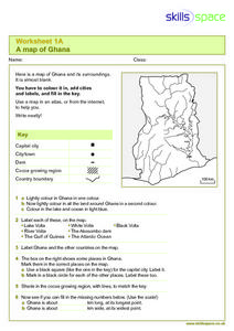
A Map of Ghana
For this Map of Ghana worksheet, students are given a blank map and key. They are told to label major features and color according to directions.
Curated OER
Make a Map
In this mapping activity worksheet, learners finish the map by following the 5 directions and using the map key. Students the map key, scale, and an inch ruler for help.
Curated OER
Outline Map of Japan
In this geography worksheet, students examine a black line outline map of Japan. There is a compass rose on the page. There are no labeled cities.
Curated OER
Freeform Pennsylvania Map
In this Pennsylvania map worksheet, students research, study and label twenty important cities, physical attributes and the neighbors that surround Pennsylvania on a Pennsylvania map.
Curated OER
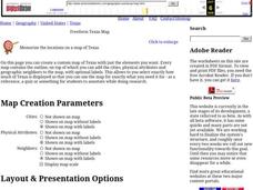
Freeform Texas Map
In this Texas map worksheet, students research, label and discuss the most important cities in Texas, its physical attributes and the states that surround Texas.
Curated OER
Geography
In this geography activity, students answer multiple choice questions about maps, rivers, land, and more. Students complete 20 multiple choice questions.
Curated OER
Geography Worksheet
For this geography skills worksheet, students respond to 14 short answer questions by using maps and atlases. The maps and atlases are not included.
Curated OER
Globe Skills Lesson 5
In this map skills worksheet, learners read a text selection about locations during the American Revolution and then respond to 8 fill in the blank questions.
Curated OER
Ancient Middle East Geography
As part of a study of ancient Middle East geography, kids locate seas, rivers, regions, and cities on a map of the region.
Curated OER
Freeform Rhode Island Map
In this free form Rhode Island map learning exercise, students study, locate and memorize key cities, physical attributes and surrounding states for a quiz. Students fill out the major cities on a blank map of Rhode Island.
Curated OER
Rivers Run Through It
In this mapping practice instructional activity, 5th graders read an informational paragraph and answer 7 questions about the parts of a map along with places shown on a given map.
Curated OER
Tourism in Northern Ireland
In this tourism worksheet, students label pictures of tourist destinations with the name of the country they are located in, write sentences about pictures showing damage caused by tourists, identify locations on a map, and fill in...
Curated OER
Tooling Around Arizona: Measuring Distances
In this measurement worksheet, student measure the distances between Arizona cities by using a the scale on an Arizona Cities map. Students complete 15 problems.
Curated OER
Diagon Alley in Toronto
In this Harry Potter instructional activity, students draw a diagram of Toronto's wizarding quarter. Students make the map as colorful and accurate as possible.
Curated OER
Real World Investigation- Math and Geography- Elevation Changes
In this math and geography real world investigation, 6th graders plan a driving trip to a city that is located several states away from their home while recording the elevations of three cities that are included in the trip. They use...
Curated OER
Physical and Human Geography Review Worksheet and Study Guide
In this geography skills worksheet, students respond to 30 short answer questions pertaining to physical and human geography.
Curated OER
Country Shape Quiz #1
In this online interactive geography quiz worksheet, students respond to 16 identification questions about the shapes of countries shown . Students have 4 minutes to complete the quiz.
Curated OER
Country Shape Quiz
In this online interactive geography quiz worksheet, learners respond to 16 identification questions about the shapes of countries shown . Students have 4 minutes to complete the quiz.
Curated OER
Country Shape Quiz
In this online interactive geography quiz worksheet, learners respond to 16 identification questions about the shapes of countries shown . Students have 4 minutes to complete the quiz.
Curated OER
Country Shape Quiz #4
In this online interactive geography quiz worksheet, learners respond to 16 identification questions regarding the shapes of countries of the world. Students have 4 minutes to finish the timed quiz.
Curated OER
Battle of Clontarf 2
In this Battle of Clontarf worksheet, students read about the battle, answer short answer questions, draw a picture, and estimate the population. Students complete 4 activities.
Other popular searches
- Using a Map Scale
- Map Scale Worksheets
- Map Scale Activities
- Geography Map Scale
- Map Scale Math Lessons
- Map Scale Math
- Geography Map Skills Scale
- Math Map Scales
- Map Scale Lesson Plans
- Using Map Scales
- Reading a Map Scale
- Using Map Scale Distance


