Richmond Community Schools
Map Skills
Young geographers will need to use a variety of map skills to complete the tasks required on this learning exercise. Examples of activities include using references to label a map of Mexico, identify Canadian territories and...
Curated OER
Scale Skills
In this mapping skills activity, students read an excerpt that describes three different types of scales and how to calculate distance on a map. They respond to two short answer questions using the map provided on the sheet and to...
Curated OER
Project Map: Scale Worksheet
In this map reading instructional activity, students determine the distance from a plotted treasure on a topographic map. They must adjust for magnetic declination.
Curated OER
Map Reading
In this social studies instructional activity, 3rd graders discover the various attributes of a road map. Students work with routes, map keys, and scale to find distances from one city to another.
Curated OER
Ancient Egypt Geography
Nine questions to answer and one map to read. Seventh graders will use the map of Ancient Egypt to practice map reading skills and build a visual image of Ancient Geography.
Curated OER
Maps- Looking at Map Scales
In this map scale activity, students examine how to convert measurements on a map. They read 5 examples before completing 8 multi-step conversion problems. They insert the answers in an online version of the activity to determine if...
Curated OER
How To Read A Map
In this map skills worksheet, learners view a map and answer five short answer questions by using the map key as a...
Curated OER
Geographical Skills-- Map Scale
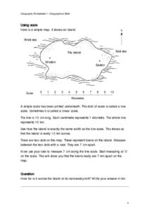
In this maps instructional activity, students study a simple map and the scale in kilometres. Students read the directions and answer one question. Students then look at a sketch map of a town and answer 2 questions. Students also read...
Curated OER
Scale Problem
In this scale problem worksheet, 6th graders solve 9 different problems that include reading a map scale of a neighborhood. First, they determine the distance between each person's home as illustrated. Then, students determine the...
Curated OER
Map Analysis Worksheet
In this map analysis worksheet, students decipher what type of map they are using based on a complete list of criteria. Students then answer multiple questions based on their discoveries.
Curated OER
The Roman Empire-Map Activity
In this Roman Empire instructional activity, students complete a map activity in which they label and color civilizations, countries and physical features as instructed. There are no maps included.
Curated OER
Topographic Maps
In this topographic map worksheet, students learn how to read a topographic map and create a topographic map of their own using clay or Play-Doh. Students include contour lines by layering the clay. Students answer 6 questions about...
Curated OER
Exploring Earth Through Maps and Technology
In this maps worksheet, students read 3 pages of detailed information about maps, latitude, longitude, topography, satellites and global positioning. Students then answer 10 questions. There is also a research project assignment available.
Curated OER
Where Am I? Map Activity
In this map activity worksheet, students determine which countries are shown on a set of 16 maps, then read facts about each country designed to help with a report on that country.
Curated OER
Topographic Maps Worksheet
In this geography skills learning exercise, students respond to 37 multi-part questions that require them to read and interpret topographic maps.
Curated OER
Lakes of Methane on Titan
In this methane lakes worksheet, learners read about the false-color synthetic radar map taken by the Cassini spacecraft indicating methane lakes on Titan. Students solve 4 problems about the surface area of the lakes from the image, and...
K-State Research and Extensions
Water
How are maps like fish? They both have scales. The chapter includes six different activities at three different levels. Scholars complete activities using natural resources, learn how to read a map, see how to make a compass rosette,...
Curated OER
Complex Analysis: Linear Transformations, Inversion Mappings
In this transformation worksheet, students identify a series of transformations and sketch them. They use inversion mapping to establish a one-to-one correspondence between nonzero points. This four-page worksheet contains...
Curated OER
Comparing the New Madrid and San Andreas Fault Zones
In this faults worksheet, students use an earthquake reference sheet to find the numbers for a modified Mercalli and Richter scale. They compare the San Andreas Fault zone and the New Madrid fault zone on the United States map. They...
Curated OER
Formulas Multiple Choice
In this formulas activity, students determine the distance between two points. They read story problems, identify needed information, write equations and solve them. Students find the midpoint of a line. This two-page...
Curated OER
Unit 19 Scale Drawing
In these scale drawing worksheets, students read the distance problems and select the answer from the choices. Students complete 9 problems.
It's About Time
Volcanic Hazards: Airborne Debris
Pupils interpret maps and graph data related to volcanic ash. Then they analyze the importance of wind speed and the dangers of the ash to both life, air temperature, and technology.
Curated OER
Globe Skills Lesson 5
In this map skills learning exercise, students read a text selection about locations during the American Revolution and then respond to 8 fill in the blank questions.
Curated OER
Tour of the World
In this tour of the world puzzle, students read a map and determine a travel itinerary based upon given criteria. They are required to visit 23 cities. This one-page worksheet contains one puzzle. The answer is provided...


