PBS
Map a Model Solar System
Creating a solar system map is a snap thanks to a hands-on activity! Science scholars explore the solar system by building it wherever they choose during an interactive from PBS's Space series. Users pick both the location and scale for...
Curated OER
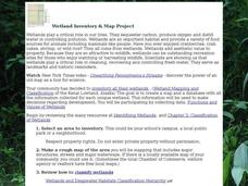
Wetland Inventory and Map Project
In this wetlands inventory and map project worksheet, students do research on the wetlands and complete a map project about it. Students follow 6 sets of directions with Internet links.
Curated OER
Tree Inventory and Map Project
For this tree inventory and map project worksheet, learners follow the directions on how to take inventories of trees and create a map from it. Students follow 4 sets of directions.
Curated OER
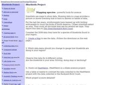
Bluebirds Project: Mapping Species
In this bluebirds project: mapping species worksheet, students create a map based on data for bluebirds in their area, then answer 5 questions about the mapping of the species. This page has numerous links to helpful web...
Curated OER
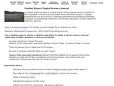
Habitat Project Digital Science Journal
In this habitat project digital science journal worksheet, students use a digital camera or camcorder to create a science journal about a habitat they have studied. This page includes links to helpful web resources for planning and...
American Battle Monuments Commission
Americans in Great Britain: 1942-1945
Watch the pivotal moments of America's presence in embattled Britain during World War II with an exceptional interactive tool. From personal stories about life on the front lines to a map that tracks every group and division...
American Battle Monuments Commission
The Normandy Campaign: The Advance Inland
Over the summer of 1944, the Allied powers of World War II came together to take back the beaches of France. See the ways each division operated to turn the tide of war with an interactive timeline and map.
American Battle Monuments Commission
The Strategic Bombing Campaign
An extensive look at World War II details the strategic bombing campaign of the Allied forces. Beginning in September 1939 and ending in May 1945, the interactive map follows British and American forces throughout the bombing campaigns...
American Battlefield Trust
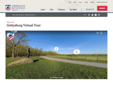
Gettysburg Virtual Tour
Step into one of the most iconic battlefields of the American Civil War with an educational interactive resource. Young historians learn about key moments, locations, soldiers, and turning points in the battle with a clickable map and...
Curated OER
Bluebirds Project
In this bluebirds project worksheet, learners are given directions on completing a project about bluebirds including measurements, scientific method questions, data entry, and more. Students complete 15 exercises.
Curated OER
Understanding Community Environment
In this understanding community environment activity, students, after exploring 5 parts of a study unit (link provided), choose a project (make a video, book, game, plan a garden or nature map, collect data, write a rap or crossword...
Curated OER
Frayer Model
For this Frayer model worksheet, students use the Frayer model to complete a chart about a word study. Students complete 5 steps in the model.
University of Richmond
Renewing Inequality: Family Displacements through Urban Renewal 1950-1966
What is progress? Who bears its cost? High schoolers consider the questions as they review data on families displaced by urban renewal projects in the 1950s and 1960s. An interactive, curated data project asks historians to consider the...
Mr. Nussbaum
Battle of Fort Sumter
Fort Sumter, the site of the Civil War's first battle, taught the Union and the Confederacy an important lesson: they would both need to take stronger steps than anticipated if they wanted to win the war. History pupils read about the...
Annenberg Foundation
Geometry 3D Shapes: Euler's Theorem
How do you get a theorem named after you? Euler knows what it takes! The third lesson of five asks pupils to use an interactive activity to compare the faces, vertices, and edges of seven different three-dimensional solids. They use...
NOAA
Seamounts
How do chains of islands form? Young oceanographers explore the mountains of the deep in the final installment in a 13-part series. The interactive compares types of seamounts based on their overall height and height under the water, as...
Describing Egypt
Horemheb - (18th Dynasty)
Who was Horemheb and why is his tomb so famous? An fascinating resource uses virtual reality tools and even comes equipped with the ability to use a VR headset. Learners view information panels to the side of the location to understand...
Curated OER
Getting Together - a Groupings Crossword Puzzle
Introduce your class to words for groups of animals and people. This is a crossword puzzle that includes 25 clues for collective nouns. The puzzle is online interactive and learners can receive immediate online feedback. Answers are not...
Curated OER
Weather Facts Internet Hunt
For this weather worksheet, learners click on the links in the questions about weather to find the answers to the questions and then come back and answer the questions. Students answer 17 questions total.
Curated OER
Butterfly Math
In this math word problems instructional activity, students complete words problems having to do with butterflies. Students complete 6 problems total and click on the links in the questions to help them.
Curated OER
Show What You Know!
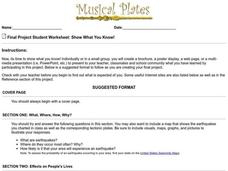
In this earthquakes activity, students create a brochure, poster, or other form of presentation to show what they know about earthquakes. Students complete 4 sections.
Curated OER
Passive in Context
In this tense worksheet, students read the sentences or phrases and choose which tense they are written in. Students complete 10 problems total.
Curated OER
Milkweed and Monarch Quiz
In this milkweed and monarch butterfly instructional activity, students take a quiz online about the milkweed and monarch butterflies. Students complete 10 multiple choice questions.
Curated OER
ESL: Idioms with "Put"
In this ESL idioms worksheet, students choose the correct phrase to complete a sentence that uses an idiom that contains the word "put."
Other popular searches
- 3 Different Map Projections
- Map Projections Worksheets
- Different Map Projections
- Map Projections Cylinders
- Globe and Map Projections
- Types of Map Projections
- Map Projections Explanation
- Map Projections Cyclinders
- Map Projections Mercator

