Library of Congress
Investigating the Building Blocks of Our Community’s Past, Present, and Future
As Ken Jennings said, "There's just something hypnotic about maps." Certainly, the longer you look at them the more you can learn. In this project-based learning lesson, individuals study both historic and present-day maps of...
Columbus City Schools
Constructive and Destructive Geologic Processes
Show the class the world as they've never seen it before—from way above! Learners try to unravel the mysteries presented by rich satellite imagery, learn to interpret topographic maps, and study erosion by constructing their very...
Beyond Benign
House Project Overview
What does your perfect house look like? Pupils design a sustainable house given certain specifications. They create concept maps that detail the math skills they need to use while considering their designs.
Curated OER
Maps Reinforcement
In this map worksheet, students complete 6 multiple choice questions and 5 short answer questions about 3 different map figures.
Curated OER
Project Whistlestop:Missouri Vacation Learning Unit
Fourth graders reserach the state of Missouri. In this Missouri History lesson, 4th graders plan a vacation to a region of Missouri. Students work in collaborative groups to determine all aspects of the trip. Students use math...
Curated OER
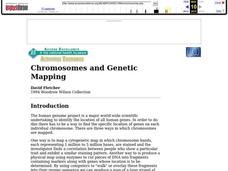
Chromosomes and Genetic Mapping
High schoolers are introduced to mapping by crossover frequency. Genes travel as packaged trains on chromosomes. They use this experiment, genetic mapping assignment, that allow students to quickly complete the assignment and yet...
Curated OER
North Carolina Salt Dough Map Social Studies Project
In this lesson, North Carolina Salt Dough Map, 4th graders create a salt dough map of North Carolina, Students use dough to form the shape of the state of North Carolina. Students label the three regions of North Carolina and all of...
Curated OER
Map It!
Fourth graders demonstrate map making skills by using the computer to create maps of the geographic features, regions, and economy for their state.
Curated OER
2nd Grade - Act. 21: Me On the Map
Second graders read book, Me On the Map, and create map of their bedroom and of their house.
Curated OER
Handy Map
Students become familiar with the purpose of maps through a hand mapping lesson. For this hand mapping lesson, students draw their hand and use it to explain directions and labeling on a map.
Curated OER
Fairy Tale Maps
Students study direction as they listen to the stories of Little Red Riding Hood and The Jolly Postman. In this cardinal direction lesson, learners create a map to show the path Little Red Riding Hood took in the story and label the path...
Curated OER
Map Exploration
Are you looking for a terrific lesson on map activities for your second graders? Then, this resource is for you! The activities range from decoding, to fill-in-the-blank, to read-and-search. There is a website activity related to maps...
Curated OER
Story Map Book Report
This is an example of what a story map book report can look like using mind wing teaching concepts. Consider this idea as a way to provide special needs or those with learning disabilities a way to communicate what they know or learned...
Curated OER
Exploring Maps: Lesson 2 Guide: Navigation
Students explore and examine how maps have been used in navigation. They research how travelers collected observations to keep track of their positions and plotted information on maps. Each student then makes a Mercator projection...
Curated OER
Semantic Mapping In Biochemistry
Students create a semantic map utilizing material learned in previous biochemistry lessons. Their maps will include material on the four types of organic compunds previously explored in class.
Curated OER
Map Maker, Map Maker
Map maker, map maker, make me a map! Your class can sing this tune as they work to create their own regional maps by taping paper to the wall, projecting an overhead transparency image, and tracing. Where this lesson plan intends for the...
Curated OER
Read a Fall Foliage Map
Young scholars examine the purpose of a color key and use a color key to help them read a map.
Curated OER
Electronic Mapping
Young scholars identify countries, oceans, and capitals by building an electronic map.
Curated OER
Mapping My Spot in History
Students create their own town's history. They place themselves on the map in a literal as well as figurative sense. Students produce portions of an updated version of an early twentieth century panoramic map. Students gather information...
Curated OER
Studying Mind Maps Created at Other Schools
Students explore Africa and mind maps created by students from other schools. They discuss Africa and the number of countries, diversity of language, cultures, races, religions, and lifestyles and in groups study a mind map from another...
Curated OER
Unit III: Worksheet 2 - Motion Maps
Make motion maps, draw graphical representations, and determine displacement. These are the activities included in this physics assignment. This is a great review of velocity, position, acceleration, and displacement concepts.
Rocklin Unified School District
Spanish Speaking Countries Project
Ask your class members to provide a tour of a Spanish speaking country with a brochure and flag project. Learners research their assigned country, making sure to check off each of the required pieces of information listed on the first...
Curated OER
Guide to Business Process Modelling
Project managers can add another cog in the wheel of understanding. This guide to business process modelling shows how to construct and use a process map to handle major projects. Tip: While the resource is intended for a vocational...
Tech Know Teaching
6th Grade Constructed Response Question
Graphs, charts, maps, diagrams. Reading and comprehending informational text is far more than just decoding the words on a page. Here's a packet that provides young readers with practice answering constructed response questions using...
Other popular searches
- 3 Different Map Projections
- Map Projections Worksheets
- Different Map Projections
- Map Projections Cylinders
- Globe and Map Projections
- Types of Map Projections
- Map Projections Explanation
- Map Projections Cyclinders
- Map Projections Mercator


