Hi, what do you want to do?
Other
Bryan Strome : First Nations Seeker
An alphabetical listing and detailed map showing the location of the lands of the aboriginal tribes and linguistic groups found in North America.
University of Texas at Austin
University of Texas: Exploration and Settlement Before 1675
A great map showing the explorations of Spanish, French, and English explorers in North America between 1530 and 1675. A detailed key identifies each explorer and route. From the Perry-Castaneda Collection
Curated OER
Educational Technology Clearinghouse: Maps Etc: Central America, 1916
A map from 1916 of Mexico, Central America, and the West Indies, showing physical features and political boundaries at the time. The map uses color-contouring to show land elevations from sea level to over 5000 feet. The map shows...
Curated OER
Educational Technology Clearinghouse: Maps Etc: Central America, 1914 1919
Central America in 1919.
Curated OER
Etc: Maps Etc: Central America and the West Indies, 1902
Central America and the West Indies in 1902.
Curated OER
Educational Technology Clearinghouse: Maps Etc: North Atlantic Region, 1598
A facsimile of an early map from Wolfe's Linschoten (1598) showing locations of: 1.
Curated OER
Educational Technology Clearinghouse: Maps Etc: Central America, 1861
A French map from 1861 of the Yucatan Peninsula and Central America showing the territories of native groups, the sites of ancient ruins, terrain, lakes, rivers, and coastal features of the region.
Curated OER
Etc: Maps Etc: James's Map of Charlton Island Vicinity, 1633
Charlton Island vicinity of Canada.
Gabriel Dumont Institute
The Hudson's Bay Company Trading System [Pdf]
A 42 page learning module presenting a detailed history of the Hudson's Bay Company and the development of their fur trading routes. This document, published in PDF format, contains maps of the trading system, historical timelines and...
Maps of Mexico
Virtual Picture Travel Map of Massachusetts
Click on Massachusetts on the US map in order to Travel there and take a virtual tour of Boston. Visit places of interest such as Harvard University, MIT, John F. Kennedy Library and Museum, the Freedom Trail, Copley Square, Trinity...
Maps of Mexico
Virtual Picture Travel Map of Massachusetts
Click on Massachusetts on the US map in order to Travel there and take a virtual tour of Boston. Visit places of interest such as Harvard University, MIT, John F. Kennedy Library and Museum, the Freedom Trail, Copley Square, Trinity...
Maps of Mexico
Virtual Picture Travel Map of Nevada
Click on Nevada and take a virtual tour of Lake Tahoe and Las Vegas. Visit places of interest such as the Hoover Dam, Diamond Peak and views of Lake Tahoe.
Maps of Mexico
Virtual Picture Travel Map of Nevada
Click on Nevada and take a virtual tour of Lake Tahoe and Las Vegas. Visit places of interest such as the Hoover Dam, Diamond Peak and views of Lake Tahoe.
Maps of Mexico
Virtual Picture Travel Map of Illinois
Click on Illinois and take a virtual tour of Chicago. Visit places of interest such as Oak Park, the Frank Lloyd Wright House, DuSable Museum, Lincoln Park and the Sears Tower.
Maps of Mexico
Virtual Picture Travel Map of Illinois
Click on Illinois and take a virtual tour of Chicago. Visit places of interest such as Oak Park, the Frank Lloyd Wright House, DuSable Museum, Lincoln Park and the Sears Tower.
Maps of Mexico
Virtual Picture Travel Map of Arizona
Travel to Arizona and take a virtual tour of Phoenix and the Grand Canyon. While in Phoenix visit places of interest such as the Roosevelt Dam, Goldfield Ghost Town and the State Capital Museum.
Maps of Mexico
Virtual Picture Travel Map of Arizona
Travel to Arizona and take a virtual tour of Phoenix and the Grand Canyon. While in Phoenix visit places of interest such as the Roosevelt Dam, Goldfield Ghost Town and the State Capital Museum.
Maps of Mexico
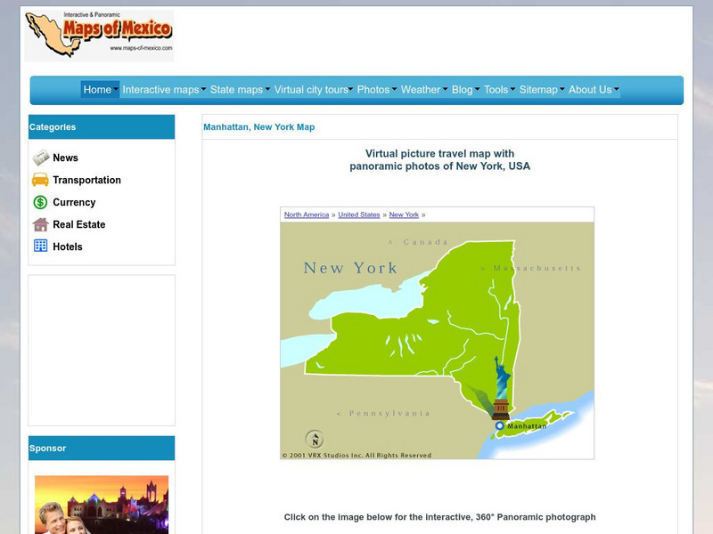
Virtual Picture Travel Map of New York
Click on New York and take a virtual tour of Manhattan. Visit places of interest such as Ellis Island, the Brooklyn Bridge, the Empire State Building, Times Square, Rockefeller Center and the Central Park Zoo. Uses popups.
OpenStax
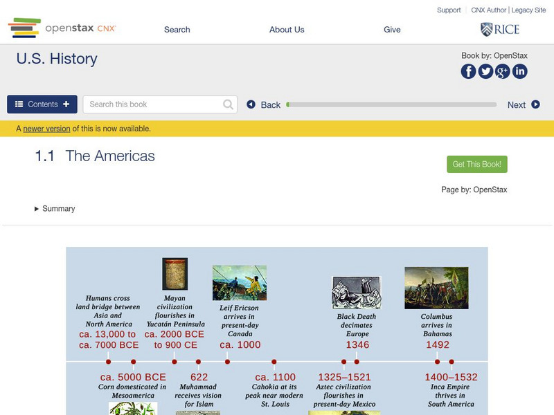
Open Stax: The Americas
After reading this section, students will be able to locate on a map the major American civilizations before the arrival of the Spanish, discuss the cultural achievements of these civilizations and also the differences and similarities...
Enchanted Learning
Enchanted Learning: Geography
At this site from Enchanted Learning, you can take a quiz, printout a map of the United States of America, and see where the Middle East is located in the world. Links are also provided for additional information.
Science Education Resource Center at Carleton College
Serc: Mapping the Glaciers
In this activity, students will use Minnesota Geological Survey 3-D maps of the upper Midwest to trace the outlines of where they believe glaciers may have affected North America. They will identify landforms that resulted from glacial...
Smithsonian Institution
National Museum of Natural History: Arctic Studies Center: Polar Bear
The Smithsonian National Museum of Natural History, in a section titled "North American Mammals," offers a general overview of the polar bear. Additional content includes detailed drawings, photographs, and a map showing the polar bear's...
Smithsonian Institution
National Museum of Natural History: American Mammals: Hooded Skunk
The Smithsonian National Museum of Natural History, in a section titled "North American Mammals," offers a general overview of the hooded skunk. Content includes detailed drawings, photographs, specimens, and a map showing the skunk's...
Curated OER
Etc: Maps Etc: Mexico, Central America, and the West Indies, 1898
A map from 1898 of Mexico, Central America and the West Indies. The map includes an inset map of Cuba and the Isthmus of Nicaragua. "The surface of the Rocky Mountain highland in Mexico is quite similar to that of the great plateau...


