Curated OER
Quarter Conservation
Here is another in the interesting series of lessons that use the special State Quarters as a learning tool. This one uses the California State Quarter. During this lesson, pupils learn the many ways they can conserve natural resources...
Science Matters
Seismic Activity and California Landforms
By the 19th lesson plan in the 20-part series, scholars realize volcanoes and earthquakes are related to plate boundaries. The lesson plan extends and applies the knowledge by having individuals create a bumper sticker for one specific...
Curated OER
California Crops
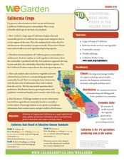
Young scholars explore agriculture by researching the native food crops of California. Students define a list of agriculture vocabulary terms and analyze maps of California which explain which foods come from which area. Young scholars...
California Academy of Science
California's Climate
The United States is a large country with many different climates. Graph and analyze temperature and rainfall data for Sacramento and Washington DC as you teach your class about the characteristics of Mediterranean climates. Discuss the...
Curated OER
Isoseismal Maps
Young scholars examine the difference between magnitude and intensity in earthquakes. They complete map work and write a first hand account of a person living in each level of intensity on the Modified Mercalli Scale.
Curated OER
California Biodiversity
Students examine several maps of California exhibiting features such as precipitation, topography, and vegetation. They look for patterns that might be the source of or influence biodiversity in different regions. They pay particular...
Curated OER
North American Biomes
In this Science worksheet, learners color a biome map of North America. Students color the map by solving the clues listed on a separate sheet of paper.
NASA
Mystery Planet
What can one learn about a planet based on a small surface sample? Learners will explore artifacts from a mystery planet and see what they can determine about the planet based on the evidence in front of them.
Curated OER
You Can Depend on Me
Students identify how they depend on others, and examine and discuss the images on the California Quarter Reverse. They view and discuss images of various habitats, complete a Habitat Research worksheet, and create a habitat diorama.
Curated OER
Bioregions of California
Students map out the bioregions of California by examining the species and environment in different areas of the state. They use information and pictures from a PowerPoint presentation to complete a map handout and play a trivia game.
Curated OER
Biome Map
In this biomes worksheet, learners color the map of North America according to the biome clues. Students then answer questions about the North American biomes.
Channel Islands Film
Island Rotation: Lesson Plan 1
How do scientists provide evidence to support the theories they put forth? What clues do they put together to create these theories? After watching West of the West's documentary Island Rotation class members engage in a series of...
Curated OER
Traveling Through Literature
Integrate geography with literature in this interdisciplinary lesson. Begin by reading a poem such as The Time We Climbed Snake Mountain by Leslie Marmon Silko. On a large map, place push pins in the cities or states mentioned. An...
Curated OER
Project Map: Latitude And Longitude Worksheet
In this latitude and longitude worksheet, students find the coordinates of 14 cities around the world and use this information to complete 14 short answer questions. This worksheet includes online atlas web links.
Curated OER
Lahar Travel Time
Ninth graders analyze published geologic hazard maps of California and comprehend how to use the map's information to identify evidence of geologic events of the past and present and predict geologic changes in the future. They select...
Curated OER
Those Particular Plants in Particular Regions
Fourth graders, acting as a botanist, analyze information on different plants in different regions of California. They characterize each plant for each region and answer a variety of question for each plant while doing this study.
Indian Land Tenure Foundation
Respect for Land
Youngsters examine how people show respect and care for the land. Specifically, learners see how the Native Americans truly did care for and respect the land, and still do so to this day! They also explore how they themselves can care...
Curated OER
Hazards: First Grade Lesson Plans and Activities
Examine the environmental hazards associated with volcanoes with a three-part science lesson. In the pre-lab, first graders learn that gas, landslides, ash, and lava are all hazards that come from volcanoes. They then explore...
Curated OER
Why Do Geese Fly South For the Winter?
Fifth graders examine migration by tracing animal migration routes on a map. In this animal life lesson, 5th graders observe a map of North America and read about the migration patterns of geese. Students trace the path most...
Curated OER
The New Madrid Earthquakes of 1811-1812: Shaking Our Misconceptions about Earthquakes in United States History
Students Examine how earthquakes work and what plate tectonics and fault lines are. For this earthquake lesson students complete an earthquake scavenger hunt.
Curated OER
Scaling the Map
Middle schoolers practice determining map distances using the map scales. They discover how much an area represents on the map in relation to the actual area. They decide on the best place to build their cavern.
Curated OER
ESRI Live Earthquake Site
Students examine a World map and find earthquakes near plate boundaries. They locate and describe earthquakes in the United States and California.
Curated OER
Then and Now, A Watershed in San Francisco
Students compare recent and historic maps to explore landscape changes. Using photos provided, students identify prominent features on the maps. They discuss differences in landscape, human impact on watershed, and changes in natural...
Curated OER
San Francisco Bay Watershed
Students examine relief maps of California and discuss the San Francisco Bay watershed. Discussion continues with the class helping complete a journey of water through seasons in a "finish my sentences" style lecture. They label rain...


