Curated OER
Go West Young Man#148
Students determine the difference between immigration and emigration. They read and listen to books about emigration westward during the Gold Rush years. They examine life in Gold Rush towns while determining why gold is so valuable....
California Polytechnic State University
Australian Geography Unit
At the heart of this resource is a beautifully detailed PowerPoint presentation (provided in PDF form) on the overall physical geography of Australia, basic facts about the country, Aboriginal history, and Australia culture and lifestyle.
Agriculture in the Classroom
Farmland: GMOs and Organic Agriculture
Learn more about genetic modification, organic farming, and the role of biotechnology in agriculture by watching a documentary that shows how newly gained knowledge can be applied to specific situations involving farmers and the choices...
McGraw Hill
Study Guide for Island of the Blue Dolphins
Dive your class into a reading of Island of the Blue Dolphins with this in-depth study guide. Breaking the novel into three parts, the resource begins each section with a focus activity that identifies a specific theme or question...
University of California
The End of the Cold War (1979-1991)
Scholars use primary and secondary documents, as well as video evidence, to investigate the end of the Cold War. After completing the final installment of an eight-part series, class members better understand the issues surrounding...
Curated OER
The Pony Express
Fourth graders reasearch the history of the Pony Express on the internet or they can use books from the school or public library. They write a one-page story which incorporates their research. They share their stories with the class by...
Curated OER
Transportation's affect on the Growth of Cities in the United States
Eighth graders identify the major advancements that have been made in transportation throughout U.S. history (waterways, horses, steam power, railroads, automobiles, etc.) They access websites imbedded in this plan and answer questions...
Curated OER
Los Californios
Fourth graders research the culture of Los Californios through primary sources. They examine maps and draw timelines of California historical dates. They investigate deeds and s of ranches and simulate property transactions.
Curated OER
Westward Expansion: Chief Joseph's Words Of Surrender
Students explore westward expansion in the United States as it relates to Native Americans and the novel Holes. Students read a passage from Holes and discuss how westward expansion affected the Native Americans. Students compare and...
Curated OER
The Presidential Election Process
Students examine the presidential election process and discover that presidential elections are decided by the electoral college and not popular votes. They see that each state has a number of electors, and understand how this number is...
Curated OER
Geography: Intro to Canada
Students investigate the geography of Canada by analyzing a map of the country. In this North American geography lesson, students identify the 13 provinces of Canada and their locations by examining a Canadian map. Students...
Curated OER
Eagle Lesson One
Third graders investigate bald eagles. They examine a map of the United States, locate states where bald eagles live, read and discuss books, and write a paragraph on how eagles are tracked.
Curated OER
Every Grain Counts
Students research a variety of facts about rice. They read books, access information on the Internet and use maps to determine major rice growing areas in the world and the patterns of distribution for this crop. Students create maps to...
Curated OER
Communications: To the Rescue!
Students role-play as soldiers rescuing lost mountain climbers. Working in teams, they interpret maps to locate the climbers and use flashlights to send and receive coded messages about the rescue. Their goal is to complete the task in...
Curated OER
Volcanoes:How Safe Are They?
Students explore volcanoes, locate them on maps, record general information about volcanoes, and organize information on a fact sheet.
Curated OER
Oh My Darling
Students discuss human interaction with the environment and sing "Clementine" with historical fiction lyrics. They create a map or model of a mining camp in which Clementine may have lived. They discuss what might happen to their...
Curated OER
Trade and Travel on the Overland Trails
Students compare and contrast trade routes. In this trade route lesson, students explore the Oregon Trail and the Santa Fe trail. Students compare and contrast the purposes for these trails.
Curated OER
Brick by Brick
Students use their previous knowledge of the Pyramid Lake War to help them analyze different primary sources of Fort Churchill. In this source analysis lesson, students work in groups to study 4 different primary sources for Fort...
Curated OER
North Or Northern?
In this direction words worksheet, students complete a ten question multiple choice on-line interactive quiz about the correct use of direction words such as north, northern, east, eastern.
Curated OER
Native Plant Restoration Project
Students distinguish between exotic and native plant species. They work in groups in the field to restore a natural habitat. A class map is created to reflect their work in the field.
Curated OER
"Go West, Young Man!"
Students examine reasons why people migrated west. They describe how the geography of the U.S. changed in the 19 th century and design a PowerPoint presentation to convey factors for westward expansion.
Curated OER
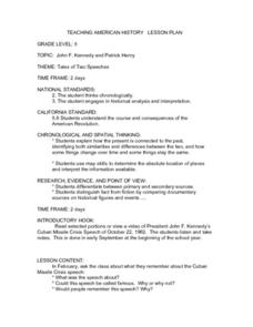
Tale of Two Speeches
Students view and read portions of John F. Kennedy's Cuban Missile Crisis speech from October 22, 1962. Later in the year, students recall what they remember about the speech and use a Venn Diagram to compare it to Patrick Henry's...
Curated OER
Lincoln Home National Historic Site: A Place of Growth and Memory
Eighth graders study the history of Lincoln's home. In this American History lesson, 8th graders examine artifacts from his home to learn about his beliefs. Students participate in a webquest on Lincoln's home.
Curated OER
Possible Locations
Middle schoolers create maps with cutout pieces of paper that represent caverns. They develop a scale for their map and decide where the best location is to live. They discover the importance of map reading skills.


