Curated OER
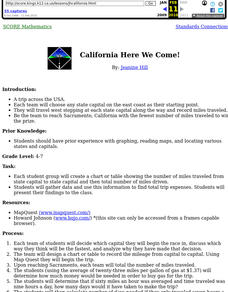
California Here We Come!
A highly relevant and great cross-curricular project! In teams, your class will plot a course from the East Coast to Sacramento, California passing through all of the state capital cities along the way. As part of the journey, teams...
Curated OER
What They Left Behind: Early Multi-National Influences in the United States
Students research the impact of European voyages of discovery and colonial influence on different aspects of American culture. They access a number of online sources and reference maps to trace the influences of England, France, Holland,...
Curated OER
The State Seal Offline Lesson
Fourth graders discover the meaning of the different objects on the State Seal. They identify changes in the State Seal over time students hypothesize why elements have changed students suggest what elements should represent the State of...
Curated OER
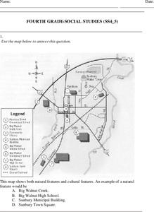
Fourth Grade Social Studies
In this social studies worksheet, 4th graders answer multiple choice questions on state maps, city maps, road maps, political maps, and more. Students complete 25 multiple choice questions.
Curated OER
California Outline Map
In this California outline map instructional activity, students examine political boundaries of the state and the placement its capital city as well as its major cities. This map is not labeled.
Curated OER
Water Features - Lesson 2 - U.S. Political Map Grade 4-5
Students locate water features on maps. In this geography lesson, students complete worksheets that require them to identify water features on a U. S. political map.
Curated OER
States in the USA Quiz
In this online interactive geography quiz instructional activity, students respond to 50 identification questions about the states in the United States of America. Students have 4 minutes to complete the quiz.
Curated OER
U.S. Geography: California
In this map skills about the state of California instructional activity, students locate and label specific places and areas and create a map key and symbolize the economy and areas of personal interest. Students answer 5 questions.
Curated OER
California: Land and People
Fourth graders research information about some of California indigenous tribes to find out as much as possible about the first people found in the four regions of California. They research the history of a selected tribe and their...
Curated OER
California: Landform Regions Map
In this California landforms map activity, students examine the landform regions located within the state of California.
Curated OER
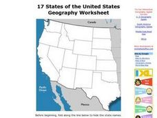
17 states
In this states worksheet, students label states in the United States that are on the west side of the country. Students label 17 states.
Wells Fargo
Wells Fargo History Museum: Curriculum Guide
Learn about the California Gold Rush from an institution that has been in place since the early days of the American West: Wells Fargo History Museum. From domain-specific vocabulary review to group research projects, an expansive packet...
University of California
The Civil War: Secession of the South
Was the Southern states' decision to secede from the Union protected by the United States Constitution? Eighth graders discuss the constitutionality of the South's justification for secession, particularly the secession of South...
Curated OER
The Founding of Los Angeles, California
Seventh graders examine the social and cultural impact of settler groups in California and the origins of the founding of Los Angeles, California. They read and discuss an informational handout, and discuss what it is and was like to...
Curated OER
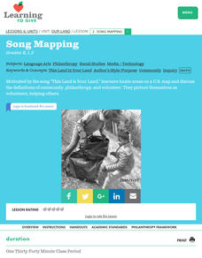
Our Land Lesson 2: Song Mapping
Students study the meaning of philanthropy as giving of time. talent, and treasures. They sing This Land Is Your Land while locating five of the places on a map of the United States showing that relief office are everywhere. They decide...
Curated OER
California- Gold Fever
In this Gold Rush instructional activity, students read a one page article with pictures and maps pertaining to the Gold Rush in California in 1949. Students then answer 4 essay questions.
Curated OER
Name The States Worksheet 3
In this states worksheet, students analyze the shape of 5 US states. Students identify each state and write the name of the state and its postal abbreviation.
Angel Island Immigration Station Foundation
Where Is Angel Island? An Introductory Geography Lesson
Prepare young historians for a study of Angel Island Immigration Station with a lesson examining primary and secondary source materials, maps, and websites. Using what they have learned, individuals create a map of Angel Island, labeling...
University of California
The Vietnam War (1945 – 1975)
Have you ever wanted to do something so perfectly you wound up not doing it well at all? Young historians use primary and secondary documents to analyze the United States involvement in the Vietnam War. The issues surrounding the...
Curated OER
Planning A Railroad
Students use topographical maps students explain the challenges involved in building the railroad in the Sierra Nevada mountains.
Curated OER
Isoseismal Maps
Students examine the difference between magnitude and intensity in earthquakes. They complete map work and write a first hand account of a person living in each level of intensity on the Modified Mercalli Scale.
Curated OER
California Biodiversity
Students examine several maps of California exhibiting features such as precipitation, topography, and vegetation. They look for patterns that might be the source of or influence biodiversity in different regions. They pay particular...
Curated OER
California Regions Map
For this California regions outline map worksheet, students examine the coastal, mountain, central, and desert regions of the state.
Curated OER
Trails West: Westward Expansion Maps
In this United States historical map worksheet, students examine the trails that settlers of the Western United States took during the period of Western Expansion. Major cities on the routes are labeled.


