Curated OER
STONEHENGE
Students work in cooperative groups to create a theory about the origin of Stonehenge. Each member of the group has a specific role, responsibilities and tasks. The group work can be implemented as a scaffolding technique.
Other
California State University: Topographic Map Symbols
Click on any of the geographical terms on this website to see examples that illustrate the symbols commonly used on maps. Includes boundaries, building symbols, caves, mines, elevation symbols, coastal features, and more.
Enchanted Learning
Enchanted Learning: California
Enchanted Learning provides this fact sheet for California as well as a state map, pictures, state symbols, and links to related information.
A&E Television
History.com: The States
Learn unique facts about each American state. You can also read a more in-depth history of each state, watch videos and play a game about all the states.
Cayuse Canyon
The Us50: California
Provides excellent information regarding California's history, famous people, cities, geography, state parks, tourism, and historic sites. A fact sheet of information and a quiz are also available.
Maps of Mexico
Virtual Picture Travel Map of California
Click on California and take a virtual tour of San Francisco, Hollywood and Palm Springs. Visit places of interest such as the PGA West Golf Course, Santa Monica Pier, Alcatraz Island, Golden Gate Bridge and the Japanese Tea Garden.
Maps of Mexico
Virtual Picture Travel Map of California
Click on California and take a virtual tour of San Francisco, Hollywood and Palm Springs. Visit places of interest such as the PGA West Golf Course, Santa Monica Pier, Alcatraz Island, Golden Gate Bridge and the Japanese Tea Garden.
Kidport
Kidport: United States of America Geography
This site contains a fun way to learn about the states within the United States. Click on the state that you want to learn more about and it provides facts, geographic landmarks, points of interest, major industries, a quiz and more.
PBS
Pbs Learning Media: 50 States Part 1 Lesson Plan
In this lesson, students travel virtually to 25 different states from Alabama to Missouri. While on their journey students explore geography, learn state capitals and interesting facts along the way. Movements are unique and incorporate...
Johns Hopkins University
Johns Hopkins University: California Maps
At this site from the Johns Hopkins University Applied Physics Laboratory, you can learn more about the great state of California. Find out about the landforms that run through this vast state. There are several types of maps found at...
Curated OER
Educational Technology Clearinghouse: Maps Etc: California, 1904
A map of California from 1904 showing the State capital of Sacramento, major cities and towns, railroads, mountain systems, lakes, rivers, and coastal features. "California, first settlement made in 1769 by the Spaniards. Gold was...
Curated OER
Educational Technology Clearinghouse: Maps Etc: California, 1902
A map of California from 1902 showing the State capital of Sacramento, major cities and towns, railroads, mountain systems, lakes, rivers, and coastal features. An inset map shows the continuation of the southeast part of the state.
Curated OER
Educational Technology Clearinghouse: Maps Etc: California, 1909
A map of California from 1909 showing the State capital of Sacramento, major cities and towns, railroads, mountain systems, lakes, rivers, and coastal features. An inset map shows the continuation of the southeast part of the state.
Curated OER
Educational Technology Clearinghouse: Maps Etc: California, 1919
A map of California from 1919 showing the State capital of Sacramento, major cities and towns, railroads, mountain systems, lakes, rivers, and coastal features. An inset map shows the continuation of the southeast part of the state.
Curated OER
Educational Technology Clearinghouse: Maps Etc: California, 1922
A map of California from 1922 showing the State capital of Sacramento, major cities and towns, railroads, mountain systems, lakes, rivers, and coastal features. An inset map shows the continuation of the southeast part of the state.
Curated OER
Educational Technology Clearinghouse: Maps Etc: California, 1919
A map of California from 1919 showing the State capital of Sacramento, counties and county seats, major cities and towns, railroads, mountain systems, lakes, rivers, and coastal features. An inset map shows the continuation of the...
Curated OER
Educational Technology Clearinghouse: Maps Etc: California, 1914
A map of California from 1914 showing the State capital of Sacramento, counties and county seats, major cities and towns, Indian reservations, railroads, mountain systems, lakes, rivers, and coastal features. An inset map shows the...
Curated OER
Educational Technology Clearinghouse: Maps Etc: California, 1892
A map of California from 1892 showing the State capital of Sacramento, counties and county seats, major cities and towns, railroads, mountain systems, lakes, rivers, and coastal features. An inset map details the San Francisco Bay area.
Curated OER
Educational Technology Clearinghouse: Maps Etc: California, 1906
A map of California from 1906 showing the State capital of Sacramento, major cities and towns, railroads, mountain systems, lakes, rivers, and coastal features. Two inset maps detail the San Francisco Bay area and the vicinity of Los...
CRW Flags
Flags of the World: Clickable Map of the United States
Includes both printable images and fascinating trivia behind the flag of each state. It includes alternate flags used in the past.
Houghton Mifflin Harcourt
Holt, Rinehart and Winston: Estados Unidos De America: California
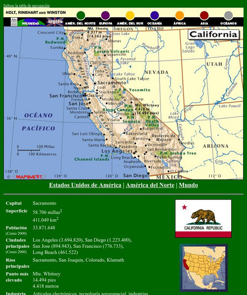
This site has a map of California in Spanish, with informational data also presented in Spanish about the state of California. Land mass, population, elevation, industry, agriculture, minerals, and resources are among the topics...
Harvard University
Harvard Univ.: Immigration to Us, 1789 1930: California Gold Rush (1848 1858)
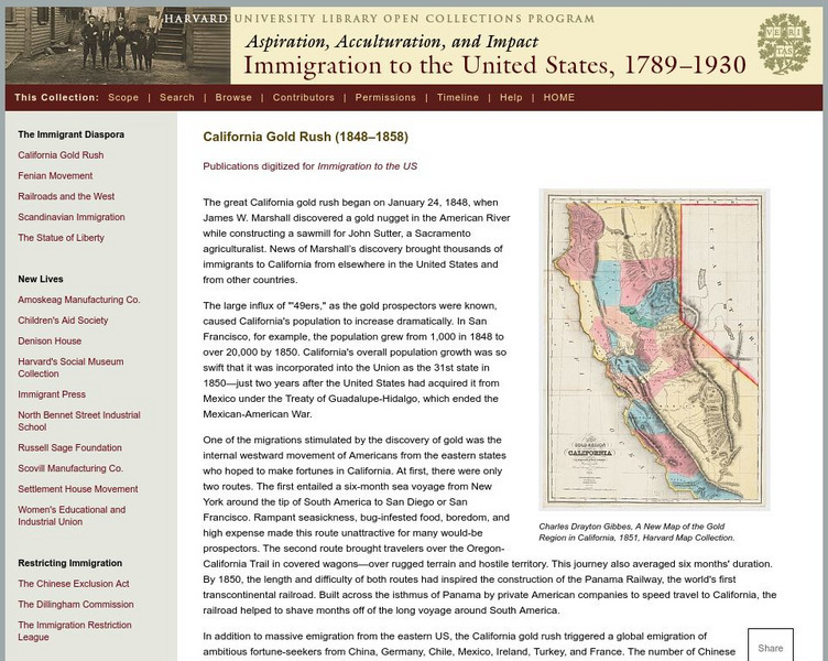
Describes the California Gold Rush and the impact it had on immigration to the United States and to the future demographics of California. Includes a high-resolution map of the gold region of California in 1851.
Curated OER
Etc: Maps Etc: California (Northern and Central), 1920
A map of Northern and Central California from 1920 showing the State capital of Sacramento, counties and county seats, major cities and towns, railroads, National Park boundaries, National Forest boundaries, Indian reservation...


