Library of Congress
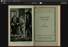
Treasure Island
For 30 years, Long John Silver has sailed the seas. An eBook version of Treasure Island introduces readers to the tales Long John Silver has to tell. This 1883 version of the text includes an introduction to encourage critical...
University of California
Containing Communism Abroad
Learn more about the policy of the United States to contain communism during the Cold War. The fifth installment of an eight-part series looks at primary and secondary materials about a challenging time in history. After analyzing the...
California Academy of Science
Nuclear Energy: What's Your Reaction?
OSHA confirms that rules governing worker safety at nuclear power plants ranks higher than worker safety in offices. Scholars must consider safety, cost, alternatives, and other factors before recommending whether a town should build a...
Curated OER
Home: the Story of Maine "A Love for the Land": Where Are You? Who Are You?
Students investigate their neighborhood both as it is now and as it was 100 years ago. They take a walk around their neighborhood and fill out a worksheet before completing a worksheet.
Curated OER
BOUND TO BE NEW HAMPSHIRE
Learners identify neighborhood, town, and state boundaries. They distinguish between natural and man-made boundaries. They identify major state geological features and explain how NH boundaries have changed over time.
Curated OER
Historical Atlas
Sixth graders evaluate how revolutions have affected the world throughout history (i.e. boundaries of nations, culture, economics, etc...) through the research for and creation of a historical atlas for assigned countries.
Curated OER
Oceans: A Sensory Haiku
Students create an ocean haiku. In this haiku activity, students use their five senses to write a haiku. Students watch videos about the ocean, make a sensory portrait, and create a class haiku.
Curated OER
Medial Consonants, Hard and Soft c and g
Students participate in a series of lessons that are used to develop phonics skills. There are a variety of activities and a curricular map is included in the plan. A good list of age appropriate texts is given for extensions of going to...
Curated OER
North, South, East, and West
A basic lesson on the teaching of the cardinal directions awaits your class. They are directed to go to different parts of the playground and where they attempt to describe their location in relation to each other by using the cardinal...
Curated OER
Revolutionary Boston
Learners annotate core maps to explain either the political or the military situation in the British North American colonies, using Boston as a case study. They explain the British military strategy for suppressing the rebellion in Boston.
Curated OER
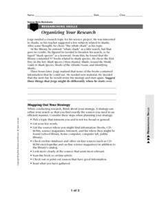
Organizing your Research
In this research worksheet, students read about how to organize themselves when doing research. They read about a student who had a topic to research but had difficulty coming up with books about his topic. Students suggest ways to...
Curated OER
Continents and Critters
Students investigate and identify the continents of the world. They identify and locate the seven continents on a map, and label a coloring page of a world map. Students then conduct research on an assigned continent, and write and...
Curated OER
Famous Afro-Americans Historical Sites Recognized by the National Park System
Learners use the library to find historical information about each Afro-American. They use magazines, articles from newspapers, and oral histories from video tapes and slide presentations to write biographical sketches about each...
Curated OER
A Place Called Nepal
Students investigate maps of Nepal and then create their own to disover how human activity is influenced by terrain and climate. Students participate in a trek across Nepal simulation to imagine the challenges people have to face...
Curated OER
The Artifact Problem
Students work in small groups and make a map of a familiar room. In this artifact lesson plan, students decide on a suitable scale for their maps, the tools they will use and how they will make it and decide on strategies they would use...
Curated OER
Land Use Over Time
Students view aerial photos and topographic maps of their local area. They compare and contrast major land use patterns over time by comparing these images to maps that are at least 50 years old. They analyze them using the four land use...
Curated OER
Canada Geography PowerPoint
Young scholars create a PowerPoint about Canadian geography or history. In this Canada lesson, students spend two days researching their Canadian topic in the library and online. They create a PowerPoint presentation and add pictures...
Curated OER
On a Pilgrimage
Sixth graders engage in a variety of learning experiences surrounding the study of the Middle Ages. They construct a map of Europe, create a graphic organizer for the hierarchy of feudalism, design their own family crest, and write their...
Curated OER
Joseph Had a Little Overcoat Lesson Plan
Students discuss various features of a book, aspects of the story, and then engage in a retelling of the story. In this early childhood lesson plan, students identify the author, illustrator, and title of a book, Joseph Had a Little...
Curated OER
Filling Up Florida
Students study factors controlling Florida's population growth and related environmental impacts. They research natural community types and construct maps (including a large-sized map of Florida) to be used for a simulation activity.
Curated OER
The Pirates of the Caribbean
Third graders participate in a demonstration lesson that shows a map of the Caribbean Islands. They examine a natural resource that each island is known for. Next, they listen to a read aloud of Gail Gibbons, "Pirates: Robbers of the...
Curated OER
U.S. geography for Children: New York
In this geography activity, 5th graders study the state of New York. Students follow the given directions to complete 5 tasks on the state map that is given.
Curated OER
Basin & Range Faulting
Students identify that the crust of the earth is constantly moving and that with the exception of faults accompanied by earthquakes, this rate of movement is far too slow to notice. Then they print a copy of cross-section map A and...
Curated OER
Directionality
Second graders discuss the cardinal directions and intermediate directions and then look at the spooky map to locate different points on the map. They answer questions about where things are located in reference to another object and...
