Curated OER
A Taste of Our Classroom
Young scholars explore their classroom tastes. For this lesson plan, students list the four tastes that the tongue can detect, map the individual areas of taste on the tongue, and demonstrate the ability to identify objects through the...
Curated OER
Louisiana and Canada: Understanding Acadian Cultural connections
Ninth graders investigate why Acadians moved to Lousiana. In this geography lesson plan, 9th graders research the migration of Acadian to Louisiana and how that influenced the culture. Students analyze a list of cultural...
Curated OER
Time Zones
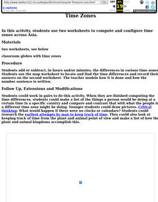
Fifth graders locate different time zones. In this time zones lesson, 5th graders label the different time zones. Students research the different ways man has kept time throughout history. Students also compute the differences in time...
Curated OER
The Role Of NATO
Students examine the role of the North Atlantic Treaty Organization (NATO). In this NATO instructional activity, students research the Truman Doctrine, the Marshall Plan, Winston Churchill's "Iron Curtain" speech, and the Berlin airlift...
Curated OER
Forester
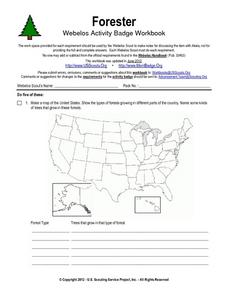
In this forester activity, students illustrate a map that shows the types of forests growing in various parts of the country. They also identify six forest trees common to the area where they live and explain how both wildlife and humans...
Curated OER
The Time Has Come: Poetry and Drama Use in the Geography Class
Students use drama and poetry in their Geography class. In groups, they role play an interviewer or the interviewee in various plays that were presented to them. In their role, they must locate and label where the countries mentioned...
Curated OER
Coordinates
In this coordinates worksheet, learners analyze two maps and identify the coordinates of ten specific locations. Students plot sixteen points on a graph and check their answers online at the end of each exercise.
Curated OER
Observing and Identifying Matter
In this observing and identifying matter worksheet, students use a cookie in a bag and list 10 different descriptions of the cookie. They draw and label their cookie and given the cookie in the bag to their teacher who mixes all the...
Curated OER
Social Studies: Lesson 2
Students explore the beginning of Communism. For this World History lesson, students exhibit their knowledge of Communism and the Marshall Plan through completion of a map activity.
Curated OER
Describing A Place - Part I The British Isles
In this describing place worksheet, students label the cardinal and ordinal directions on a compass rose using the drop-down menus. They complete a matching activity by matching an item from column C with one in A and B. They read an...
Curated OER
Family Life in a Village in Bangladesh
In this Bangladesh worksheet, students read about the lives of men and women and the weather in Bangladesh. They then take that information to create a poster. Maps are also provided.
Curated OER
Roundtable
Fifth graders apply the Five Themes of Geography as they relate to the U.S., the world, and specific places in United States history. They recognize and label geographical locations on a map of the United States.
Curated OER
The Sahara Desert
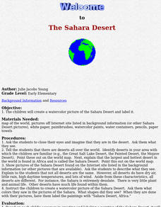
The children will create a watercolor picture of the Sahara Desert and label it.
Curated OER
The Brief American Pageant: The Planting of the English America
A series of maps illustrate the early growth of English America, which includes the Maryland, Virginia, Carolina, and Georgia colonies. Settlements such as Jamestown, Roanoke, and Charleston are labeled on the map, allowing a teacher or...
Curated OER
The 50 States and its Holidays
Though the format of this ELL lesson is confusing (the standards listed are for plate tectonics, yet the objectives are for American geography and holidays), a teacher could glean some ideas from the main idea. Here, pupils complete a...
Curated OER
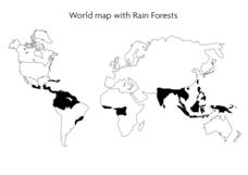
World Map With Rain Forests
In this geography worksheet, young scholars study a map of the world which shows shaded areas indicating where the rain forests are located. There are no labels for countries or continents.
Curated OER
Making Globes
Fifth graders construct and design paper mache globes. They paint and draw the continents and oceans, and label each continent and ocean.
Curated OER
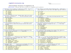
Intermediate Sentence Completion 16
Although this worksheet is labeled for intermediate English language learners, I'd argue the vocabulary is more appropriate for advanced learners. The pupil reads each sentence and selects the appropriate word to complete the sentence....
Curated OER
World Map and Globe - Four Main Directions
Students study the four main directions on a map. In this map lesson, students locate the North and South pole, and learn the four cardinal directions. They use the compass rose on a map to help with the directions. (Map is not included...
Curated OER
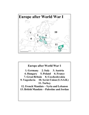
Europe after World War I
In this Europe after World War I map worksheet, students note the 11 regions of the Europe labeled on the map.
Curated OER
2 Cities: Europe's Capital Cities
In this European cities worksheet, students label the countries and then provide an alphabetical key for each country. Students then label each capital city and provide a numerical key for each city.
Curated OER
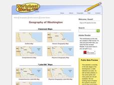
Washington
In this social studies worksheet, students label places on a map of Washington state. There are other worksheets on this link, including a scrambled places, word search and a crossword puzzle of places in Washington.
Curated OER
Direction and Angle: Positions and Directions
This is an interesting mix of concepts. Half of this presentation provides double-digit addition and subtraction practice and the other half has students discuss cardinal directions and right angles. Use these together, or use them on...
Curated OER
Instruments From Around the World
How much does the environment affect how and what man creates? Children explore the effect of the environment on primitive man as they research raw materials from a specific location. They use their findings to write a short essay about...
Other popular searches
- Labeling a Map
- Africa Map Labeling
- Midwest Map Labeling
- Geography Map Labeling
- Labeling a Map Continents
- Labeling Map Parts
- Labeling Parts of Map


