Curated OER
Core Democratic Values in Action
Pupils compare and contrast rules they have in their homes and in the classroom. In this values instructional activity, students identify rules at home and relate to rules of other families. They list family rules, connect classroom...
Curated OER
Globe Lesson 6 - Longitude - Grade 6+
For this longitude worksheet, students read a 3-paragraph review of longitude and respond to 13 short answer questions.
Curated OER
Two Reasons for the Four Seasons
Students explore the reasons for the seasons. In this season instructional activity,students use flashlights to demonstrate the movement of the Earth and how it influences the seasons. Students label pictures and discuss what would...
Curated OER
Minnesota
In this Minnesota activity, students analyze a simple unlabeled outline map of the state of Minnesota. Students may color the map or label it with cities or physical features.
Curated OER
Donde en el mundo estas?
Learners give & follow directions given in Spanish, using oral, written and graphics. They use maps, globes, atlases, and remote sensing, GIS, and GPS to acquire and process information about places.
Curated OER
Your Map of Rights
Students explore the Bill of Rights, which rights have limitations on them, and how these rights apply to their personal lives. They write their own Bill of Rights for the class community.
Curated OER
Sonar Mapping
Students use a shoe box to create a seafloor model and use cardboard for layering inside of the shoe box to simulate the ocean floor. They probe the ocean floor to simulate sonar echoes. Finally, students graph their data to get a...
Curated OER
Mapping the Circulatory System
Students investigate the circulatory system in human beings. In this human body lesson, students create an outline of a human body using colored markers and butcher paper. Students use red and blue colors to simulate the...
Curated OER
Tongue Map
Students explore human anatomy by conducting a human senses experiment. In this taste lesson, students identify the main purpose of a tongue and how it enhances our eating habits. Students utilize baking coca, lemon juice, salt and honey...
A to Z Teacher Stuff
Facts About Australia
Here is a quick printable with some basic facts about Australia, such as its population, area, type of government, and currency, as well as a simple drawing of an outline of the country.
Mathematics Assessment Project
Linear Graphs
A line is a line is a line. As a middle school assessment task, learners first identify graphs of given linear equations. They then identify the equations that represent real-world situations.
Curated OER
Finding Your Spot in the World
Young scholars learn the concept of movement by locating their house and the houses of their ancestors.
Curated OER
Color-Coded Sentence Diagrams
Students read Ruth Heller's books and learn to identify various parts of speech. They label words according to the parts of speech and use the words to form simple and then more complex sentences. Afterward, they analyze sentences and...
Curated OER
Native Pottery Replicas
Students study ancient Native American traditions and practices. They select one type of Native American pottery to duplicate in a hand-made replica. Afterward, they create a map of the United States and label where indigenous peoples...
Centers for Ocean Sciences
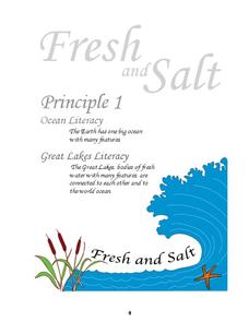
Ocean and Great Lakes Literacy: Principle 1
Is your current lesson plan for salt and freshwater literacy leaving you high and dry? If so, dive into part one of a seven-part series that explores the physical features of Earth's salt and freshwater sources. Junior hydrologists...
Channel Islands Film
Island Rotation: Lesson Plan 3
How far have California's Channel islands moved? What was the rate of this movement? Class members first examine data that shows the age of the Hawaiian island chain and the average speed of the Pacific Plate. They then watch West...
Curated OER
Where are the Watersheds in San Francisco?
Students create a mental map of San Francisco. They compare it with actual topographical maps of the city. Then they label various locations on the San Francisco Hillshade map and locate watershed boundaries.
Curated OER
Rescue!
Learners explore movement and position concepts. They follow directions using left , right, up, down, North, South, East and West. Students draw and follow a path on a grid to show a route followed. They label and follow legends on a map.
Curated OER
Finding Important Community Sites
Students locate community sites on a city map using the map legend and grid system.
Curated OER
United Kingdom
Pupils investigate the geographical features of the United Kingdom. They create a clay, playdoh, or salt and flour map of the region. The maps should be labeled with landmarks and bodies of water. They can also draw maps on paper for...
Curated OER
Exercise 23--the Regular Pentagon on a Given Side
Middle schoolers examine and study how to recognize the characteristics of a regular pentagon and demonstrate how to construct one. They become aware of associating a regular pentagon to its term of a double map and practice the concept...
Curated OER
Help! I Am Lost at Fox Chapel
Sixth graders create a map to locate places on campus and share the map with another student. The other students use the map to locate certain places and validate for accuracy via a checklist. The parents use the completed map at open...
Curated OER
Finding Your Spot in the World
Learners investigate a world map, a United States map, a state map, a county map and a city map. They locate each student's house on the city map and put a length of yarn from their house to a country of one of their ancestors.
Curated OER
Weather Reporter
Fourth graders explore the components of a weather map, mark cities on the map and place the appropriate temperatures and weather conditions occurring in the cities on the weather map created.
Other popular searches
- Labeling a Map
- Africa Map Labeling
- Midwest Map Labeling
- Geography Map Labeling
- Labeling a Map Continents
- Labeling Map Parts
- Labeling Parts of Map


