Curated OER
Sand Explorations
Students experiment with different samples of sand from Maui leeward and windward beaches. They create a sand map to suggest at least one contributing factor for the formation of each beach sample. They test the samples to determine...
Curated OER
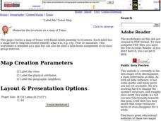
"Label Me" Texas Map
In this Texas map worksheet, students research, label and discuss the top ten major cities in Texas on a map, label the physical attributes and identify the surrounding states around Texas.
Curated OER
Geography of Canada
All about Canada! Learners explore the geography and providences of Canada by watching videos, studying maps and conducting internet research. By the end of this lesson, your class should be able to locate major areas and compare and...
Curated OER
Guide to Business Process Modelling
Project managers can add another cog in the wheel of understanding. This guide to business process modelling shows how to construct and use a process map to handle major projects. Tip: While the resource is intended for a vocational...
Curated OER
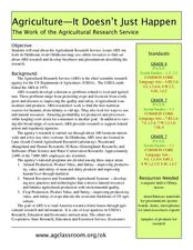
Agriculture: It Doesn't Just Happen
After reading an informational text on the Agricultural Research Service, learners research the role of the ARS in Oklahoma. Using reputable online sources, they label a map of the state with relevant areas. Researchers focus on one of...
Curated OER
China Quest
Read and research information on China. Young researchers complete a knowledge hunt about China then locate and describe each location using directional words. They recognize the word meaning through context clues and application practice.
SeaWorld
Animal Migrations
Here is a fabulous set of activities for your young scientists. Each lesson contains map, hands-on, and game activities that will help the class understand why and how animals migrate from one place to another. First they'll examine the...
Curated OER
The Country of Nigeria - Map Work
In this map worksheet, students label 14 items on a map of Nigeria. They follow directions to label and color Nigeria, and the water-bodies and countries that surround it.
Curated OER
Mapping Japan
In this Japan worksheet, students label cities, islands, seas, and more. Students label 11 different areas of the country of Japan.
Curated OER
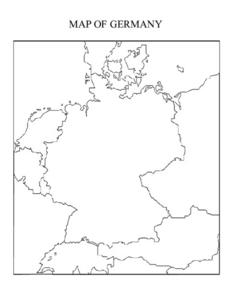
Mapping Germany
In this Germany instructional activity, students label the map of Germany with different landmarks. Students label the map with 10 different cities, rivers, and borders.
Curated OER
Mapping New Zealand
In this New Zealand worksheet, students label the map of New Zealand with oceans, cities, mountains and more. Students label 9 items.
Curated OER
Creating a Map of France
In this crating a map of France activity, students find and label important parts of France, bodies of water, mountains and surrounding countries.
Curated OER
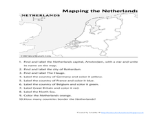
Mapping the Netherlands
In this Netherlands worksheet, students label cities, countries, landforms, and more. Students label 10 places in the Netherlands.
Curated OER
Mapping Brazil
In this Brazil worksheet, students label cities, oceans, and surrounding countries around Brazil. Students label and color 10 places.
Curated OER
Mapping the United States
In this map of the United States worksheet, students label mountains, surrounding countries, oceans, and more. Students complete 12 tasks.
Curated OER
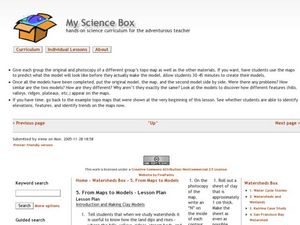
From Maps to Models
Fourth graders study topography maps and learn the importance of their contour lines. In this map lesson plan students create their own topography map.
Curated OER
States On A Map
Third graders locate the states of Main and Kansas on a map. In this state location lesson plan, 3rd graders read the book Sarah, Plain and Tall and discuss what states she traveled through.
Curated OER
Reading distance on maps
Eighth graders complete worksheets on reading the distance on maps in miles or kilometers. For this maps lesson plan, 8th graders use a calculator and ruler.
Curated OER
Printable Map of Arkansas
In this printable map of Arkansas worksheet, students see a clip art picture of the state of Arkansas superimposed on the map of the United States. The see the capitol city, Little Rock, labeled on the map. There are no directions given...
Curated OER
Map of Germany
In this map worksheet, pupils can color and label a blank map of Germany. This map show Germany and it's surrounding neighbors.
Curated OER
Illinois State Map
In this Illinois geography learning exercise, students color and label a map of Illinois. Students study the location of the capital and where Illinois is situated in the United States. There is a black line map of the state with a grey...
Curated OER
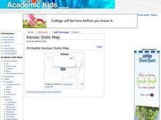
Kansas State Map
In this map of Kansas activity, students color and label major cities and physical features of this state. Students also study the location of Kansas in relation to the other states in the U.S. by studying the background map.
Curated OER
Indiana State Map
In this Indiana state map worksheet, students color and label the important cities and physical features on this outline map. Students also learn of Indiana's location in the U.S. by studying the background map.
Curated OER
Iowa State Map
For this Iowa state map worksheet, students color and label the important cities and physical features. Students also study the background map that shows the location of Iowa in the United States.
Other popular searches
- Labeling a Map
- Africa Map Labeling
- Midwest Map Labeling
- Geography Map Labeling
- Labeling a Map Continents
- Labeling Map Parts
- Labeling Parts of Map

