Curated OER
What do Maps Show?
Eighth graders practice the skill of reading maps. In this geography lesson, 8th graders participate in a classroom lecture on how to read a map.
University of Southern California
What Is The Ocean?
Go on a tour of the ocean through the lens of a scientist. Learners read maps of the ocean floor, study tide behavior, examine wave motion, and analyze components of soil. Each lesson incorporates a hands-on component.
Curated OER
Locating IIT Using Ordered Pairs
Students investigate ordered pairs. In this math lesson, students plot and locate ordered pairs in a coordinate plane and are exposed to how to read and create a map.
Curated OER
Blackout!
Students read news reports and first-person accounts of a blackout in a large city and keep weblogs or journals. They take on different roles of people who live in the city or commute there to work and then use their journal accounts to...
Curated OER
TE Activity: Nidy-Gridy
Students make a grid and coordinate system map of their classroom as they investigate why it is important to have a common map making system. They look at how landmarks are used for navigating an area.
Curated OER
Are We There Yet?
Students discover how to use maps and why they are important when using a map. They calculate distance using a map scale and time using travel speed and a map scale.
Curated OER
Where Am I?
Students apply map reading skills by locating places through the use of latitude and longitude.
Curated OER
Algebra/Geometry Institute Summer 2007: Graphing Activity
Seventh graders practice identifying coordinates by examining a city map. In this graphing lesson, 7th graders create coordinate directions on an index card and practice locating these locations on a grid. Students read and discover...
Curated OER
Metrics And Measurements
Middle schoolers engage in a study of measuring distances between geographical locations on a map. They are able to define and use the map scale in conjunction with the metric system. For this lesson they make their own maps and measure...
Curated OER
Making Sense Of A Round World On A Flat Surface
Students engage in a lesson that is concerned with the development of geography skills. They take part in a number of activities that center around finding and traveling to different locations. The lesson has resource links that can be...
Curated OER
Can You Name that Town
Young scholars, after becoming familiar with different names of towns in Arkansas, practice using a map grid and map index.
Curated OER
Geographics in Arkansas
Third graders discuss where Arkansas is located on the United States map. They use geographic tools to participate in activities.
Curated OER
Plotting A Hurricane Using latitude and Longitude
High schoolers explore map and plotting skills by tracing the movement s of hurricanes through the Earth's systems. a hurricane map is developed from daily media reports.
Curated OER
Treasure Hunt: Coordinate Graphing
Two of the best words any one can hear– treasure hunt! Your class will be excited to practice graphing on a coordinate grraph as they identify and write coordinates for landmarks they see on a treasure map. They trace their route to the...
Curated OER
Dream House
Students solve real world problems involving area and perimeter in this unit culminating activity.
Curated OER
Lesson: Journey of a Tree
Third graders explore the operation of a Christmas farm and how trees are shipped. After taking a tour of a Christmas tree farm and researching transportation, location and cost issues, 3rd graders create a map to show the distribution...
Curated OER
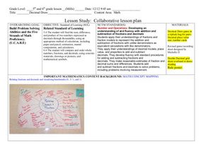
Decimals: Collaborative Lesson
Students explore mathematics by participating in a group activity. In this number value lesson, students identify the uses for decimals and how to best estimate whole numbers based on decimals and fractions. Students collaborate with...
Curated OER
Hurricane Frequency: Identifying Regions with Similar Numbers of Hurricanes
In this earth science worksheet, students answer 6 questions about the hurricane map and data provided. They create a data table based on the information provided on the map.
Curated OER
My Own Private Idaho; Using Social Studies to Explore Idaho
Students engage in several activities to explore Idaho and Social Studies themes. Using an variety of media, students become familiar with Idaho's geography and geology.
Curated OER
LAND USE ISSUES
Students relate math with real life situations. They identify and plot points on a grid map. They identify and locate the Drop Box Sites.
Curated OER
Reach for the Stars
Students investigate the Underground Railroad. In this slavery lesson, students read books about slavery, the Undeground Railroad, and how slaves escaped the south. Students develop knowledge about coded songs and constellations that...
Curated OER
The Seven Continents Scavenger Hunt
Who doesn't enjoy an engaging scavenger hunt? Here, scholars listen to, and discuss, the informative text, Where is my Continent? by Robin Nelson. They then explore the seven continents and four major oceans using Google Earth.
Curated OER
Robot Cartography
Students identify points plotted on the coordinate plane. In this geometry lesson, students learn to read a map using concepts of a coordinate plane grid. They find the path given a map to tell them where to go.
Curated OER
Native Americans and Topography at Rose Bay
Young scholars visit a wetland ecosystem. While they are there, students explore how to read topography maps of Rose Bay.


