Curated OER
Issues About Rivers
Students explore the environmental issues of rivers. In this river lesson plan, students collaborate to create a concept mat pertaining to environmental issues regarding the Tangipahoa River.
Curated OER
ExplorA-Pond:4th Grade Surface Area
Fourth graders estimate the surface area of a pond using the chance method and the estimation method. They complete a graph and a short report comparing the results of the two methods.
Curated OER
Graphing Coordinates
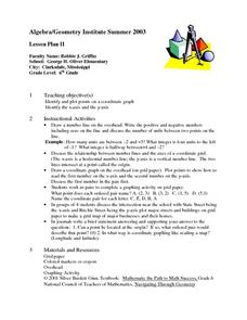
Sixth graders practice graphing coordinates. In this geometry lesson, they use the x and y axis to locate points that must be connected in the right sequence to form a straight line.
Curated OER
What Is Your Point?
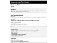
Sixth graders identify the x and y axes in a coordinate plane and identifies the coordinates of a given point in the first quadrant. They plot specific points in the first quadrant of the Cartesian coordinate system.
Curated OER
The Plains Indians
Students have a better understanding of another culture other than their own. This help them to see that there were other people living in this region before us.
Curated OER
Using Geometric Shapes To Make Patterns
Sixth graders explore the use of shapes to create geometric patterns. they start with a simple example of dividing shapes in half to create two new ones. This can be extended to creating intricate patterns.
Curated OER
Real Life Challenge
Ninth graders read and examine narratives, review chronologies, consider ideas, and analyze trends in order to understand the past and present. In this American History lesson, 9th graders examine cause and effect, review...
Curated OER
Causation-Exploration and World Trade
Students investigate spice trade. For this world history lesson, students identify various spices in jars and their places of origin. Students listen to a lecture on how spices came to countries in Europe. Students complete a source...
Curated OER
Creating a Database: Africa, Technology, Social Studies
Students use technology to create a database demonstrating their knowlede (in the case) of the African Continent. This project could be applied to almost any other concept studied.
Curated OER
Area, Perimeter, Circumference
Sixth graders use different measuring tools to measure area, perimeter, and circumference of different shapes. In this measurement lesson plan, 6th graders measure parallelograms, triangles, and circles.
Curated OER
Possible Causes
Students review any materials from two previous lessons on emissions. As a class, they use a graphic organizer to review their stakeholder's hypothesis. They identify possible causes of global warming and discover how to solve this problem.
Curated OER
Rivers And Capitals
Students become familiar with the use of GIS for research and become aware of the importance of rivers to cities. They also analyze the placement of cities and learn the names of rivers in the United States.
Curated OER
Indiana Tornado Project
Learners become familiar with the use of GIS for research, natural phenomena in Indiana, and analyzing collected information.
Curated OER
Got Park? Or if you build it, they will come!
Students use GIS and GPS technology to evaluate, research, locate, and recommend where a new park should be located that benefit the community.
Curated OER
Perimeter and Area
Sixth graders explore the relationship between area and perimeter of rectangles. In this area and perimeter lesson, 6th graders measure and determine perimeter and area of various rectangles. Students create rectangles with given areas...
Curated OER
Going Places
First graders study directional words such as North, South, East, West, up and down.
Curated OER
Properties of Lines - Parallel and Perpendicular
Sixth graders identify parallel and perpendicular lines in the alphabet. In this line properties lesson, 6th graders use the letters of the alphabet to show parallel and perpendicular lines. Students open a Geogrid Mat on the computer...
Curated OER
The Geography of Aboriginal Languages in Canada
Middle schoolers study the relationship between geography and the Aboriginal language communities.
Curated OER
Heritage: Make a Model of a Typical Utah Settlement
Fourth graders examine the different types of settlements used in Utah. They take a community map of Utah past and present and compare the two. They create a model of the early types of settlements used by pioneers in Utah.
Curated OER
Parliamentary Structure and Process on " Deck"
Tenth graders design a "deck" of individual slides on Power Point to synthesize, in a graphic organizer, their recently acquired knowledge of different levels of government in Canada.
Curated OER
Population Growth
Students discover how much the world population has grown and how much it is expected to grow. Using historical events, they discuss how they have impacted population and compare and contrast the current emission rates verses projected...
Geographypods
Geographypods: Map Skills
A collection of highly engaging learning modules on various topics within mapping skills. Covers map symbols, how to use four- and six-figure grid references, cardinal directions, distance, contour mapping, and drawing cross-sections....
PBS
Pbs Kids Afterschool Adventure!: Operation: Lost and Found Activity Plan
Gorillas, groceries, pirate treasure, and aardvark homes: these are just a few of the things children will search for and find in this week's Afterschool Adventure, Lost and Found. Children will use position words like above, below, and...
Science Education Resource Center at Carleton College
Serc: Mn Step: Student Created Landform Maps With Glacial Emphasis
An activity where students work together to make topographic maps of a local park. The map must include a key and the grid locations of landforms in the park.


