Describing Egypt
Ramesses VI - (20th Dynasty)
An interactive tour of the tomb of Rameses VI illustrates ancient Egypt's explanation of life with its intricate drawings and details. Dragging the mouse shows a 365-degree view of the tomb, and details about the meaning of each location...
K20 LEARN
Show and Tell Museum - Investigating Primary Sources: Read and Interpret Primary Sources
Scholars become detectives in a lesson plan that focuses on primary sources. Learners practice their observational skills by examining the teacher's artifact and visiting the Show and Tell Museum that highlihgts items from...
Describing Egypt
Ty Mastaba
Many know the beauty of a pillared hall, but what makes those from ancient Egypt so breathtaking? An eye-catching resource takes viewers on a journey through the Ty Mastaba to discover the importance of pillars to architecture. They see...
Curated OER
Arkansas History Lesson Plan: Identifying Arkansas on a Map
Students investigate their hometown of Arkansas. In this U.S. Geography lesson, students identify Arkansas on a map and distinguish it form the other states. Students investigate the history, state line, and personal...
Curated OER
Mapping the Prairie
Fifth graders study maps of the Chicago area looking at defining characteristics and place names. They investigate settlement patterns by looking at the maps.
Curated OER
Things That Stick Out Or: How To Find Your Way Around on a Map
Students explain the meaning of and recognize the map outlines of a peninsula, an isthmus, and a cape.
Curated OER
The Silk Road, An Ancient Internet
Students examine how goods and ideas moved along an ancient trade route between China and Europe. They make charts of items, ideas, etc. that were transported along the Silk Route.
Curated OER
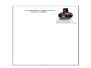
Indian Women in Texas History
Fourth graders study Indian women in Texas. In this US history lesson, 4th graders discuss what each Indian woman's contribution was by completing a timeline and table. Students examine the Caddo Women's pottery tradition...
Alpha Omega
History and Geography—Two World Wars
Here's a combination textbook/workbook that examines the conditions in Europe that lead to World War I. Ideal for homeschoolers as well as classroom use.
National Gallery of Art
Islamic Art and Culture
Provided by the National Gallery of Art in Washington, this resource for teachers examines Islamic art, including calligraphy, arabesques, and geometric designs. A recounting of the spread of the faith and the tumultuous political...
Devine Educational Consultancy Services
Geography Student Workbook, Australia
Your youngsters will be experts on the geography of Australia after working with these activities and worksheets, which review the continent's weather, major landforms, dimensions, history, and climate.
Mary Pope Osborne, Classroom Adventures Program
The Backpack Travel Journals
Strap on those backpacks, it's time to travel through history with this literature unit based on the first four books of The Magic Tree House series. While reading through these fun stories, children create story maps, record...
Curated OER
Ancient Trade Routes
Learners research details about ancient trade routes such as the silk, amber, tin, and incense routes. They make a map showing the trade routes and add details to maps, such as keys and samples of products traded. They compare ancient...
Curated OER
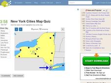
New York Cities Map Quiz
In this online interactive geography worksheet, students examine a map of New York and identify the 11 noted cities on the map using a pull down menu within 3 minutes.
Curated OER
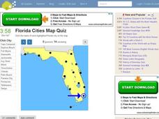
Florida Cities Map Quiz
In this online interactive geography instructional activity, students examine a map of Florida and identify the 12 noted cities on the map using a pull down menu within 3 minutes.
Curated OER
Texas Cities Map Quiz
In this online interactive geography worksheet, students examine a map of Texas and identify the 15 noted cities on the map using a pull down menu within 3 minutes.
Curated OER
South America Map Quiz
In this online interactive geography quiz worksheet, students examine the map that includes all of South America's countries. Students identify the 13 countries in 2 minutes.
Curated OER
Middle East Map Quiz
In this online interactive geography quiz worksheet, students examine the map that includes 26 Middle Eastern countries. Students identify the names of the countries in 4 minutes.
Curated OER
Central America Map Quiz
In this online interactive geography quiz worksheet, students examine the map that includes 22 Central American countries. Students identify the names of the countries in 3 minutes.
Curated OER
California Cities Map Quiz
In this online interactive geography quiz activity, students examine the map that includes 12 California cities. Students identify the names of the cities in 3 minutes.
Curated OER
Canada Map Quiz
In this online interactive geography quiz activity, students examine the map that includes 13 Canadian provinces and territories. Students identify the names of the provinces and territories in 2...
Describing Egypt
Horemheb - (18th Dynasty)
Who was Horemheb and why is his tomb so famous? An fascinating resource uses virtual reality tools and even comes equipped with the ability to use a VR headset. Learners view information panels to the side of the location to understand...
NIOS Download
The Harappan Civilization
The Harappan Civilization, also known as the Indus Valley civilization (2600 BC-1900 BC), is the focus of a resource packet that details the rise and fall of a culture that existed in India during the Chalcolithic period of...
Curated OER
Family Album
Kids of all ages discover their family histories through pictures. First, flip through the PowerPoint provided (or consider making one of your own). It should show pictures of your family and have clear, easy to understand sentences that...

