Mathematics Assessment Project
Discovering the Pythagorean Theorem
Young mathematicians join the ancient order of the Pythagoreans by completing an assessment task that asks them to find the area of tilted squares on dot paper. They then look at patterns in the squares to develop the...
Scholastic
Women's Suffrage for Grades 1–2
Scholars take part in a grand conversation after they examine facts and stories about the Women's Suffrage Movement. Eight discussion questions bring light to influential women, the importance of voting, citizenship, and voting rights.
Smithsonian Institution
Spanish American War
Today, Cuba and America sometimes struggle with diplomatic relations, but did you know that America went to war against Spain to free Cuba? Learners examine many interesting facts related to the Spanish American War using an informative...
Edgate
Native Americans of the Lewis and Clark Trail
As part of a study of the Corps of Discovery expedition, class groups research the different Native American tribes Lewis and Clark encountered on their journey and share their findings with the class.
Curated OER
Tracing the Route of Bracero
Students make a map showing the work of a Bracero Worker. In this Bracero lesson plan, students listen to a worker in an online oral history as he explains his work locations and crops. They use a map to plot the areas he worked and the...
Curated OER
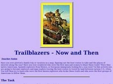
Trailblazers- Now and Then
Students examine and study the routes of trailblazers. In this American history lesson, students find a route on a map and compare that to the route of trailblazers. Students will then compare that map with a topographical map to...
Curated OER
European Exploration, Trade and Colonization
Students complete many activities including mapping, reading books, and Internet research to learn about European exploration. In this European lesson plan, students study geographical mapping, trade, and colonization.
Curated OER
Elements of Civilization
High schoolers create their own ancient civilizations based off of topographical maps of Egypt, Mesopotamia, the Indus Valley, and the Yellow River. In this social studies lesson, students are assigned one topographical map to use to...
Curated OER
Reasons to Settle in America
Students complete a research project. For this American History lesson, students work in groups to research reasons that people wanted to settle in America. Students record the information, share what they found and write...
Curated OER
We Found It!
First graders identify and describe landforms. They demonstrate an understanding of the compass rose and a map key using the trail of Lewis and Clark and the Corps of Discovery. They generate a map key.
Curated OER
Loco for Cocoa
Third graders research the history of cocoa. In this cocoa lesson plan, 3rd graders investigate how the cocoa bean has been traded from one country to another. Students create a timeline and map to track the history of the cocoa bean.
Curated OER
World Cup 2010: WebQuest and Activities
Students discover the history of the World Cup and the current host country, South Africa. In this athletics lesson, students utilize the Internet to research and complete a WebQuest about South Africa. Students discuss their...
Curated OER
Unraveling the Web
Students consider how a message might be traced along a complex network, then explore backbone maps as a basis for understanding the purpose and structure of the Internet.
Curated OER
Migration from the Dust
Students trace their own family's migrations and history. They listen to the story, 'Blue ow.' They design a plate which is shared at an open house.
University of New Mexico
New Mexico Land of Enchantment
Third graders research Native American Cultures surrounding New Mexico. They analyze the history and geography of the state. They play a guessing game that incorporates the indigenous plants and animals of New Mexico. In groups, learners...
Curated OER
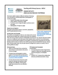
Agriculture Around the World
Students explore various kinds of farming methods around the world. In this history lesson, students view pictures of farming methods, then compare and contrast them in a class discussion with the methods of farming that are used...
Curated OER
Mayan History
Students examine Mayan contributions to the world. In this Mesoamerican culture lesson, students view a slideshow about the Maya and then peruse books about the accomplishments of the culture. Students create...
Curated OER
Mapping the Lewis and Clark Trail
Students explore how physical and human geography features effected Lewis and Clark's expedition by using the Lewis and Clark Digital Discovery Web site.
Curated OER
Map Lesson Plan
Fourth graders locate and label major sites related to the Revolutionary War in the Hudson River Valley. They examine topographical features of each site and list a few of these features and list two advantages of each military site.
Curated OER
Utah History & Geography
Fourth graders practice large digit addition. Students become familiar with column addition. Students develop knowledge of counties and county seats.
Curated OER
Arkansas is Our State: Differentiating Between a State and a Country
An ambitious geography lesson is geared toward kindergartners. They discover what the differences are between states and countries. They look at maps of Arkansas, and learn what the shapes and lines mean. Additionally, they create a...
Curated OER
Colonial Vacation Planner
Looking for a good lesson on the Colonial Period for your upper-elementary class? Then, this lesson is for you! They use website designs, U.S. travel publications, and maps to plan a family vacation to states which were part of the...
Curated OER
Where Has It Been? Tracking the Ivory-Billed Woodpecker
By studying the assumed extinction, and subsequent rediscovery of the Ivory-billed Woodpecker, learners use maps and come up with a scenario for the rediscovery of the bird. This incredibly thorough lesson plan is chock-full of...
Curated OER
Recreate the Race
Young scholars research and find the route of the Alaskan dog sled race.In this Iditarod race lesson students find the checkpoints for the Iditarod on a map. Young scholars research information in pairs about each one of the checkpoints....

