Curated OER
Making Sense of the Census
In this unit of lessons, young scholars make sense of the census. They examine why a census is taken and participate in activities.
Curated OER
Making Sense of the Census
In this unit of lessons, students make sense of the census. They examine why a census is taken and partipate in activities.
Curated OER
Where's the Barbecue?
Students identify the major landforms, regions and rivers on a map of South Carolina. They compare the locations of the major Native American groups in the state as well. They chart where barbecue restaurants are located and write...
Curated OER
Community Map of The Giver
Students read "The Giver" after finishing the unit on inventions and inventors. Using the information in the novel, they develop a geographic map illustrating the community in the story. They identify human and physical features and...
Curated OER
My Neighborhood:
Pupils act as tour guides for their communities after conducting research about their neighborhoods. After conducting research, students write stories and create maps of their communities to share with classmates and community members.
Curated OER
Finding Your Spot in the World
Students practice locating places on a Thomas Brothers map. In this map skills lesson, students locate places on the map of where their ancestors are from and then practice finding various community places on a map. Students graph the...
Curated OER
Lesson Eight: Depending on Others
Students consider what real needs are and how people meet them. In this community lesson, students read A New Coat for Anna and utilize a landscape picture map to help them discuss community.
Curated OER
My Perfect Neighborhood
Second graders make a map of their neighborhoods and identify their homes as being East, West, South, or North from the school on the map. They identify at least six local landmarks on a map of their town.
Curated OER
SpellO': An Orienteering Lesson
Students participate in hands-on activities to practice orienting maps. Given activity cards, students accurately read maps and locate specific stations. Students collect information from the maps to spell a message when the activity...
Curated OER
Drought Presentation
In this drought worksheet, students are given directions on how to give a presentation of facts, maps, videos, and more. Students inform the audience with 4 of the facts asked.
Curated OER
A Planting We Will Go
Students explore how to transplant trees in their community. In this citizenship lesson, students construct a map of where to plant trees and then plant the trees.
Curated OER
4-H Citizenship Activity Page
Using this activity to explore citizenship, learners evaluate the importance of positive participation in their community, neighborhood and country. The 15 questions in this learning exercise relate to jobs in the community.
Curated OER
River Study
Students explore a stream in their area and show the class the topographic map of the stream. They locate the topographic map and name the streams, lakes and ponds in their watershed. They write a paragraph about their stream and...
Curated OER
What Caused The Industrial Revolution In Maine?
Students investigate the apparent causes of the industrial revolution in the state of Maine. They read a text provided by the teacher. Then students use a concept map to organize information. The core of the discussion and research is...
Curated OER
Discovering the Local Community
Third graders create a mini-atlas of the human and physical characteristics of their local community, which includes landforms, climate, vegetation, population, and economics. They use nonfiction map-related resources to obtain ...
Curated OER
United We Stand: One Day
Students explore what it means to be part of a community. In this community lesson, students read a story about a man who finds unity in community. They then discuss how the community affected his life. This lesson also contains 5...
Curated OER
The Road to Success
Students chronicle the main events in their lives so far. They draft, revise, and publish an anecdote. Students get to know their fellow classmates and they build a nurturing learning community. Students take an interest inventory and...
Curated OER
Locating Points Using Cartesian Coordinates
Students discover coordinates as they explore Chicago. In this math lesson plan, students give the coordinates of a point, plot a point, and use the coordinate system in locating places on a map.
Curated OER
Families and neighborhoods
Students create their house to add to a class "neighborhood". For this lesson on family and community, students read the book Family by Todd Parr and discuss how all families and houses are different. Then, students create their own...
Curated OER
Developing a Life-Managment Plan
Students investigate values and goals to develop a life-management plan. In this life goals lesson, students identify life choices and factors affecting the choices. Students establish short and long term personal goals and the resources...
Curated OER
Favorite Foods
Students explore human health by completing food choice worksheets. For this world hunger lesson, students discuss the importance of eating three daily meals and how to feed the underprivileged through charities and soup kitchens....
Curated OER
Where Am I, and How Do I Get Where I am Going?
Students describe geographical places through art, music, writing, and math. They compile information in booklets which may be published.
Curated OER
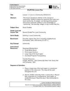
Lesson 1-I Live in a Community
Second graders brainstorm the concept of a community and all the elements involved in the make up of one. They pull from the resources on the community that they already live in or have lived in. In addition, they share their reflections...
Curated OER
Geography: Mapping Neighborhoods
Learners examine their neighborhoods and draw maps reflecting land use. In addition, they make predictions about their community's future. Students also consider the impact of business and industry on their communities and predict ...

